


All Files > Page 3764
FS2002
WWII British ships panel
(Category: FS2002 > Panels)
0.20Mb (276 downloads)
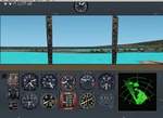
FS2002
WWII British ships panel With radar. By Jean-Jacques Parel
Unknown author of the radar. 200K
Posted Jun 23, 2008 14:32 by archive
FS2002
WWII Japanese ships panel With radar.
(Category: FS2002 > Panels)
0.16Mb (264 downloads)
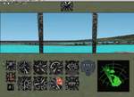
FS2002
WWII Japanese ships panel With radar. By Jean-Jacques Parel.
164K
Posted Jun 23, 2008 14:32 by archive
FS2002
WWII US ships panel With radar.
(Category: FS2002 > Panels)
0.20Mb (409 downloads)
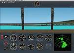
FS2002
WWII US ships panel With radar. By Jean-Jacques Parel. 207K
Posted Jun 23, 2008 14:32 by archive
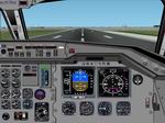
FS2002
- Panel DC-9.
(Category: FS2002 > Panels)
2.13Mb (1182 downloads)
FS2002
- Panel DC-9. REPLACES DC-9 panel packaged together with
Continental DC-9 old livery of 12April, 2002. Fixes all of
the numerous bugs and nubs on bitmap. Delete old file. Jim
Waters. 2.2MB
FS2002
- DC9 FIX 1!!! Sound file not found erro - fixed. Starts
right up. Some gauges removed with no corresponding sound
file. 481K
Gauges.
621K
Posted Jun 23, 2008 14:32 by archive
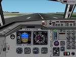
Boeing
777 panel (fs200x standard/PRO)
(Category: FS2002 > Panels)
4.98Mb (957 downloads)
Boeing
777 panel (fs200x standard/PRO) Here you see my newest Boeing
777 panel. This panel is created for FS2000 and FS2002. This
panel got all the normal things, like GPS, ATC support. This
panel has also cabin sign's and a specail throttle window. This
panel is also tested over more than 4 hours in FS2000 without
any problems. This panel includes also all the 777 internal
views, and my newest 777 Wingviews, and a removeable flightyoke.
This panel is also frame rate friendly! I have also included
2 new Boeing 777 Winampskins! By Frank Elfert. 5.1MB
Posted Jun 23, 2008 14:32 by archive
FS2002
Boeing 777-200
(Category: FS2002 > Panels)
(833 downloads)
FS2002
Boeing 777-200
A 777 panel highly realistic,based on photos from 777-200. Uses
mostly standard gauges,and custom gauges from varius authors.
by Pasquale Rinaldi. 1.3MB
Posted Jun 23, 2008 14:32 by archive
Mini-Panel
for FS2002
(Category: FS2002 > Panels)
0.31Mb (910 downloads)
Mini-Panel
for FS2002 This new Mini-Panel Feature a jet Panel and a
Hud specialy adjust for choppers By Jean-Claude Rolland (Coco
Design Unlimited) From the excellent works of Rob Barendregt
and Stephen Hanley. 321K
Posted Jun 23, 2008 14:32 by archive
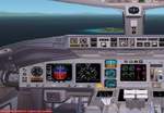
FS2002
A 320-200 Captain panel.
(Category: FS2002 > Panels)
2.33Mb (1866 downloads)
FS2002
A 320-200 Captain panel. Panel by: Ingmar Hendriks. 2.4MB
Posted Jun 23, 2008 14:32 by archive
FS2002
A 320-200 Co-pilot panel.
(Category: FS2002 > Panels)
2.40Mb (665 downloads)
FS2002
A 320-200 Co-pilot panel. Panel by: Ingmar Hendriks. 2.4MB
Posted Jun 23, 2008 14:32 by archive
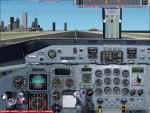
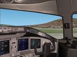
FS2002 Pro Dash8 Panel with external views
(Category: FS2002 > Panels)
(1717 downloads)
FS2002
Pro Dash8 Panel with external views. All of those great
Dash8 freeware aircraft on the net and very few Dash8 panels.
Photo-real 1024x768 resolution, uses mostly the default gauges
plus a few more and you'll need the FS2000
Concorde gauge. Buckz. 4.4MB
Required files:
required file
Posted Jun 23, 2008 14:32 by archive