


All Files > Page 2819
0.06Mb (1859 downloads)
FS98
Olympic
Airways Dornier DO 228-200 full pack with panel, sounds
& full moving parts. File size 1713477. V Hassiotis, M Lieberecht,
G Waterfield
Posted Aug 24, 2009 06:42 by archive
0.06Mb (1859 downloads)
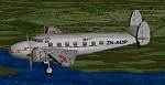
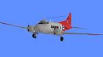
FS98
RNZAF
Lockheed Lodestar. File size 120705. H Follas, B Horsey
Posted Aug 24, 2009 06:42 by archive
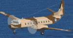
0.06Mb (1859 downloads)
FS98
RNZAF
Hawker Sideley Andover. File size 88583. H Follas
Posted Aug 24, 2009 06:42 by archive
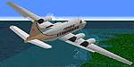
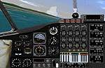
0.06Mb (1859 downloads)
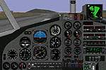
FS98
Prinair
De Havilland DH114 Heron with full moving parts, panel &
sounds. Includes accurate panel and full stereo sound as well
as improved flight dynamics. Aircraft model by L Penridge. Original
flight model by B Horsey. Modifications, moving parts, stereo
sound and repaint by D Henderson. Panel by D McGee and D Haskell.
Lycoming engine sounds by J de Miranda. File size 3251562
Posted Aug 24, 2009 06:42 by archive
0.06Mb (1859 downloads)
FS98 RNZAF
de Havilland DH104 Devon. File size 75360. H Follas, L Penridge
Posted Aug 24, 2009 06:42 by archive
0.06Mb (1859 downloads)
FS98 Saunders
ST27, a modified de Havilland Heron, with full moving parts,
panel & sounds. File size 3910852. A Swindle, L Penridge,
D McGee
Posted Aug 24, 2009 06:42 by archive
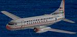
0.06Mb (1859 downloads)
FS98 American
Airlines 1960 Convair 240. File size 212712. E Ellis
Posted Aug 24, 2009 06:42 by archive
0.06Mb (1861 downloads)
FS98
Hawker
Siddeley Andover C Mk 1 of the RNZAF. File size 75517. H
Follas
Posted Aug 24, 2009 06:42 by archive
0.06Mb (1860 downloads)
FS98
Air
Sunshine Douglas DC-3 with moving parts. File size 66634.
J Kelley, D Henderson
Posted Aug 24, 2009 06:42 by archive
0.06Mb (1860 downloads)
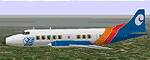
FS98
Aer
Lingus Shorts 360-200. File size 94340. C Bawden, D Griffiths
Posted Aug 24, 2009 06:42 by archive