All Files > Page 1440


FSX/FS2004 CASA C-295 AEW Airbus Military prototype Textures
(Category: FSX > Military)
2.10Mb (2087 downloads)
TEXTURE ONLY for CASA C-295 AEW by PAD.
The AEW (Airborne Early Warning) version of the CASA 295 first flew in prototype form in June 2011. File needed: casa295aew_x.zip (Jean-Pierre Brisard and Bob May - Premier Aircraft Design.)
Required files:
required file
Posted May 26, 2013 10:51 by Enrique Medal


Fairchild C-82 updated package
(Category: FSX > Vintage)
25.48Mb (3723 downloads)
I updated Daisuke Yamamoto's Fairchild C-82A Packet originally (Project Phoenix) by replacing incompatible gauges in both the 2D and VC panels, including Dave McQueen's L-1049 sound set, and Luiz Foernges's Cruzeiro do Sul Cargo Fairchild C-82 and Heather Sherman's FS2004 Trans World Airlines Fairchild C-82 textures. I recommend file names C82P2.ZIP and c82-patch if you can find them. I searched, but came up empty. Has both 2D and VC panels.
Posted May 25, 2013 23:29 by Michael E. Roberts


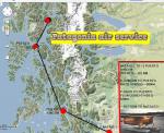
Patagionia Air Service
(Category: FSX > Missions)
0.44Mb (4458 downloads)
Many bush pilots believe that Alaska is the "Bush pilot's" paradise. Well, I am not sure of that for I fly in the Patagonia region of Chile and Argentina where volcanoes abound and the final portions of the Andes degenerate into deep valleys and gorges that not many pilots can live with for many years. If you are lost or crash around here you soon will meet good old St. Peter for the chances of someone finding you are as remote as finding a twenty three cent coin in your neighborhood....anyways, Gerry Hupstairs has a daily route you could try, he won't ming you flying around......
Posted May 25, 2013 23:01 by Gera Godoy Canova


Airbus A319-111 Aer Lingus Package
(Category: FSX > Civil Jets)
52.23Mb (4822 downloads)
Airbus A319-111 Aer Lingus for FSX. Includes enhanced default A321 VC with
improved gauges plus popup FMC, GPWS callouts. Custom Airbus sounds. Also
added jetway configs (Ctrl J). Model by Project Airbus. Textures by Kevin
Barrett. Assembled for FSX by Chris Evans
Posted May 25, 2013 12:17 by Chris Evans


Hawkeye Simulations Republic (KFRG), New York
(Category: FSX > Scenery)
9.80Mb (847 downloads)
Located on Long Island, NY, this airport is where a lot of Long Islanders achieved their flight training. The airport comes with photo realistic scenery, as well as custom objects and default objects. Created by Tom Neubauer
Posted May 24, 2013 23:57 by Tom Neubauer

AN225 United Cargo Textures
(Category: FSX > Civil Jets)
3.48Mb (7029 downloads)
United Cargo textures (fictional) for Thomas Ruth's Antonov AN225, the world's largest aircraft. Livery repaint by Daniel Lane.
Required files:
required file
Posted May 24, 2013 23:51 by Michael B. (UAL364)

Bradford Regional Airport, Pennsylvania
(Category: FSX > Scenery)
1.87Mb (497 downloads)
FSX Bradford Regional Airport
in north western Pennsylvania.
A complete remake of BFD (ICAO=KBFD).
Compatible with default FSX Scenery
and MegaScenery Earth 2.0 PA
By Thomas M. Lewis
Posted May 24, 2013 23:51 by uploader


Airbus A319-111 Air France Package
(Category: FSX > Civil Jets)
50.38Mb (5707 downloads)
Airbus A319-111 Air France F-GRHO for FSX. Includes enhanced default A321 VC with improved gauges plus popup FMC, GPWS callouts. Custom Airbus sounds. Also added jetway configs (Ctrl J). Model by Project Airbus. Textures by Mohammed Al-Khalifa. Assembled for FSX by Chris Evans
Posted May 24, 2013 06:28 by Chris Evans


Airbus A319-111 British Airways Package
(Category: FSX > Civil Jets)
51.85Mb (8148 downloads)
Airbus A319-111 British Airways G-EUPX for FSX. Includes enhanced default A321 VC with improved gauges plus popup FMC, GPWS callouts. Custom Airbus sounds. Also added jetway configs (Ctrl J). Model by Project Airbus. Textures by Mathieu Vos. Assembled for FSX by Chris Evans
Posted May 24, 2013 06:21 by Chris Evans

MN Seaking Update
(Category: FSX > Helicopters)
0.01Mb (1854 downloads)
There were problems with CoG and sunken in wheels reported, this is solved by the attached replacement aircraft.cfg
Required files:
required file
Posted May 24, 2013 05:36 by Mike November


