


All Files > Page 1401
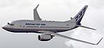
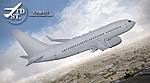
TDS Boeing 737-700 Boeing House Livery
(Category: FS2004 > Civil Jets)
11.22Mb (1163 downloads)
FS2004 Boeing House Livery Boeing 737-700. A B737-700 in Boeing house colors, registration N737X, developed by Tenkuu Developers Studio (TDS). Model features high resolution textures, dynamic flexing wings, nose gear steering, rudder lock, ground spoilers, low speed aileron locks at high speed, fully animated control surfaces, fully independent suspension, trim animation, opening passenger doors, rolling wheels, animated thrust reversers with reverser block doors, detailed textures, full night lighting, ground service vehicles and more. Model design by Hiroshi Igami. Flight dynamics design by Nick Wilkinson, with assistance from David Biggar. Master textures by Kyle Schurb. Livery by Kyle Schurb.
Posted Sep 15, 2013 11:06 by uploader
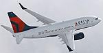
TDS Boeing 737-700 Delta Airlines
(Category: FS2004 > Civil Jets)
11.19Mb (2707 downloads)
FS2004 Delta Airlines Boeing 737-700. A B737-700 in Delta Air Lines livery, developed by Tenkuu Developers Studio (TDS). Model features high resolution textures, dynamic flexing wings, nose gear steering, rudder lock, ground spoilers, low speed aileron locks at high speed, fully animated control surfaces, fully independent suspension, trim animation, opening passenger doors, rolling wheels, animated thrust reversers with reverser block doors, detailed textures, full night lighting, ground service vehicles and more. Model design by Hiroshi Igami. Flight dynamics design by Nick Wilkinson, with assistance from David Biggar. Master textures by Kyle Schurb. Livery by Kyle Schurb.
Posted Sep 15, 2013 11:04 by uploader
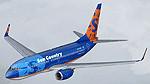
TDS Boeing 737-700 Sun Country Airlines
(Category: FS2004 > Civil Jets)
15.58Mb (9040 downloads)
FS2004 Sun Country Airlines Boeing 737-700. A B737-700 in the Sun Country Airlines livery, developed by Tenkuu Developers Studio (TDS). Model features high resolution textures, dynamic flexing wings, nose gear steering, rudder lock, ground spoilers, low speed aileron locks at high speed, fully animated control surfaces, fully independent suspension, trim animation, opening passenger doors, rolling wheels, animated thrust reversers with reverser block doors, detailed textures, full night lighting, ground service vehicles and more. Model design by Hiroshi Igami. Flight dynamics design by Nick Wilkinson, with assistance from David Biggar. Master textures by Kyle Schurb. Livery by Kyle Schurb
Posted Sep 15, 2013 10:58 by uploader
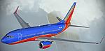
TDS Boeing 737-700 Southwest Airlines "Canyon Blue"
(Category: FS2004 > Civil Jets)
14.99Mb (3490 downloads)
FS2004 Southwest Airlines "Canyon Blue" Boeing 737-700. B737-700 in the Southwest Airlines livery, developed by Tenkuu Developers Studio (TDS). Model features high resolution textures, dynamic flexing wings, nose gear steering, rudder lock, ground spoilers, low speed aileron locks at high speed, fully animated control surfaces, fully independent suspension, trim animation, opening passenger doors, rolling wheels, animated thrust reversers with reverser block doors, detailed textures, full night lighting, ground service vehicles and more. Model design by Hiroshi Igami. Flight dynamics design by Nick Wilkinson, with assistance from David Biggar. Master textures by Kyle Schurb. Livery by Kyle Schurb.
Posted Sep 15, 2013 10:56 by uploader
TDS Boeing 737-700 - Base Package
(Category: FS2004 > Civil Jets)
30.92Mb (3060 downloads)
Tenkuu Developers Studio - Boeing 737-700 - Base Package
TDS is pleased to release our Boeing 737-700 for Microsoft Flight Simulator 2004.
Model Builder : Hiroshi Igami
FDE Designer : Nick Wilkinson, with assistance from David Biggar.
Master Painter : Kyle Schurb
Supported by TDS staff and others who helped.
Livery Painted by : Kyle Schurb
Posted Sep 15, 2013 10:40 by uploader
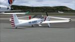
AMT-200 Super Ximango
(Category: FS2004 > Props)
67.43Mb (2050 downloads)
AMT-200 Super Ximango package for Fs2004. Model includes VC. By Osvaldo Icemam & MArio Donadon
Posted Sep 15, 2013 10:39 by uploader
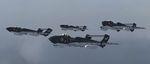
De Havilland Sea Vixens AI Aircraft
(Category: FSX > Military)
11.20Mb (2148 downloads)
FSX AI Aircraft. De Havilland Sea Vixens.
FAW2, multi-LOD models with 5 variations
including wing and nose fold animation.
10 textures of 899 NAS aircraft circa 1971,
including XP924 (G-CVIX), the present day
display aircraft seen at many UK air shows.
Paint Kit included. Separate pack in FS9 native
code is in JYAI_Sea_Vixens_FS9_1.zip.
By John Young ACG/MAIW.
Posted Sep 15, 2013 09:55 by uploader
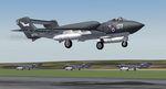
De Havilland Sea Vixens AI Aircraft
(Category: FS2004 > Misc)
11.61Mb (1517 downloads)
FS9 AI Aircraft. De Havilland Sea Vixens.
FAW2, multi-LOD models with 5 variations
including wing and nose fold animation.
10 textures of 899 NAS aircraft circa 1971,
including XP924 (G-CVIX), the present day
display aircraft seen at many UK air shows.
Paint Kit included. Separate pack in FSX native
code is in JYAI_Sea_Vixens_FSX_1.zip.
By John Young ACG/MAIW.
Posted Sep 15, 2013 09:53 by uploader
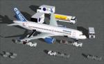
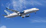
House Colors Bombardier FTV1 CSeries 100
(Category: FSX > Civil Jets)
5.09Mb (1406 downloads)
FSX House Colors Bombardier FTV1 CSeries 100 V4. This version 4, features more improved and detailed aircraft model and textures , including CamSim own static displays and Animated Ground Servicing (AGS). 2d panel but no VC.
Model design and paint by Camil Valiquette.
Posted Sep 15, 2013 09:42 by Camil Valiquette
House Colors Bombardier FTV1 CSeries 100
(Category: FS2004 > Civil Jets)
3.33Mb (891 downloads)
FS2004 House Colors Bombardier FTV1 CSeries 100 V4. This version 4, features more improved and detailed aircraft model and textures , including CamSim own static displays and Animated Ground Servicing (AGS).
Model design and paint by Camil Valiquette.
Posted Sep 15, 2013 09:39 by Camil Valiquette