


All Files > Page 1822
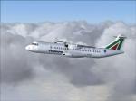
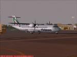
FS2004/FSX Flight 1 Avianova ATR 72-500 Textures
(Category: FSX > Payware)
3.75Mb (1592 downloads)
FS9/FSX Avianova ATR 72-500, registration EI-CLB, textures only for the payware Flight One ATR72, requires Flight1 "Text-O-Matic" texture installation software.
Posted Dec 26, 2011 08:23 by Stefano Meneghini
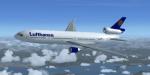
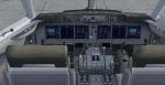
MD-11 Lufthansa Package
(Category: FSX > Civil Jets)
15.68Mb (8338 downloads)
Lufthansa MD-11 with VC, sounds. Model by SMS. FSX panel mods by Chris Evans.
Posted Dec 26, 2011 05:36 by ricardo_tv
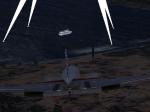
Smugglers Cove
(Category: FSX > Missions)
9.99Mb (2204 downloads)
A FSX Acceleration mission. Just a short delivery hop - or is it? Then comes the secret black box, the professor, the marines. Spend a day with Captain Ron - about 50 minutes.
Posted Dec 25, 2011 20:52 by David Blake
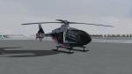
Icaro EC-135 Brose Textures
(Category: FS2004 > Helicopters)
3.60Mb (336 downloads)
Brose Textures for the Icaro EC-135 package.
Required files:
required file
Posted Dec 25, 2011 18:28 by benimix - Benedikt Fröhlich
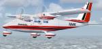
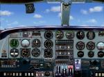
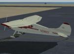
Partenavia P-68C Package
(Category: FSX > Props)
29.08Mb (4780 downloads)
I updated Arne Bartels, Jean-Pierre Langer, Massimo Taccoli and James Mckays' FS2002/FS2004 Partenavia P-68C. I reworked the 2d panel and CFG to make them work in FSX I also added Texture thumbnails. NO VC.
Posted Dec 25, 2011 18:22 by Michael E. Roberts
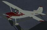
Alphasim Cessna 170B Textures
(Category: FSX > Props)
1.15Mb (927 downloads)
This is a repaint (and the first of its type, I think) for Alphasim's Cessna 170B, a taildragger cousin of the eponymous 172. This repaint replaces the default registration of the original paint with American registration, for my fellow American simmers.
Required files:
required file
Posted Dec 25, 2011 17:47 by Russell Irwin
Bombardier CRJ 700 Wings Air Textures
(Category: FSX > Civil Jets)
1.58Mb (2310 downloads)
CRJ 700 Wings Air Indonesia textures for the FSX default CRJ-700
Posted Dec 25, 2011 12:23 by ikhsan ramadhan ritonga
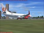
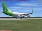
Boeing 737-800 Wings Air Textures
(Category: FSX > Civil Jets)
3.77Mb (1326 downloads)
Wings Air White textures for the default Boeing 737-800.
Posted Dec 25, 2011 12:18 by ikhsan ramadhan ritonga
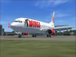
Boeing 737-800 New Citilink Garuda Indonesia
(Category: FSX > Civil Jets)
3.21Mb (5448 downloads)
New Citilink Garuda Indonesia textures for the default Boeing 737-800.
Posted Dec 25, 2011 12:07 by ikhsan ramadhan ritonga
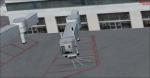
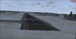
Manchester-Boston Regional Airport (KMHT), NH
(Category: FSX > Scenery)
13.18Mb (2125 downloads)
This airport was made using Airport Design Editor 9x (ADE9x). Manchester Boston Regional Airport is an airport located in Mancherster New Hamshire. I replaced all of the stock building with more accurate ones. I added more gates at the terminal a cargo gates to the southwest. At the cargo area, I added cargo buildings and cargo trucks. At the main terminal I put jetways and more gates. At the general aviation area, I put static aircraft and more parking. I made all this based on Google earth and Bing maps. Please read the readme for instructions on how to install. This is for Flight Simulator X only.
By Tyler Lawrence
Posted Dec 24, 2011 23:29 by Tyler Lawrence