All Files > Page 1518
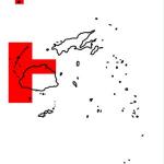
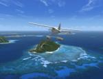
FSX Fiji Photoreal Scenery Package - Western Division 2 (Mamanucas)
(Category: FSX > Scenery)
229.53Mb (1685 downloads)
FSX Fiji Photoreal Scenery Package - Western Division 2 (Mamanucas)
Fiji is an island nation in the South Pacific with more than 300 islands in total.
Fiji is divided into four major administrative divisions: Western, Central, Northern
and Eastern. These Western Division scenery packages cover the entire area of
the Western Division. Included are more than 40 islands and huge areas of reefs
stretched over a total area of 20,000 sq km – all in photoreal, 1m/pixel texture
resolution. List of the 23 islands included in this package: Beachcomber, Bounty,
Castaway, Eori, Kodomo, Mala Mala, Malolo-Lalai, Mana, Matamanoa, Monu, Monuriki,
Namotu, Nautanivono, Navini, South Sea, Tavua, Tavarua, Tivua, Tokuriki, Treasure,
Vanua Levu, Vomo, Yanuya. By Tiberius Kowalski
Posted Jan 3, 2013 03:15 by TK
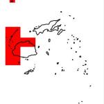
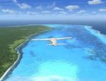
FSX Fiji Photoreal Scenery Package - Western Division 1 (Vatulele)
(Category: FSX > Scenery)
32.59Mb (1433 downloads)
FSX Fiji Photoreal Scenery Package - Western Division 1 (Vatulele)
Fiji is an island nation in the South Pacific with more than 300 islands in total.
Fiji is divided in four major administrative divisions: Western, Central, Northern
and Eastern. These Western Division scenery packages cover the entire area of
the Western Division. Included are more than 40 islands and huge areas of reefs
stretched over a total area of 20,000 sq km – all in photoreal, 1m/pixel
texture resolution. List of islands included in this package: Vatulele By Tiberius
Kowalski
Posted Jan 3, 2013 01:47 by TK

Big Dawg Heliport and Practice Area
(Category: FSX > Helicopters)
0.07Mb (2548 downloads)
Your own house and hanger and your own private practice area for helicopters. By BigDawg205.
Posted Jan 3, 2013 00:08 by BigDawg 205
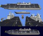
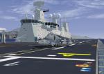
LHD Juan Carlos I Aircraft Carrier
(Category: FSX > Misc)
16.23Mb (3085 downloads)
Spanish Armada LHD Juan Carlos I. To be used with AIcarriers. Improved version of previous releases by jagl04
Posted Jan 2, 2013 18:51 by jagl04


Aeroprakt A-22 Foxbat
(Category: FSX > Props)
9.27Mb (5968 downloads)
Aeroprakt A-22 Foxbat.
The A-22 'Foxbat' is available as a Ready-To-Fly factory built aircraft or as an advanced kit. Building time for the kit is 300 to 500hrs. Designed by former Antonov design engineer, Yuri Yakovlev , the A-22 is one of a line of many aircraft produced by Aeroprakt in the Ukraine. Construction is aluminium with some parts of the wing and control surfaces covered with Ceconite. The A-22 is powered by the reliable Rotax 912 or 912S engine, and the 3-blade composite ground adjustable propellor from KievProp is very quiet. A cabin width of 120cm (128cm at the elbows) ensures ample room for pilot and passenger. As a comparison, the cabin with of a Cessna 172 is 100cm and a Jabiru SP is 97cm (107cm at the elbows). Transparent doors with convex sides allow for excellent downward visibility. The instrument panel has room for a generous instrument layout. Dual controls are standard with options of either conventional control yokes or a centre stick. A centre stick with a "Y" grip is also available. Basic VFR flight and engine instruments are included with the ready-to-fly aircraft. A stall speed of 50kph (30mph) using the full span flapperons puts the A-22 safely into the microlight category. The all round visibility from the A-22 is spectacular. The aircraft has a baggage compartment that allows up to 20kg to be carried.
Posted Jan 2, 2013 14:41 by uploader


Aeroprakt A-22 Foxbat Ultralight
(Category: FSX > Props)
9.27Mb (2567 downloads)
Aeroprakt A-22 Foxbat.
The A-22 'Foxbat' is available as a Ready-To-Fly factory built aircraft or as an advanced kit. Building time for the kit is 300 to 500hrs. Designed by former Antonov design engineer, Yuri Yakovlev , the A-22 is one of a line of many aircraft produced by Aeroprakt in the Ukraine. Construction is aluminium with some parts of the wing and control surfaces covered with Ceconite. The A-22 is powered by the reliable Rotax 912 or 912S engine, and the 3-blade composite ground adjustable propellor from KievProp is very quiet. A cabin width of 120cm (128cm at the elbows) ensures ample room for pilot and passenger. As a comparison, the cabin with of a Cessna 172 is 100cm and a Jabiru SP is 97cm (107cm at the elbows). Transparent doors with convex sides allow for excellent downward visibility. The instrument panel has room for a generous instrument layout. Dual controls are standard with options of either conventional control yokes or a centre stick. A centre stick with a "Y" grip is also available. Basic VFR flight and engine instruments are included with the ready-to-fly aircraft. A stall speed of 50kph (30mph) using the full span flapperons puts the A-22 safely into the microlight category. The all round visibility from the A-22 is spectacular. The aircraft has a baggage compartment that allows up to 20kg to be carried.
Posted Jan 2, 2013 13:57 by uploader


Borax Open Pit Mine, California
(Category: FSX > Scenery)
59.80Mb (979 downloads)
Photoreal coverage of Borax Open Pit Mine near Edwards AFB in California. Scenery includes blend masks, water masks, and night textures.
Posted Jan 2, 2013 02:41 by Chuck79


Changuinola FS-X
(Category: FSX > Scenery)
17.70Mb (441 downloads)
MPCH scenery for FSX.
Airport located in Changuinola, Bocas Del Toro, Panama
Posted Jan 2, 2013 01:27 by Victor Pinto

TR-612 USAF T33
(Category: FSX > Military)
17.92Mb (4272 downloads)
This is Tim Conrad's T-33 Updated For Flight Simulator X. Design work for the Lockheed P-80 began in 1943 with the first flight on 8 January 1944. Following on the Bell P-59, the P-80 became the first jet fighter to enter full squadron service in the United States Army Air Forces. As more advanced jets entered service, the F-80 took on another role - training jet pilots. The two-place T-33 jet was designed for training pilots to fly jets. This Aircraft belongs to the United States Air Force. This Aircraft has a new 2D and 3D fully functioning cockpits and new Effects. Textures and Updates by Mark " Fireball " Rooks of RDG Aircraft. Package Includes Pictures of the original TR-612 Aircraft Currently located In South Ga.
Posted Jan 1, 2013 00:27 by Mark Fireball Rooks
.jpg-thumb.jpg)
.jpg-thumb.jpg)
Avia 57 on Floats
(Category: FS2004 > Props)
148.48Mb (2170 downloads)
The AVIA 57 Float Plane for FS9 or FSX as Portover - VERSION 1.03
Update includes all known fixes
by Milton Shupe, Nigel Richards, John Smith, and James Banks with help from SOH members. Our gratitude goes out to several very helpful and interested Czech Republic aircraft enthusiasts who were instrumental in discovering rare information that was key to the design quality.
Pkg incl one Aircraft (Passenger and Cargo) with custom flight model and features era panels and gauges, easy-to-read clickable virtual cockpits, elegant cabin interiors, and beautifully crafted thematic exterior textures. Authentic Radial Custom sounds included with thematic variants. Special thanks to Bill "Lionheart" Ortis for use of the pilot figures. FSX Portover Updates Included.
Posted Dec 31, 2012 23:31 by Milton Shupe


