All Files > Page 1532
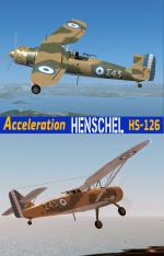
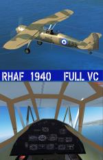
FSX Acceleration Henschel HS-126 RHAF Package
(Category: FSX > Vintage)
37.41Mb (1462 downloads)
FSX Acceleration Henschel HS-126 RHAF package. Royal Hellenic Air force Reg ID# S35 & S43. The HS-126 was Introduced in Greece at December of 1939 and served until 1941.It was used as a reconnaissance and light bomber.This is the new fine model of A.F.Scrub featuring full VC, 2D panel, effects and sound. There are two repaint variations of the aircraft with light blue markings (1939)and mid blue(1940). I have done some minor changes in the 2D panel configuration so the Main panel now appears in Acceleration and changed the prodisk texture so it does not look solid in FSX. Historical info from the RHAF records and photos are included in the package. Modifications and Repaint by Hellenic Aircraft/Yiannis Katehis Tsetsas.
Posted Dec 15, 2012 02:43 by YIANNIS KATEHIS TSETSAS

Airbus A319 Germanwings Package
(Category: FSX > Civil Jets)
35.07Mb (5727 downloads)
Project Airbus A319 Germanwings new livery for FSX.
Includes default VC, upgraded by Jim Fly.
You can find this aircraft under 'Project Airbus' in your FSX menu.
Repaint by Jim Fly
Posted Dec 15, 2012 01:22 by Jim Fly
Lockheed L-149 Panair Textures
(Category: FSX > Vintage)
5.85Mb (638 downloads)
FSX/FS9 Panair Do Brasil L-149 textures for Manfred Jahn's outstanding Lockheed L-1049 Super G Constellation.
Required files:
required file
Posted Dec 14, 2012 21:36 by Gary Harper
Abandoned/half-finished Challenger 601 model (.max) Project
(Category: FS Design > Aircraft Design)
2.40Mb (138 downloads)
Here is a MAX file of the Challenger 601 I never finished. It's almost fully animated, has most of the textures mapped, but I didn't like it...so you can have it. Merry Christmas!
Posted Dec 14, 2012 18:45 by The Ozzman


FS2004 American Pacific Lockheed Constellation Textures
(Category: FS2004 > Props)
0.12Mb (267 downloads)
Repaint textures for the Connie by Mike Stone in the livery of American Pacific, one of the airlines from the sim. Repaint by Don Brynelsen using Mike's paintkit.
Required files:
required file
Posted Dec 14, 2012 15:00 by Don Brynelsen
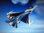
Belgian Airforce F-16 Solo Display Team 2012 Textures
(Category: FSX > Military)
3.84Mb (1632 downloads)
The Belgian F-16 solo Display jet of 2012.
Texture for the Kirk Olsson VIPER for FSX only. Hope u like im!
Texture by Mees Jansen
Required files:
required file
Posted Dec 14, 2012 13:42 by Mees Jansen
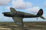
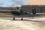
Arado Ar79
(Category: FSX > Vintage)
8.18Mb (1846 downloads)
FSX/FS2004 Arado Ar 79
Back in more successful pre-war times, the Ar 79 had represented the company’s attempt to design a cheap & cheerful modern light aircraft that would lend itself well to common, non-utility tasks. Unusually, despite it being 1938, it was designed for the civil market only and very few were actually used in military service. Its clean lines and retractable main gear gave it a respectable performance. GMAX mdl by A.F.Scrub.
Posted Dec 14, 2012 09:55 by A.F.Scrub

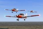
BAe Bulldog T1
(Category: FS2004 > Vintage)
10.07Mb (1863 downloads)
Bulldog T1 Pup trainers. Model and textures by J R Lucariny
Posted Dec 14, 2012 08:38 by JRLucarinyFS2004Models


Baade VEB 152
(Category: FS2004 > Civil Jets)
3.53Mb (2025 downloads)
152A East Germany commercial airplane. Model and textures by J R Lucariny
Posted Dec 14, 2012 08:24 by JRLucarinyFS2004Models
.jpg-thumb.jpg)

Avia 57 Trimotor Package
(Category: FS2004 > Props)
128.91Mb (4623 downloads)
The AVIA 57 for MSFS2004/FS9 ACof - VERSION 1.0
by Milton Shupe, Nigel Richards, John Smith, and James Banks with help from SOH members. Our gratitude goes out to several very helpful and interested Czech Republic aircraft enthusiasts who were instrumental in discovering rare information that was key to the design quality.
Pkg incl three Aircraft (Passenger and Cargo) with custom flight models and features era panels and gauges, easy-to-read clickable virtual cockpits, elegant cabin interiors, and beautifully crafted exterior textures. Authentic Radial Custom sounds included. Special thanks to Bill "Lionheart" Ortis for use of the pilot figures.
This is the last in the series of Avia aircraft we have done. They are the Avia 51, 156, 56, and 57, all original Czech designs by Robert Nebesar.
This will also work in FSX but is not intended for use in FSX.
Posted Dec 14, 2012 03:47 by Milton Shupe


