All Files > Page 937


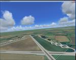
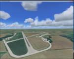
RAF Down Ampney, UK
(Category: FSX > Scenery)
1.94Mb (414 downloads)
RAF Down Ampney (ICAO X2DA) was a Royal Air Force station located 1.8 miles (2.9 km) north east of Cricklade, Wiltshire and 3 miles (4.8 km) south west of RAF Fairford, Gloucestershire.
The airfield operated during World War II from February 1944 until February 1947.
Down Ampney was part of a group of 3 airfields with RAF Broadwell and RAF Blakehill Farm dedicated to air transportation.
No. 48 Squadron RAF and No. 271 Squadron RAF flew Douglas Dakotas on major missions. On D-Day they dropped the main elements of the 3rd Parachute Brigade in Normandy as well as towing Airspeed Horsa gliders across the English Channel.
They were also active in Operation Market Garden (Arnhem) and the Rhine crossing.
Source: Wikipedia
Posted Apr 15, 2016 09:52 by Terry Boissel


FSX/P3D Boeing 747-400 Air China package
(Category: FSX > Civil Jets)
33.73Mb (2995 downloads)
FSX/P3D Boeing 747-400 Air China package with enhanced VC.
Air China currently (2016) operate 3 Boeing 747-400 aircraft and these are due to be replaced by 747-8i.
Project Opensky Boeing 747-400 assembled and upgraded for FSX with the developed B747 VC (virtual 3d cockpit) from Alejandro Rojas Lucenda (Manual included). This is the Project Opensky FSX native Boeing 747-400 model, and includes ground cargo servicing, stairs, opening nose section and more. (FSX Go to Instrument Panel -Posky Util: P3D - Go to Vehicle - Instrument panel - Posky util )
Included CF engine sounds from BrandonG, with realistic jet whine to make your flight sound great.
Thank you to Project Opensky for their contributions to the worldwide community of flight simulation. I have added the great weathered textures by Corey Ford.
Also includes the Boeing 747 VC textures upgrade. This give a much clearer 747 interior virtual cockpit look. Zip preview for larger pictures.
Assembled and edited for FSX by Chris Evans.
Posted Apr 15, 2016 09:39 by chris evans

Boeing 747-400 Air China
(Category: FS2004 > Civil Jets)
10.58Mb (841 downloads)
Boeing 747-400 Air China. Air China currently (2016) operate 3 Boeing 747-400 aircraft and these are due to be replaced by 747-8i. Model by Project Opensky. Textures by Corey Ford.
Posted Apr 15, 2016 08:36 by ChrisE

Project Airbus A320 Paintkit
(Category: FS Design > Aircraft Paintkits)
16.18Mb (2514 downloads)
Project Airbus A320 Paintkit. Contains PSD files for full fuselage and aircraft for the PA A320.
Posted Apr 14, 2016 19:37 by archive

Skyspirit/ Project Opensky Boeing 777-8x (777X) Paintkit
(Category: FS Design > Aircraft Paintkits)
5.20Mb (618 downloads)
Official paintkit for the Skyspirit Boeing 777-8 / 777X.
Posted Apr 14, 2016 15:37 by chrisE


'If My Heart Had Wings' Glider
(Category: FSX > Gliders and Ultralites)
6.29Mb (1587 downloads)
If My Heart Had Wings first glider by Mellin - Version 1.0.0
This is a glider from a visual novel: 'If My Heart Had Wings', by Pulltop and/or moenovel. This glider was built by students of KEIFU Technical Collage in Kazegaura, Japan who attended 'Soaring Club'. With this glider they flew through 'Morning Glory' (a rare meteorological phenomenon).
More information about this visual novel can be found on their page: http://moenovel.com/imh/
Posted Apr 14, 2016 11:05 by Piotr Mellin Malicki


FSX/P3D Northrop Grumman E-11A Sentinel USAF Package
(Category: FSX > Military)
40.60Mb (4347 downloads)
FSX/P3D Northrop Grumman E-11A Sentinel USAF Package.
The E11A was the USAF designation for four Global Express aircraft being used as a platform for the Battlefield Airborne Communications Node. A BD-700 has also carried the High-Altitude Lidar Operational Experiment (HALOE) in order to survey large areas rapidly.
Model by Iris with added enhanced CRJ700 VC, including HUD/HGS, FMC and more. Upgraded VC by Robert Taylor, includes HUD/HGS, GPWS, better VC textures. I have added Honeywell FMC (Find it in Instrument panel - Views) and revised MFD as well as custom sounds. High quality model with opening doors and stairs.
All credit to the fantastic talents of Iris and thank you to them for the wonderful model. USAF textures by S Petersen. Zip preview for larger images. Other updates and packaged by Chris Evans.
Posted Apr 14, 2016 06:23 by chris evans


RAF Fairford 1944, UK
(Category: FSX > Scenery)
1.51Mb (281 downloads)
RAF Fairford (IATA: FFD, ICAO: EGVA) is a Royal Air Force (RAF) station in Gloucestershire, England which is currently a standby airfield and therefore not in everyday use.
RAF Fairford was constructed in 1944 to serve as an airfield for British and American troop carriers and gliders for the D-Day invasion of Normandy and Operation Market Garden during World War II
Posted Apr 14, 2016 03:10 by Terry Boissel


FSX/P3D Boeing 747-400ERF AirBridge Cargo package
(Category: FSX > Civil Jets)
36.64Mb (1996 downloads)
FSX/P3D Boeing 747-400ERF AirBridge Cargo (o/b ASL Airlines) package with enhanced VC.
Air Bridge Cargo is Russia's largest cargo airline and operates 19 Boeing 747 aircraft, of which 5 are ERF, on flights throughout the globe.
Project Opensky Boeing 747-400ERF assembled and upgraded for FSX/P3D with the developed B747 VC (virtual 3d cockpit) from Alejandro Rojas Lucenda (Manual included). This is the Project Opensky FSX native Boeing 747-400 model, and includes ground cargo servicing, stairs (FSX - Go to Views - Instrument Panel -Posky Utility. In P3D go to Vehicle - Instrument panel - Posky Utility), opening nose section and more.
Included CF engine sounds from BrandonG, with realistic jet whine to make your flight sound great.
Thank you to Project Opensky for their contributions to the worldwide community of flight simulation. I have added the great textures by RyanC.
Also includes the Boeing 747 VC textures upgrade. This give a much clearer 747 interior virtual cockpit look. Zip preview for larger pictures.
Assembled, edited and tested in FSX Acceleration and P3D by Chris Evans.
Posted Apr 13, 2016 09:08 by chris evans

Boeing 747-400ERF AirBridge Cargo
(Category: FS2004 > Civil Jets)
13.67Mb (493 downloads)
Boeing 747-400ERF AirBridge Cargo. Air Bridge Cargo is Russia's largest cargo airline and operates 19 Boeing 747 aircraft, of which 5 are ERF, on flights throughout the globe. Model by Project opensky. Textures by RyanC.
Posted Apr 13, 2016 08:25 by ChrisE


