All Files > Page 5142
Jet
Attack mission
(Category: CFS1 > Missions & Campaigns)
0.30Mb (494 downloads)
Jet
Attack mission. You are a P51 pilot flying escort for a formation
of B-17s attacking oil refineries in central Germany. You are attacked
by three 109ks, two 190s and three Me 262s while dodging VERY heavy
flak. There is also a 60% chance of meeting two more 190s on the way
home. The mission comes with a 109k and a correctly scaled Me 262.
By Chris Amon. 310K
Posted Jun 10, 2008 11:32 by archive
20
missions set for Microsoft Combat Flight Simulator 1
(Category: CFS1 > Missions & Campaigns)
1.52Mb (1231 downloads)
20
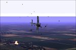
missions set for Microsoft Combat Flight Simulator 1 All required
elements includedThis is a 20-missions-set located around northern-france
in the time from May 1944 until the end of war in Germany in 1945,
flown by axis-side. I didn´t build a truly historical campaign, but
there´s a headline: The march back of the german forces from France
to the "Defense of the Reich", the fall of the "Third Reich". The
Luftwaffe has been in a defense role. Airfields and key positions
of the Wehrmacht have been under permanent attack. The Luftwaffe started
operating from improvised airfields. A reflection of "like it could
have been" is what you get with this campaign. You will suffer under
multiple attacker-waves, high altitude dogfights, difficult take-offs
and landings from a road, heavy-to-master ground attacks,Bomber-raids
at night and of course you will fly that great Fw190´s and Me262a1
included into the package!!! By Mathias Pommerien. 1.5MB
Posted Jun 10, 2008 11:32 by archive
Seed
Files for CFSItaly and CFSItalyN
(Category: CFS1 > Missions & Campaigns)
0.04Mb (415 downloads)
Seed
Files for CFSItaly and CFSItalyN (CFS scenery files for Italy,
available at this site). These files flatten the default terrain below
the add-on Italy sceneries, and eliminate invisible crashes and propstrikes
which were happening at low altitudes. Now feel free to barrel through
the alps at high speed at treetop height... By C Burgess. 37K
Posted Jun 10, 2008 11:32 by archive
Italy
Mission Pack for CFS
(Category: CFS1 > Missions & Campaigns)
1.77Mb (686 downloads)
Italy
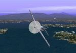
Mission Pack for CFS: Italy Mission Pack for CFS (repost):
A set of missions designed for the CFS Italy scenery CFSItaly and
CFSItalyN. All other required scenery and airplanes are included.
The repost replaces an anonymous swordfish with Steve Lovass-Nagy's
CFS classic, which I'd originally meant to include. By C Burgess (UPDATED)
Posted Jun 10, 2008 11:32 by archive

CFS
UH-1H(Huey),
(Category: CFS1 > Modern Aircraft)
1.07Mb (999 downloads)
CFS
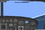
UH-1H(Huey), with a rescued pilot dangling from the winch, operated
by the spoiler key. Gunship Helicopter. Also includes DP, panel and
sound. Airfile By Deane Baunton. Repaint and DP file by Steve McClelland.
File size 1123248
Posted Jun 10, 2008 11:32 by archive
CFS
McDonnell XF-85 Goblin
(Category: CFS1 > Modern Aircraft)
0.12Mb (855 downloads)
CFS
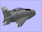
McDonnell XF-85 Goblin Moving Parts model of the experimental
Parasite escort fighter. Designed to be carried within the fuselage
of a bomber. G key operates recovery hook & ski gear. DP included.
by Satoshi Terasaki. File size 124521
Posted Jun 10, 2008 11:32 by archive
F84E
Thunderjet,
(Category: CFS1 > Modern Aircraft)
0.15Mb (778 downloads)
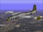
F84E
Thunderjet, USAF Korean fighter. F-84e Thunderjet PPP v1.0 1999
Tim Piglet Conrad File size 154259.
Panel
for this :F84Pangau
CFS Only.
F-84E Thunderjet panel.
Would suit other '50's jets. File size
421023
Author Mike Eustace
Posted Jun 10, 2008 11:32 by archive

P-80
Shooting Star
(Category: CFS1 > Modern Aircraft)
0.67Mb (843 downloads)
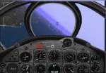
P-80
Shooting Star. 1st US jet aircraft to be used in operation, 1945.
Later used in Korea. Lockheed P-80 Shooting Star for MS Combat Flight
Simulator Aircraft by Chris Lampard Panel by Phil Perrot DP by Katy
Pluta. File size 700131
Posted Jun 10, 2008 11:32 by archive

CFS
VERSION
(Category: CFS1 > Modern Aircraft)
0.35Mb (718 downloads)
DH Venom Mk 4 CFS
VERSION File size 368391. Capt Slug
Posted Jun 10, 2008 11:32 by archive

F-14A
Tomcat
(Category: CFS1 > Modern Aircraft)
2.09Mb (1263 downloads)
F-14A
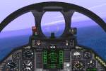
Tomcat. FS98 / CFS Grumman F-14A Tomcat Package The F-14A Tomcat
is a twin engine, two seater, sweep wing jet fighter. It has been
the standard U.S.Navy carrier-based interceptor for more than twenty
years. This version features panel and flight model enhacements, as
well as full CFS compatibility and .dp file (featuring the Vulcan
cannon). Original 3D model by Terry Hill,repaints flight model & panel
by Dino Cattaneo. Soundwork by Aaron Swindle. File size 2192496
Posted Jun 10, 2008 11:32 by archive


