


All Files > Page 1352
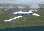
Bombardier Learjet 35
(Category: FS2004 > Civil Jets)
2.20Mb (2406 downloads)
This aircraft is built for FS2004 , The aircraft may work in FS2002, but I do not support it , Use Shift-E to open the doors , Texture/Paintkit Fixed , Texture By Alfin Vincent B. Omosura , Aircraft From Mike Stone
Posted Dec 14, 2013 22:52 by Alfin Vincent B. Omosura
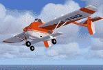
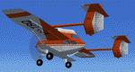
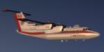
Transavia PL-12 Airtruck VH-TRQ Textures
(Category: FS2004 > Props)
1.58Mb (335 downloads)
FS2004/FSX TEXTURES ONLY - Transavia PL-12 Airtruck VH-TRQ. You can see it in Cuatro Vientos Air Museum, Madrid, Spain. Its needed Mike Stone's original model (spl12.zip)
Required files:
required file
Posted Dec 14, 2013 18:15 by Enrique Medal
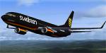
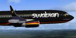
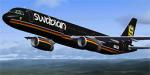
Swabian Airlines Boeing 737-800 Textures
(Category: FSX > Civil Jets)
8.37Mb (487 downloads)
Textures for the default FSX Boeing 737-800 only
Posted Dec 14, 2013 16:41 by Nils N.
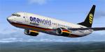
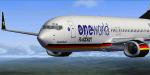
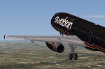
Swabian Airlines (oneworld) Boeing 737-800 Textures
(Category: FSX > Civil Jets)
8.43Mb (452 downloads)
Oneworld textures only for the default FSX Boeing 737-800.
Posted Dec 14, 2013 14:52 by Nils N.
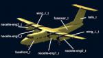
Dash 7 Paint Kit-FS9-FSX
(Category: FS Design > Aircraft Paintkits)
63.84Mb (517 downloads)
Dash 7 DHC 7 Paint Kit for both -FS9-FSX. Contains PSD, BMP and configuration files for painting.
Posted Dec 14, 2013 11:16 by Milton Shupe

FSX Boeing 787 American Airlines
(Category: FSX > Civil Jets)
8.25Mb (6924 downloads)
The Boeing 787 dreamliner is the latest airliner wide body and long range produced by this company. Here is the American Airlines version from Camil Valiquette including AGS (Advanced Ground Servicing). 2D panels for wide and standard screen (no VC), GPWS callout, and warning horn callout by Philippe Wallaert. See instructions in the readme.txt file. Credits: Camil Valiquette for the original and excellent aircraft. Nice flights!
Posted Dec 14, 2013 09:14 by Philippe Wallaert
Swabian Airlines A321 Textures
(Category: FSX > Civil Jets)
6.91Mb (636 downloads)
Swabian airlines textures only for the default FSX Airbus A321
Posted Dec 14, 2013 05:47 by Nils N.
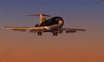
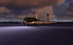
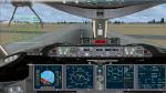
VikingAir Boeing 727-100 Super Performer
(Category: FSX > Civil Jets)
66.43Mb (6267 downloads)
VikingAir Boeing 727-100 Super Performer.
Enjoy this Classic aircraft. Original 727-100 JT8D jet engines turbofan sound. "The Whisper jet". Smoke file. Press "F2" and hold it Down, the plane will pushback while you stear it. Aircraft.cfg. Udated. New 2D Cockpit with great overlook. Have a nice flight.
Posted Dec 14, 2013 02:18 by Kim Schandorff
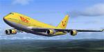
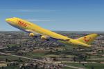
TUIfly Boeing 747-400 Textures
(Category: FSX > Civil Jets)
6.23Mb (1439 downloads)
TUIfly textures only for the default FSX Boeing 747-400
Posted Dec 14, 2013 01:20 by Nils N.
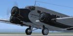

JU52 - D-AQUI Textures
(Category: FSX > Vintage)
6.50Mb (2235 downloads)
D-AQUI is the oldest still airworthy JU52. Built in 1936 she started service for Lufthansa. She then served in Norway, Germany, and ultimately Ecuador. She was found there in 1969 by an American, restored and flown at airshows throughout the USA. In 1984 she was acquired by Lufthansa, painstakenly restored, and painted with her original markings of D-AQUI (her modern ID is D-CDLH located on the fuselage under the elevators). She still flies about 10,000 passengers a year. Textures only for the O.Fischer model.
Required files:
required file
Posted Dec 14, 2013 01:01 by Wlfgang Bitterolf