
24.25Mb (933 downloads)
FSX Scenery 5B2 - Saratoga County Airport 5B2 - Saratoga County Airport, v2.0 for FSX-Acceleration Located in the foothills of the Adirondack Mountains in upstate NY, USA. This facility is owned by Saratoga County, formerly housed Rich Air and currently houses North American Aviation. 5B2 is a non-controlled airfield catering to small engine a/c up to a few private jet daily traffic serving 'The Northcountry' and Saratoga Springs, New York. All Objects fully designed and completely redone in GMAX using high resolution photo-real textures. Optional seasonal files included. Also includes new ADEX file, more accurate airport grounds perimeter, satellite photo-real grounds, custom taxiways, taxi-signs and taxi lights. ADEX file also designed to support general aviation AI. All textures mipmapped for performance. By EdGeneer Cox.
Posted May 3, 2012 09:12 by uploaded


0.65Mb (706 downloads)
In this file there are 2 airports. Stoney River Rigional "WMSR" and Close call "WMCC". These aiports are close and work together. Built with FSX Acceleration Effects. Hope you like it as much as i liked making it
Posted May 3, 2012 00:03 by Coosbay323

3.32Mb (6002 downloads)
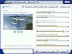
FS Water Configurator is a freeware addon utility for Microsoft Flight Simulator X designed to modify the look of the reflective water in the game. It will increase the realism of the reflections and lighting of the water and is completely controllable by the user. If you prefer glass like reflections or very subtle water reflections, FSWC is the utility for you.
Official site (below)
Posted May 1, 2012 11:17 by ricardo_tv


0.81Mb (440 downloads)
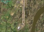
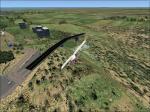
Kokstad Airfield, South Africa (also known on FSX as the H.M.S Bastard Airfield). This airfield is located approximately eight
kilometres from the town of Kokstad. I have also enhanced the town of Kokstad and access roads to provide a more realistic interpretation of this town when flying over it.
Posted Apr 30, 2012 21:53 by Greg Olfin
2.00Mb (1136 downloads)
This is the final update for VOML scenery at Mangalore, India. Included (fictional) parallel taxiway for rw 06- 24 to assist AI traffic.
Posted Apr 30, 2012 10:51 by Ratan Lewis

2.35Mb (1370 downloads)
Des Moines Iowa International Airport For FSX. Updated scenery.
1. The entire default terminal was excluded in FSX and new terminal buildings have been modelled with FSDS.
2. All jetways and buildings will display as long as scenery complexity in FSX is set at normal or higher.
3. The vehicle paths have been redesigned so as not to allow airport vehicles to enter taxiways.
4. Optionally, both runways may be opened for AI traffic. & more.
Patrick Finch
Posted Apr 29, 2012 04:09 by uploader
.jpg-thumb.jpg)
8.03Mb (1081 downloads)
Fly from the worlds highest airport, taking off from the longest public runway. Located in the vast wilderness of Tibet, Qamdo Bamda Aiport is one of the worlds most remote airports, a two and a half hour drive from the nearest city. This is proudly brought to you by DB FlightSim
Posted Apr 20, 2012 18:51 by David Birch
0.52Mb (1252 downloads)
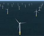
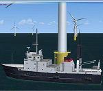
100 animated wind turbines with optional boat landing platforms - located off the Kent coast, England. Addon for freeware FSX Power Project - includes a model library upgrade for the project.
Required files:
required file
Posted Apr 20, 2012 07:05 by Ray Porter


45.42Mb (1322 downloads)
Regional airport located to the west of San Felipe city.
Used for both military and civilian aircraft, works
only for private flights and small-scale aircraft.
With photo-terrain scenery from satellite imagery
of Yahoo Satellite.
Not compatible with versions prior to FSX.
This scenery includes terminal building and hangars with realistic
textures from images obtained from Internet.
Also includes a friendly Auto-Install.
Posted Apr 17, 2012 20:47 by David Maldonado

47.74Mb (3517 downloads)
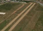
The scenery covers the airfield of Courbessac. Situated in Nimes in the Gard, it possesses two runways. A photorealistic ground retouched by a precision of a meter by pixel and an autogen are present on the scenery.
Posted Apr 15, 2012 07:18 by Flymandrier


