
6.30Mb (1956 downloads)
Mangaluru International Airport, (VOML) formerly known as Bajpe Airport, is
an international airport serving the coastal city of Mangaluru, India. Several daily flights connect Mangaluru
with most major cities in southern and western India as well as many major cities in the Middle East.
As of 2014, Mangaluru International Airport has one of the highest year-over-year passenger growth rates in India,
with a 54 percent growth in international passenger traffic.
Posted Mar 16, 2015 18:19 by Ratan Lewis


103.40Mb (1017 downloads)
Upgrade for Augsburg2003 version 2 including 3D volumetric grass, asphalt road textures and some enhanced ground polygon textures. Also includes fixes for some rendering issues that occurred in version 2.0
Required files:
required file
Posted Mar 15, 2015 15:40 by daveh
2.91Mb (481 downloads)
Last Update V2.2: USA_SBX3 folder, redrawn default LC 21, mixed with my LC 4 from USA_SBX1, and separated. Optional for using with your own textures. No previous Version required.
Posted Mar 14, 2015 09:39 by Markus Balz
10.41Mb (1995 downloads)
Trivandrum International terminal is approximately 3.7 km (2.3 mi) due west from the city centre,16 km (9.9 mi) from Kovalam beach, 13 km (8.1 mi) from Technopark Thiruvananthapuram and 21 km (13 mi) from the proposed Vizhinjam International Seaport spread over an area of 750 acres (300 ha). Trivandrum airport being strategically located at the southern tip of Indian subcontinent, it serves as shortest hopping point from India to Sri Lanka and Maldives and thus preferred airport for international tourists.
Posted Mar 13, 2015 09:34 by Ratan Lewis


11.71Mb (1088 downloads)
Sirnak Airport (LTCV), Turkey. New airport in the southeast of Turkey near Syria border. Sirnak Airport opened 2013. This airport was made using Airport Design Editor. Main terminal added default building of ADE. This also places a few objects from the default FSX scenery library. Compiled using Airport Design Editor. Version LTCV 2015v1. By Hakan DAGHAN
Posted Mar 12, 2015 11:25 by Hakan DAGHAN

0.01Mb (216 downloads)
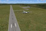
New runway to Quintero added to Chile V.12 Juan Lucero
Posted Mar 10, 2015 15:06 by Juan Lucero
0.00Mb (289 downloads)
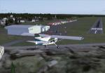
New Airport La Araucania Chile adds to V.12 Juan Lucero
Posted Mar 10, 2015 15:01 by Juan Lucero
7.67Mb (468 downloads)
FSX/P3D Saint-Georges Aerodrome, (CYSG), is a GA aerodrome located 1.5 miles west-southwest of Saint-Georges, Quebec, Canada near the border with Maine. The airport has a long, paved runway, suitable for use by jets. This scenery FSX and P3D Airport St-Georges was inspired by the great FS2004 scenery of the late pilot Virtual Hugues Caron img12. It was made in his memory. This scenery been validated and tested with FSX SP1, SP2, Acceleration and P3D v2. This is a complete reproduction, more accurate and realistic in Saint-Georges Beauce airport with all the buildings around it. Many thanks to Georges Bourgouin for creating this scenery
Posted Mar 9, 2015 02:45 by Mike Leitz

19.46Mb (936 downloads)
This is an FSX scenery package for the CYHM airport, in Hamilton, Ontario, Canada. 20150305. By Flights Ontario.
Posted Mar 5, 2015 10:25 by Fern Marques

1.36Mb (1671 downloads)
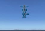
Altitude2K is a flying hotel with 3,000-foot runway.
It is held in the air with a kevlar tank Helium H3 compressed helium. Stability is ensured by the transfer of pressure between the reservoirs and reinforced by four multi-rotor, which also control the travel speed, typically 10 knots.
Altitude2K traveling at a constant altitude of 2,000 feet.
The ship may drop to the sea for procurement, refueling or emergency, controlled neutralization of helium which temporarily made him lose its properties. The tanks then act as floats.
Posted Mar 5, 2015 05:32 by Jean-Pierre Fillion


