


All Time Popular > Page 3415
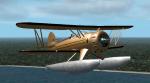
FS2002/2004 Waco Classic Floatplane
(Category: FS2004 > Props)
0.35Mb (767 downloads)
A brown paint scheme for use with Custom Classics Waco Classic Biplane. You need the original package (Available here) to use Repaint by Don Brynelsen
Required files:
required file
Posted Apr 14, 2010 13:40 by Don Brynelsen
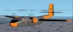
FS2002/2004 DHC-4 Caribou Polar Supply Plane Textures
(Category: FS2004 > Military)
0.13Mb (767 downloads)
Repaint textures for Mike Stone's Caribou depicting the Kee Bird II, an Air Force Plane supplying Polar bases. Textures only, requires Mike's full model (above). Repaint by Don Brynelsen
Required files:
required file
Posted Aug 6, 2010 11:16 by Don Brynelsen
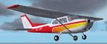
FS2002/2004 Cessna 172 Textures
(Category: FS2004 > Props)
1.07Mb (767 downloads)
A new paint job for the default skyhawk in a red and orange scheme. Repaint by Don Brynelsen using the paintkit by Mark Rooks.
Posted Apr 25, 2009 15:13 by Don Brynelsen
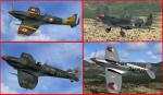
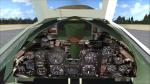
FSX/P3Dv3,v4,v5 Spitfire Mk9 clipped
(Category: FSX > Vintage)
25.18Mb (766 downloads)
FSX/P3Dv3,v4,v5 Spitfire Mk9 clipped
In order to gain a slight improvement in roll rate and about 4 mph at low level, the wing-clipping was done on those models intended (or modified) for low-level. The increase in the rate of roll made it still more competitive with the German FW 190 at low altitude. Native FSX/P3D models by A.F.Scrub.
Posted Mar 22, 2022 06:07 by A.F.Scrub
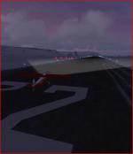
Super Cub mission in Iceland
(Category: FSX > Missions)
0.34Mb (766 downloads)
Take off in a Piper Super Cub from Patreksfjordur airport in Iceland.
Make an intermediate touch-and-go landing, add fuel at the
next landing at Thingeryi and then on to, and land at, Isafjordur airport.
Should be nice to have the landing lights!
You should briefly see the Northern lights (mostly green) as implemented in FSX.
Once at the touch-and-go and again at the approach to the final landing.
Posted Apr 21, 2019 17:43 by Don Olsson
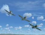
Battle of Britain tribute: flypast
(Category: FS2004 > Vintage)
23.54Mb (766 downloads)
Battle of Britain tribute-flypast. An original great FS2002 Aeroplane Heaven file now updated for FS2004 (by me) and FSX (by Michael Pook). All necessary gauges included, but unfortunately only a static VC.
Posted Nov 2, 2018 17:32 by Erik Hertzberger
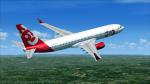
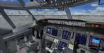
Boeing 737-800 Deccan 360 Package
(Category: FSX > Civil Jets)
26.44Mb (766 downloads)
Boeing 737-800 in the colours of Indian based Deccan 360. Model by Project Opensky. Internal model (VC) by Alejandro Lucenda. Repaint by Jacques Louw
Posted Jan 30, 2016 02:46 by Jacques Louw
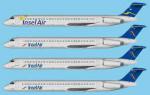
MD83 Insel Air Textures
(Category: FSX > Civil Jets)
15.99Mb (766 downloads)
These are the 3 liveries of Insel:
-Insel Air Old Livery
-Insel Air New Livery
-Insel Air Aruba. Insel Air is a Dutch Caribbean carrier that serves as the national airline of Curacao. Currently operates 3 MD-83 aircraft.
Requires the FSND McDonnell-Douglas MD-83 FSX Package version 2
Required files:
required file
Posted Aug 5, 2015 01:29 by Eduardo D'Andrea
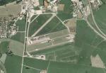
LOWZ, Zell am See, Austria, V 1.0
(Category: FSX > Scenery)
33.84Mb (766 downloads)
This is a Scenery of LOWZ Zell am See in Austria. It works in FSX ans P3D V 2.x.Zell am See Airport is a public use airport located 4 kilometres south of Zell am See, Salzburg, Austria. Usable for airplanes up to 5.7 tonne.
This is my first scenery for FSX.
Guenter Vogele (c)
Posted Oct 1, 2014 00:39 by Guenter Vogele
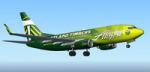
TDS Boeing 737-700 Alaska Airlines Portland Timbers Textures
(Category: FS2004 > Civil Jets)
11.36Mb (766 downloads)
Alaska Airlines Portland Timbers textures for the TDS Boeing 737-700.
Required files:
required file
Posted Sep 17, 2013 10:46 by uploader