



All Time Popular > Page 4288


DC-7B Eastern textures
(Category: FSX > Props)
4.89Mb (445 downloads)
FS9/FSX Eastern Airlines textures for the Calclassic DC-7.
Eastern Airlines textures by Gary Harper.
Required files:
required file
Posted Apr 5, 2017 17:31 by Gary Harper

Boeing 747-400 Singapore Airlines
(Category: FS2004 > Civil Jets)
12.57Mb (445 downloads)
Boeing 747-400 Singapore Airlines new colors. Singapore operated the 747-400 between 1989 and 2012. Model by Project Opensky. Textures by RyanC
Posted Nov 9, 2016 08:23 by chrisE

Circuit Breaker V1.2 (updated)
(Category: FSX > Missions)
2.37Mb (445 downloads)
Up date - "Sea Creature" problem and "clock stop" fixed.
An obstacle course around the New Zealand Airport at Paraparaumu.
Posted Mar 31, 2016 22:06 by Nebram
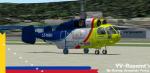
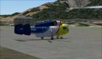
AlphasimKa-32 Heliswiss LZ-KBH Textures
(Category: FS2004 > Payware)
3.14Mb (445 downloads)
Ka-32 Heliswiss LZ-KBH s for the payware Alphasim Fs2004/FsX KA32. Texture by Jose Armando Yanez YV-Repaint's
Posted Jun 29, 2012 11:39 by Jose Armando Yanez
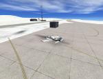
Mt Kilimanjaro Fictional Airfield
(Category: FSX > Scenery)
0.00Mb (445 downloads)
A Science spot on the top of Kilimanjaro mountain, in Kenya, Africa.
Look for airport id: WSMT
Posted May 17, 2012 19:05 by Martin
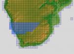
ASTER GDEMv2 30m mesh for Namibia & Botswana Pt3
(Category: FSX > Terrain Mesh)
199.19Mb (445 downloads)
There are four parts to download for this area of Africa.
ASTER GDEM Version 2 is a 30 metre definition DEM, its better than the version 1 data that ERSDAC, of Japan and NASA originally released, but it does have its limitations.
GDEM has been obtained from a satellite that uses stereoscopic infrared scanning cameras, this brings with it problems in the resultant data.....where it sees the tops of trees, buildings etc, as the ground terrain.
If you look at the jpg image with the terrain type errors shown as a graph, you will see that the only 'safe' terrain to use this data with - in FSX - is scrubland, or desert terrain.
Its hopeless in defining the terrain in places like Europe - with all the artificial structures, (buildings) and different types of woodland, so any mesh I create from this data won't include areas like that....it will be more desert type terrain, and scrubland.
I won't be doing Greenland because something about the ice around Greenland, (or any other land mass with ice) it creates false data.
It does give enough fine data to reveal railway lines, and some roads though.
This mesh has been made for FSX only.
Grateful thanks to ERSDAC, and NASA for making this data freely available to the public.
ASTER GDEM
Copyright (c) 2009 - 2011 Earth Remote Sensing Data Analysis Center (ERSDAC) All rights reserved.
ASTER GDEM is a product of METI and NASA.
Posted May 5, 2012 06:27 by Wayne Evans
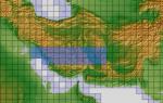
ASTER GDEMv2 30m mesh for Iran & West Caspian Sea States Pt5a
(Category: FSX > Terrain Mesh)
84.48Mb (445 downloads)
There are Fourteen (14) parts of this mesh to download as separate files.
ASTER GDEM Version 2 is a 30 metre definition DEM, its better than the version 1 data that ERSDAC, of Japan and NASA originally released, but it does have its limitations.
GDEM has been obtained from a satellite that uses stereoscopic infrared scanning cameras, this brings with it problems in the resultant data.....where it sees the tops of trees, buildings etc, as the ground terrain.
If you look at the jpg image with the terrain type errors shown as a graph, you will see that the only 'safe' terrain to use this data with - in FSX - is scrubland, or desert terrain.
Its hopeless in defining the terrain in places like Europe - with all the artificial structures, (buildings) and different types of woodland, so any mesh I create from this data won't include areas like that....it will be more desert type terrain, and scrubland.
I won't be doing Greenland because something about the ice around Greenland, (or any other land mass with ice) it creates false data.
It does give enough fine data to reveal railway lines, and some roads though.
This mesh has been made for FSX only.
Grateful thanks to ERSDAC, and NASA for making this data freely available to the public.
ASTER GDEM
Copyright (c) 2009 - 2011 Earth Remote Sensing Data Analysis Center (ERSDAC) All rights reserved.
ASTER GDEM is a product of METI and NASA.
Posted Mar 10, 2012 06:54 by Wayne Evans

VRS SuperBug VFA-101 Grim Reapers Textures
(Category: FSX > Payware)
5.82Mb (445 downloads)
VFA-101 Grim Reapers textures only for the payware VRS SuperBug .
Posted Nov 2, 2010 03:02 by Zebulun"Zebie"Wright
CFS2
The Wind Cried Mary
(Category: CFS2 > Missions & Campaigns)
0.01Mb (445 downloads)
CFS2
The Wind Cried Mary... Foul weather carrier op's multiswap
mission. Inspired by J. Hendrex, who has touched us all in some way.
By Craig Neumann aka Hells Angels_3 RET. 54K
Posted Jun 10, 2008 11:31 by archive

Le
Havre , France for Cfs2
(Category: CFS2 > Scenery)
0.18Mb (445 downloads)
Le
Havre , France for Cfs2 , By golfshaper; Doug Todd. 192K
Posted Jun 10, 2008 11:30 by archive