



All Time Popular > Page 4431


FSX/FS2004 Boeing 727-200 Delta Textures
(Category: FSX > Civil Jets)
11.96Mb (400 downloads)
Boeing 727-200 in DELTA new scheme. Textures only for the TDS Boeing 727-200 model. You can use this repaint with the JT8D-9 & JT8D-217 winglets models
Posted Nov 19, 2015 16:04 by LUIS CASTRO


G91 2 Stormo Display Textures
(Category: FS2004 > Military)
3.00Mb (400 downloads)
This aircraft is a repaint (textures only) for Kazunori Ito's G91R1A available on this site. The aircraft is representative of the 2nd Stormo Demonstration and Display G91 at their 30th Anniversary Celebration in May 1987. Original model by Kazunori Ito, repaint by Ron Wildman Gillam.
Required files:
required file
Posted Dec 8, 2014 23:57 by Ron Wildman Gillam
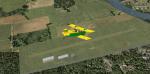
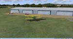
Blue Swan (Abandoned) N32 Sayre PA
(Category: FSX > Scenery)
0.00Mb (400 downloads)
Blue Swan N32 (abandoned)
Located in Sayre PA, the Blue Swan airport Served northern Bradford County PA and Waverly NY. IT survived until 2004.Now it is impossible to find on google earth even if you know Where it was. Replaced by huge industrial parking lots this once charming small town airport is another gone forever.
Posted Jun 25, 2014 02:29 by Jon Davidson


FSX Basler BT-67 Royal Thai Air Force 46-158 Textures
(Category: FSX > Props)
12.85Mb (400 downloads)
FSX Bazler BT-67 repaint textures for the real world Royal Thai Air Force 46-158.
For the wonderful Jahn-Fuernkaess-Metzger-Naegele BT-67, which you must
have previously installed in FSX. Having worn at least three different
liveries between 2004 and 2010 while in service with the Thai Air Force,
this subdued dark bluish gray version of 46-158 dates back to Aug. 26, 2004,
the day the photo that this repaint was based on was taken. Although painted
as close to the photograph's colors as my previous eye surgeries allow me to
perceive, I'm tending to believe that the aircraft is actually more gray than blue.
Anyway, the photo can be seen at Airliners.net by entering the photographer's
name, Sakpinit Promthep, into their search engine. Rumor has it that this
airframe currently resides in pieces in a hangar at Wittman Regional in Oshkosh,
Wisconsin, and now affectionately goes by the nickname "44 mag", although I
think I'd have to see that with my own eyes to believe it! Includes engine
exhaust smoke coordinates for all four exhaust stacks for those of you who like
smokey engines. Screenshots enclosed. Easy installation. By Tom Tiedman
Required files:
required file
Posted Dec 7, 2012 04:41 by Tom Tiedman


FS2004 Cessna 337 Skymaster Tan Textures
(Category: FS2004 > Props)
0.19Mb (400 downloads)
A repaint of the Skymaster by Mike Stone in a tan over dark brown scheme. These are the textures only, you will need Mike's aircraft (sc337.zip) installed to use. Repaint by Don Brynelsen using Mike's paintkit.
Required files:
required file
Posted Jun 4, 2012 15:31 by Don Brynelsen
ASTER GDEMv2 30m mesh for Iran & West Caspian Sea states Pt4b
(Category: FSX > Terrain Mesh)
75.36Mb (400 downloads)
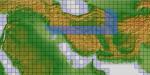
There are Fourteen (14) parts of this mesh to download as separate files.
ASTER GDEM Version 2 is a 30 metre definition DEM, its better than the version 1 data that ERSDAC, of Japan and NASA originally released, but it does have its limitations.
GDEM has been obtained from a satellite that uses stereoscopic infrared scanning cameras, this brings with it problems in the resultant data.....where it sees the tops of trees, buildings etc, as the ground terrain.
If you look at the jpg image with the terrain type errors shown as a graph, you will see that the only 'safe' terrain to use this data with - in FSX - is scrubland, or desert terrain.
Its hopeless in defining the terrain in places like Europe - with all the artificial structures, (buildings) and different types of woodland, so any mesh I create from this data won't include areas like that....it will be more desert type terrain, and scrubland.
I won't be doing Greenland because something about the ice around Greenland, (or any other land mass with ice) it creates false data.
It does give enough fine data to reveal railway lines, and some roads though.
This mesh has been made for FSX only.
Grateful thanks to ERSDAC, and NASA for making this data freely available to the public.
ASTER GDEM
Copyright (c) 2009 - 2011 Earth Remote Sensing Data Analysis Center (ERSDAC) All rights reserved.
ASTER GDEM is a product of METI and NASA.
Posted Mar 10, 2012 06:09 by Wayne Evans
FS2004 Low Altitude Flight Plan for Alaska
(Category: FS Navigation > Flight Simulator Navigation)
1.36Mb (400 downloads)
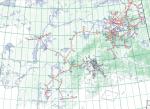
This package includes 52 individual FS2004 flight plans for current IFR, VFR and Slow Speed Routes in Alaska. These are great routes for B-52, F-111, B-1B, B-2 A6, A4, Vulcan and any fighter or bomber enthusiasts. Of course you can fly the route with any aircraft of your choice. Also included in this package is Karol Chlebowski's TFR gauge. This gauge will greatly enhance your ability to fly these challenging routes and are a great companion of the flight plans. Another option is to download Version 2.0 of my FS9 mini panel which has all this functionality and more.
Posted Sep 19, 2011 23:56 by Bill McClellan

WACHANKO Airlines Boeing 737-800 Textures 2
(Category: FSX > Civil Jets)
1.88Mb (400 downloads)
WACHANKO Airlines textures for default FSX B737-800 v.2
Posted May 1, 2011 11:50 by Walter Sanchez
Real Charts VFR Sectionals: New York
(Category: FS Navigation > Flight Simulator Navigation)
25.93Mb (400 downloads)
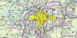
Hi-def scans of real VFR aeronautical United States charts, as available for download from the FAA, reduced
and formatted in pdf form by me for use with flight sims. Display them in a kneeboard utility,print them,
whatever...I like to use fragments of them to make pdfs for different flights, but that is only one way.
If you want to "get real" about navigating in the sim the way it's done in real life, these charts are for
you. But you might also just enjoy wandering around, comparing the chart to the world depicted in the sim.
These charts will most likely be outdated by the time you use them, or your sim may even pre-date the charts,
but they should work well enough.
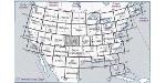
A basic guide for interpreting them is included, as well as tips on how to measure and mark them. Each chart
also includes a handy chart legend, a map showing what region it covers, and airspace and frequency
information.
If you are unfamiliar with how to use them for navigation, be sure to check out my multi-part tutorial
series "Compass, Clock, and Chart", available here at simviation.com.
Posted May 2, 2011 16:10 by Sean Morrissey

Villacoublay
(Category: CFS1 > Missions & Campaigns)
0.01Mb (400 downloads)
Villacoublay.
These are low level versions of the defult Villacoublay airfield attack.
They were re-edited with Cor Dikland's CFS Mission Editor version
2.0.0 All aircraft and scenery is defult. Richard Steele. 11K
Posted Jun 10, 2008 11:32 by archive