



All Time Popular > Page 4465

Aces High Complete Tommy McGuire
(Category: CFS2 > Missions & Campaigns)
0.15Mb (388 downloads)
Aces High McGuire Campaign highlighting the career of Tommy McGuire from December, 1942 through January, 1945, in several Fighter Squadrons of the 5th Air Force, Southeast Asia Theatre of Operations in WW II. Based on the book: Aces High, by Bill Yenne. Companion to Aces High Bong Campaign highlighting the career of Dick Bong, also of the 5th Far East Air Force under General Kenney.
Posted Nov 15, 2015 15:19 by Leland Lesher
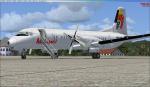
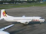
Aerosim NAMC YS-11 Asian Spirit Textures
(Category: FSX > Payware)
11.14Mb (388 downloads)
An Asian Spirit textures for the payware Aerosim NAMC YS-11.
Posted Dec 31, 2014 06:14 by Aeron M. Tumanut
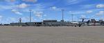
Palm Beach International Airport (KPBI) - Beta Fix.
(Category: FSX > Scenery)
1.09Mb (388 downloads)
Palm Beach International Airport (KPBI) - Beta Fix.
Description:
In my first attempt at scenery using the ground poly editor included in new versions of ADE, I failed to include the GP textures in the uploaded package. For those who don't already have the textures, I am providing them along with specific KPBI GP textures in this update to the Palm Beach International Airport (KPBI) - Beta scenery. By Art Poole
Required files:
required file
Posted Oct 28, 2014 04:34 by uploader
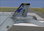
VRS Superbug VFA-97 CAG 2014 Textures
(Category: FSX > Payware)
1.97Mb (388 downloads)
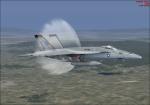
The new VFA-97 CAG 2014 textures for the payware VRS Superbug
Posted Mar 24, 2014 03:49 by Christopher Hammons
Gaza Yasser Arafat International Airport, Palestine, Lights Upgrade
(Category: FSX > Scenery)
0.00Mb (388 downloads)
Gaza Yasser Arafat International Airport Lights Upgrade LVGZ, Palestine. This is a very simple upgrade that adds PAPI4 visual guide slopes to both runways and ALSF1 approach lights.
Posted Oct 2, 2012 20:52 by L.M.
ASTER GDEMv2 30m mesh for Namibia & Botswana Pt2
(Category: FSX > Terrain Mesh)
158.51Mb (388 downloads)
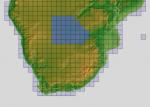
There are four parts to download for this area of Africa.
ASTER GDEM Version 2 is a 30 metre definition DEM, its better than the version 1 data that ERSDAC, of Japan and NASA originally released, but it does have its limitations.
GDEM has been obtained from a satellite that uses stereoscopic infrared scanning cameras, this brings with it problems in the resultant data.....where it sees the tops of trees, buildings etc, as the ground terrain.
If you look at the jpg image with the terrain type errors shown as a graph, you will see that the only 'safe' terrain to use this data with - in FSX - is scrubland, or desert terrain.
Its hopeless in defining the terrain in places like Europe - with all the artificial structures, (buildings) and different types of woodland, so any mesh I create from this data won't include areas like that....it will be more desert type terrain, and scrubland.
I won't be doing Greenland because something about the ice around Greenland, (or any other land mass with ice) it creates false data.
It does give enough fine data to reveal railway lines, and some roads though.
This mesh has been made for FSX only.
Grateful thanks to ERSDAC, and NASA for making this data freely available to the public.
ASTER GDEM
Copyright (c) 2009 - 2011 Earth Remote Sensing Data Analysis Center (ERSDAC) All rights reserved.
ASTER GDEM is a product of METI and NASA.
Posted May 5, 2012 05:55 by Wayne Evans
ASTER GDEMv2 30m mesh North Africa Pt17 incl Mauritania, Mali.
(Category: FSX > Terrain Mesh)
202.74Mb (388 downloads)
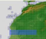
There are Eighteen (18) parts of this mesh to download as separate files.
ASTER GDEM Version 2 is a 30 metre definition DEM, its better than the version 1 data that ERSDAC, of Japan and NASA originally released, but it does have its limitations.
GDEM has been obtained from a satellite that uses stereoscopic infrared scanning cameras, this brings with it problems in the resultant data.....where it sees the tops of trees, buildings etc, as the ground terrain.
If you look at the jpg image with the terrain type errors shown as a graph, you will see that the only 'safe' terrain to use this data with - in FSX - is scrubland, or desert terrain.
Its hopeless in defining the terrain in places like Europe - with all the artificial structures, (buildings) and different types of woodland, so any mesh I create from this data won't include areas like that....it will be more desert type terrain, and scrubland.
I won't be doing Greenland because something about the ice around Greenland, (or any other land mass with ice) it creates false data.
It does give enough fine data to reveal railway lines, and some roads though.
This mesh has been made for FSX only.
Grateful thanks to ERSDAC, and NASA for making this data freely available to the public.
ASTER GDEM
Copyright (c) 2009 - 2011 Earth Remote Sensing Data Analysis Center (ERSDAC) All rights reserved.
ASTER GDEM is a product of METI and NASA.
Posted Apr 22, 2012 05:11 by Wayne Evans
ASTER GDEMv2 30m Mesh for Iraq Pt2a
(Category: FSX > Terrain Mesh)
63.12Mb (388 downloads)
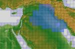
There are four parts of this mesh to download as separate files.
ASTER GDEM Version 2 is a 30 metre definition DEM, its better than the version 1 data that ERSDAC, of Japan and NASA originally released, but it does have its limitations.
GDEM has been obtained from a satellite that uses stereoscopic infrared scanning cameras, this brings with it problems in the resultant data.....where it sees the tops of trees, buildings etc, as the ground terrain.
If you look at the jpg image with the terrain type errors shown as a graph, you will see that the only 'safe' terrain to use this data with - in FSX - is scrubland, or desert terrain.
Its hopeless in defining the terrain in places like Europe - with all the artificial structures, (buildings) and different types of woodland, so any mesh I create from this data won't include areas like that....it will be more desert type terrain, and scrubland.
I won't be doing Greenland because something about the ice around Greenland, (or any other land mass with ice) it creates false data.
It does give enough fine data to reveal railway lines, and some roads though.
This mesh has been made for FSX only.
Grateful thanks to ERSDAC, and NASA for making this data freely available to the public.
ASTER GDEM
Copyright (c) 2009 - 2011 Earth Remote Sensing Data Analysis Center (ERSDAC) All rights reserved.
Posted Mar 4, 2012 05:56 by Wayne Evans
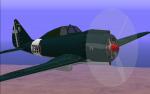

Reggiane 2002/Ariete
(Category: CFS1 > Aircraft)
0.45Mb (388 downloads)
The Reggiane Re.2002 Ariete was a best Italian "Assaltatore" (assault plane) developed during World War II. The aircraft was a development of the Re.2000 and was mainly used by the Regia Aeronautica (Italian Air Force) and Aeronautica Cobelligerante (Allied - post armistice - Italian Air Force), but it also saw limited use with the German Luftwaffe.
Original FS98 design: Bertil Nilsson \ Andrei Kobakhidze (2000)
First IS4G (I Soliti Quattro Gatti) repaint: TJD, November 2000
New bmp textures of 239ª Squadriglia Regia Aeronautica, reworked non textured parts, guns profile (2x12.7mm + 2x7.7mm + bomb release), modified Radio Navigation panel: Edmundo Abad, 2010.
Posted Jan 13, 2011 06:40 by Edmundo Abad
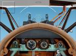
CFS2
- Instrument panel for Albatross
(Category: CFS2 > Panels)
0.53Mb (388 downloads)
CFS2
- Instrument panel for Albatross
DVa Included: panel bitmaps by:LOBO DA SILVA. 546K
Posted Jun 10, 2008 11:30 by archive