



All Time Popular > Page 4466
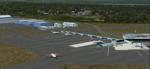
Stanfield Int. CYZH, Halifax, Nova Scotia
(Category: FSX > Scenery)
17.24Mb (389 downloads)
Stanfield Int. CYZH, Halifax, Nova Scotia, for FSX.
All new. Wherever possible buildings are modeled on photos. Rwy 6/24 changed to 5/23 and extended to 10,500'. Rwy 15/33 changed to 14/32. By Sidney Schwartz
Posted Nov 13, 2018 12:40 by Sidney Schwartz


FSX Quality Wings Boeing 757-300RR American Airlines Textures
(Category: FSX > Payware)
14.87Mb (389 downloads)
American Airlines textures for the payware Quality wings Boeing 757-300QW
Posted Aug 20, 2018 22:38 by Dillon Rock


Lechfeld, Germany -v2 FS2004
(Category: FS2004 > Scenery)
6.33Mb (389 downloads)
This airbase, located about 35 NM in the west of Munich (Bavaria, South Germany),
is the homebase of JaBoG32 riding the Tornado PA200. The german flight check
department GMFS, using C-47 in the early days and thereafter Hawker-Siddely 748
as well as HS-125 for periodic recalibration of the radar- and navigational equipment at civil and military airfields, was also on the base till 1994. After the final decision was made not to establish commercial air traffic although it had been discussed for a long time period, I reworked the airbase completely. Among other objects, 38 hardened shelters for combat aircrafts have been emplaced. The included AI-Package contains: Lockheed F-104E GAF, Panavia Tornado PA200 GAF, Mikoyan MiG-29 GAF, Douglas C-47 GAF, Canberra B.20 GAF, Boeing E3A Nato, Boeing KC-135 USAF and an aircraft.cfg for the MS Learjet 45. Several F104's, Tornados and MiG's perform touch and goes in the local area, a Nato E3A leaves IFR to Geilenkirchen (ETNG), an USAF KC-135 routes IFR to Decimomannu (LIED), a Canberra B.20 (was used for high altitude validations) goes IFR to Cologne (EDDK) high in the sky and a Learjet shoots IFR to Bremen (EDDW) per
attached flightplan. Lago's FSE is required in order to see most of the emplaced buildings / objects.
Posted May 5, 2017 09:14 by Ronald Falzon


FAA Fairey Firefly Mk5 810
(Category: CFS2 > Aircraft)
5.24Mb (389 downloads)
Firefly MK 5for CFS2.
Original FSX/FS9 model by Scrub.
Note: Scrub kindly allowed me to convert this model to CFS2.
I did not find any good Firefly panel for CFS2 in high res wide screen format so I had to make one. I dont say it's 100% correct, but the the general layout is pretty similar.
Everything needed for the installation is included except the SOUND folder.
Posted Mar 26, 2017 14:14 by Morton
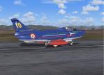
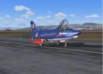
G91 Freece Tricolori Pony 10 Textures
(Category: FS2004 > Military)
2.08Mb (389 downloads)
This is a repaint(textures only) for Kazunori Ito's G91R1A available on this site. The aircraft is representative of the Freece Tricolori Pony 10 from 1963 to 1967. Original model by Kazunori Ito, repaint by Ron Wildman Gillam
Required files:
required file
Posted Dec 6, 2014 22:51 by Ron Wildman Gillam
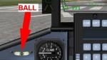
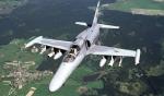
Aero Vodochody L159A Widescreen 2D panel: patch
(Category: FSX > Panels)
0.01Mb (389 downloads)
Ball gauge missing in the first upload. Sorry about that. Here it is.
Required files:
required file
Posted Oct 6, 2012 03:35 by Jean-Luc Peters
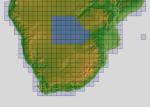
ASTER GDEMv2 30m mesh for Namibia & Botswana Pt2
(Category: FSX > Terrain Mesh)
158.51Mb (389 downloads)
There are four parts to download for this area of Africa.
ASTER GDEM Version 2 is a 30 metre definition DEM, its better than the version 1 data that ERSDAC, of Japan and NASA originally released, but it does have its limitations.
GDEM has been obtained from a satellite that uses stereoscopic infrared scanning cameras, this brings with it problems in the resultant data.....where it sees the tops of trees, buildings etc, as the ground terrain.
If you look at the jpg image with the terrain type errors shown as a graph, you will see that the only 'safe' terrain to use this data with - in FSX - is scrubland, or desert terrain.
Its hopeless in defining the terrain in places like Europe - with all the artificial structures, (buildings) and different types of woodland, so any mesh I create from this data won't include areas like that....it will be more desert type terrain, and scrubland.
I won't be doing Greenland because something about the ice around Greenland, (or any other land mass with ice) it creates false data.
It does give enough fine data to reveal railway lines, and some roads though.
This mesh has been made for FSX only.
Grateful thanks to ERSDAC, and NASA for making this data freely available to the public.
ASTER GDEM
Copyright (c) 2009 - 2011 Earth Remote Sensing Data Analysis Center (ERSDAC) All rights reserved.
ASTER GDEM is a product of METI and NASA.
Posted May 5, 2012 05:55 by Wayne Evans
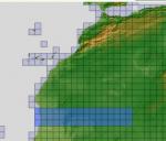
ASTER GDEMv2 30m mesh North Africa Pt17 incl Mauritania, Mali.
(Category: FSX > Terrain Mesh)
202.74Mb (389 downloads)
There are Eighteen (18) parts of this mesh to download as separate files.
ASTER GDEM Version 2 is a 30 metre definition DEM, its better than the version 1 data that ERSDAC, of Japan and NASA originally released, but it does have its limitations.
GDEM has been obtained from a satellite that uses stereoscopic infrared scanning cameras, this brings with it problems in the resultant data.....where it sees the tops of trees, buildings etc, as the ground terrain.
If you look at the jpg image with the terrain type errors shown as a graph, you will see that the only 'safe' terrain to use this data with - in FSX - is scrubland, or desert terrain.
Its hopeless in defining the terrain in places like Europe - with all the artificial structures, (buildings) and different types of woodland, so any mesh I create from this data won't include areas like that....it will be more desert type terrain, and scrubland.
I won't be doing Greenland because something about the ice around Greenland, (or any other land mass with ice) it creates false data.
It does give enough fine data to reveal railway lines, and some roads though.
This mesh has been made for FSX only.
Grateful thanks to ERSDAC, and NASA for making this data freely available to the public.
ASTER GDEM
Copyright (c) 2009 - 2011 Earth Remote Sensing Data Analysis Center (ERSDAC) All rights reserved.
ASTER GDEM is a product of METI and NASA.
Posted Apr 22, 2012 05:11 by Wayne Evans

ASTER GDEMv2 30m mesh for Arabian Peninsula Pt7b
(Category: FSX > Terrain Mesh)
57.85Mb (389 downloads)
There are Twenty parts of this mesh to download as separate files.
ASTER GDEM Version 2 is a 30 metre definition DEM, its better than the version 1 data that ERSDAC, of Japan and NASA originally released, but it does have its limitations.
GDEM has been obtained from a satellite that uses stereoscopic infrared scanning cameras, this brings with it problems in the resultant data.....where it sees the tops of trees, buildings etc, as the ground terrain.
If you look at the jpg image with the terrain type errors shown as a graph, you will see that the only 'safe' terrain to use this data with - in FSX - is scrubland, or desert terrain.
Its hopeless in defining the terrain in places like Europe - with all the artificial structures, (buildings) and different types of woodland, so any mesh I create from this data won't include areas like that....it will be more desert type terrain, and scrubland.
I won't be doing Greenland because something about the ice around Greenland, (or any other land mass with ice) it creates false data.
It does give enough fine data to reveal railway lines, and some roads though.
This mesh has been made for FSX only.
Grateful thanks to ERSDAC, and NASA for making this data freely available to the public.
ASTER GDEM
Copyright (c) 2009 - 2011 Earth Remote Sensing Data Analysis Center (ERSDAC) All rights reserved.
ASTER GDEM is a product of METI and NASA.
Posted Mar 8, 2012 06:30 by Wayne Evans
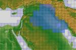
ASTER GDEMv2 30m Mesh for Iraq Pt2a
(Category: FSX > Terrain Mesh)
63.12Mb (389 downloads)
There are four parts of this mesh to download as separate files.
ASTER GDEM Version 2 is a 30 metre definition DEM, its better than the version 1 data that ERSDAC, of Japan and NASA originally released, but it does have its limitations.
GDEM has been obtained from a satellite that uses stereoscopic infrared scanning cameras, this brings with it problems in the resultant data.....where it sees the tops of trees, buildings etc, as the ground terrain.
If you look at the jpg image with the terrain type errors shown as a graph, you will see that the only 'safe' terrain to use this data with - in FSX - is scrubland, or desert terrain.
Its hopeless in defining the terrain in places like Europe - with all the artificial structures, (buildings) and different types of woodland, so any mesh I create from this data won't include areas like that....it will be more desert type terrain, and scrubland.
I won't be doing Greenland because something about the ice around Greenland, (or any other land mass with ice) it creates false data.
It does give enough fine data to reveal railway lines, and some roads though.
This mesh has been made for FSX only.
Grateful thanks to ERSDAC, and NASA for making this data freely available to the public.
ASTER GDEM
Copyright (c) 2009 - 2011 Earth Remote Sensing Data Analysis Center (ERSDAC) All rights reserved.
Posted Mar 4, 2012 05:56 by Wayne Evans