



All Time Popular > Page 4535
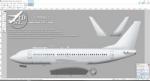
FS2004/FSX TDS Boeing 737-700/700F/C40 Paint Kit
(Category: FS Design > Aircraft Paintkits)
5.83Mb (368 downloads)
FS2004/FSX TDS Boeing 737-700/700F/C40 Paint Kit, developed by Tenkuu Developers Studio (TDS).
Posted Apr 27, 2019 04:39 by chrisE

Russia-Amur region airports
(Category: FS2004 > Scenery)
17.39Mb (368 downloads)
FS2004 Scenery-Russia-Amur region
HAR9-Beregovoy, HAS1-Dipkun, HAS4-Stoyba, HD9H-Berezitoviy rudnik, UHBA-Arkhara, UHBE-Zeya, UHBF-Fevral'sk, UHBI-Magdagachi, UHBK-Shimanovsk, UHBM-Mayskiy, UHBN-Novokievsky Uval, UHBO-Oktyabrsky, UHBW-Tynda, UHBX-Gorny, UHHG-Bomnak, XHBH-Kakhovka, XHBR-Belogorsk, XHIB-Srednebeloye, XHXA-Amaranka, Z064-Tambovka, ZAP9-Takhtamygda, ZB2P-Khvoyny, ZB36-Kuhterinskii, ZBT3-Cheremkhovo, ZC1V-Raychikhinsk, ZC8E-Snezhnogorsky, ZCE6-Fregat, ZD3S-Norsk, ZD3T-Gar', ZD3U-Yasnyi, ZD42-Pozdeyevka, ZD45-Bureya, ZD4R-Yerofey Pavlovich, ZD51-Cheugda, ZE8Y-Ust'-Nyukzha
Posted Aug 26, 2015 20:49 by Andrey Anta

Boeing 727-200 'Simviation' Textures
(Category: FSX > Civil Jets)
2.70Mb (368 downloads)
'Simviation' textures for the Thomas Ruth Boeing 727-200 package - available in multi livery version. Textures by Caltabiano Nunzio (Voyager)
Required files:
required file
Posted Jul 25, 2015 19:01 by Voyager

Annobon Airport / Guinea Ecuatorial
(Category: FS2004 > Scenery)
1.02Mb (368 downloads)
A new airport for FS2004. The real airport apparently does
not have an ICAO code - but the code FGAB is used by AI flight plan writers.
These files add the airport to your FS2004 world and setup the airport for
AI traffic - specifically the World of AI packages.
Location - FGAB/ Annobon Island is located about 220 nm west of the coast
of Africa, and about 110 miles southwest of Sao Tome Island. The island is
only about 4 miles by 2 miles. The island population is about 5,000.
The airport has minimal air traffic - often only one to three flights
per week.
Posted Oct 28, 2014 00:23 by Reggie Fields
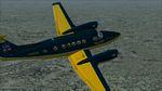
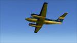
FS2004/FSX Super King Air 300 TRB Aviation Textures
(Category: FS2004 > Props)
10.94Mb (368 downloads)
This is a fictional repaint of the Super King Air 300 Base Package for FS2004/FSX in the fictional TRB Aviation colors. You need the base AFG B300 for FS9, then the upgrade for FSX.
Required files:
required file
Posted Oct 5, 2012 22:27 by Harry Gage
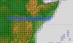
ASTER GDEMv2 30m mesh for Sudan & the Horn of Africa pt10
(Category: FSX > Terrain Mesh)
224.21Mb (368 downloads)
There are Eleven (11) parts of this mesh to download as separate files.
ASTER GDEM Version 2 is a 30 metre definition DEM, its better than the version 1 data that ERSDAC, of Japan and NASA originally released, but it does have its limitations.
GDEM has been obtained from a satellite that uses stereoscopic infrared scanning cameras, this brings with it problems in the resultant data.....where it sees the tops of trees, buildings etc, as the ground terrain.
If you look at the jpg image with the terrain type errors shown as a graph, you will see that the only 'safe' terrain to use this data with - in FSX - is scrubland, or desert terrain.
Its hopeless in defining the terrain in places like Europe - with all the artificial structures, (buildings) and different types of woodland, so any mesh I create from this data won't include areas like that....it will be more desert type terrain, and scrubland.
I won't be doing Greenland because something about the ice around Greenland, (or any other land mass with ice) it creates false data.
It does give enough fine data to reveal railway lines, and some roads though.
This mesh has been made for FSX only.
Grateful thanks to ERSDAC, and NASA for making this data freely available to the public.
ASTER GDEM
Copyright (c) 2009 - 2011 Earth Remote Sensing Data Analysis Center (ERSDAC) All rights reserved.
ASTER GDEM is a product of METI and NASA.
Posted Mar 18, 2012 04:40 by Wayne Evans
Map of CFS2 Airfields in Google Earth
(Category: CFS2 > Misc)
0.00Mb (368 downloads)
This KML file contains all of the locations of airfields listed in Combat Flight Simulator 2. The coordinates of each airfield were drawn from the "airbases.dat" file.
Open this file in Google Earth (free from Google), and viola! The location of all airfields are plotted for your use and navigation.
** DISCLAIMER **
This KML file was generated using code I wrote in the Microsoft .NET C# programming language. Any comments, additional features desired or questions about its use should be directed to me at my email address: ghtwo@live.com
Thanks, and I hope you enjoy.
Greg Harrison
Posted Jul 29, 2011 03:26 by Greg Harrison
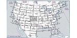
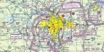
Real Charts VFR Sectionals: Seattle
(Category: FS Navigation > Flight Simulator Navigation)
27.87Mb (368 downloads)
Hi-def scans of real VFR aeronautical United States charts, as available for download from the FAA, reduced
and formatted in pdf form by me for use with flight sims. Display them in a kneeboard utility,print them,
whatever...I like to use fragments of them to make pdfs for different flights, but that is only one way.
If you want to "get real" about navigating in the sim the way it's done in real life, these charts are for
you. But you might also just enjoy wandering around, comparing the chart to the world depicted in the sim.
These charts will most likely be outdated by the time you use them, or your sim may even pre-date the charts,
but they should work well enough.
A basic guide for interpreting them is included, as well as tips on how to measure and mark them. Each chart
also includes a handy chart legend, a map showing what region it covers, and airspace and frequency
information.
If you are unfamiliar with how to use them for navigation, be sure to check out my multi-part tutorial
series "Compass, Clock, and Chart", available here at simviation.com.
Posted May 4, 2011 22:23 by Sean Morrissey
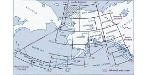
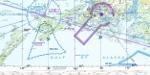
Real Charts VFR Sectionals: Alaska Pt2
(Category: FS Navigation > Flight Simulator Navigation)
82.67Mb (368 downloads)
Can be used in any flight simulator. Hi-def scans of real VFR aeronautical United States charts, as available for download from the FAA, reduced and formatted in pdf form by me for use with flight sims. Display them in a kneeboard utility,print them, whatever...I like to use fragments of them to make pdfs for different flights, but that is only one way.
If you want to "get real" about navigating in the sim the way it's done in real life, these charts are for you. But you might also just enjoy wandering around, comparing the chart to the world depicted in the sim. These charts will most likely be outdated by the time you use them, or your sim may even pre-date the charts, but they should work well enough.
A basic guide for interpreting them is included, as well as tips on how to measure and mark them. Each chart also includes a handy chart legend, a map showing what region it covers, and airspace and frequency information.
If you are unfamiliar with how to use them for navigation, be sure to check out my multi-part tutorial series "Compass, Clock, and Chart", available here at simviation.com.
Posted Apr 27, 2011 16:27 by Sean Morrissey


Skysim Hawk - RAF 2011 Display Textures
(Category: FSX > Payware)
1.50Mb (368 downloads)
Textures for the payware Sky Sim Hawk T1A - Front seat only. I have designed this
texture for this years Display Hawk which was based at RAF Valley in the UK. All textures created by Gordon Barnes
Posted Apr 10, 2011 12:49 by Gordon Barnes