



All Time Popular > Page 4584
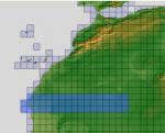
ASTER GDEMv2 30m mesh North Africa Pt16 incl W. Sahara, Mauritania, Mali.
(Category: FSX > Terrain Mesh)
221.35Mb (354 downloads)
There are Eighteen (18) parts of this mesh to download as separate files.
ASTER GDEM Version 2 is a 30 metre definition DEM, its better than the version 1 data that ERSDAC, of Japan and NASA originally released, but it does have its limitations.
GDEM has been obtained from a satellite that uses stereoscopic infrared scanning cameras, this brings with it problems in the resultant data.....where it sees the tops of trees, buildings etc, as the ground terrain.
If you look at the jpg image with the terrain type errors shown as a graph, you will see that the only 'safe' terrain to use this data with - in FSX - is scrubland, or desert terrain.
Its hopeless in defining the terrain in places like Europe - with all the artificial structures, (buildings) and different types of woodland, so any mesh I create from this data won't include areas like that....it will be more desert type terrain, and scrubland.
I won't be doing Greenland because something about the ice around Greenland, (or any other land mass with ice) it creates false data.
It does give enough fine data to reveal railway lines, and some roads though.
This mesh has been made for FSX only.
Grateful thanks to ERSDAC, and NASA for making this data freely available to the public.
ASTER GDEM
Copyright (c) 2009 - 2011 Earth Remote Sensing Data Analysis Center (ERSDAC) All rights reserved.
ASTER GDEM is a product of METI and NASA.
Posted Apr 22, 2012 04:15 by Wayne Evans
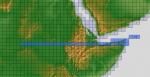
ASTER GDEMv2 30m mesh for Sudan & the Horn of Africa pt6
(Category: FSX > Terrain Mesh)
140.65Mb (354 downloads)
There are Eleven (11) parts of this mesh to download as separate files.
ASTER GDEM Version 2 is a 30 metre definition DEM, its better than the version 1 data that ERSDAC, of Japan and NASA originally released, but it does have its limitations.
GDEM has been obtained from a satellite that uses stereoscopic infrared scanning cameras, this brings with it problems in the resultant data.....where it sees the tops of trees, buildings etc, as the ground terrain.
If you look at the jpg image with the terrain type errors shown as a graph, you will see that the only 'safe' terrain to use this data with - in FSX - is scrubland, or desert terrain.
Its hopeless in defining the terrain in places like Europe - with all the artificial structures, (buildings) and different types of woodland, so any mesh I create from this data won't include areas like that....it will be more desert type terrain, and scrubland.
I won't be doing Greenland because something about the ice around Greenland, (or any other land mass with ice) it creates false data.
It does give enough fine data to reveal railway lines, and some roads though.
This mesh has been made for FSX only.
Grateful thanks to ERSDAC, and NASA for making this data freely available to the public.
ASTER GDEM
Copyright (c) 2009 - 2011 Earth Remote Sensing Data Analysis Center (ERSDAC) All rights reserved.
ASTER GDEM is a product of METI and NASA.
Posted Mar 17, 2012 10:06 by Wayne Evans


FS2004 Alaska Beech Volpar Textures
(Category: FS2004 > Props)
0.57Mb (354 downloads)
Based on a tail dragger Beech 18 I saw on a PBS program about Alaska, are these textures for use with the Beechcraft Volpar by Brian Gladden (Volpar.zip) Repaint by Don Brynelsen using Brian's paintkit.
Required files:
required file
Posted Nov 30, 2011 15:28 by Don Brynelsen
FS2004 Virtual Wingman Views Option for Supermarine Walrus
(Category: FS2004 > Vintage)
0.49Mb (354 downloads)
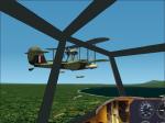
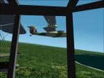
FS2004 option to display a virtual wingman for all Supermarine Walrus Seaplanes from Mike Stone, requires (swalrus.zip). How to Use: While flying in 2-D panel view mode, just press some numeric keys to see from your cockpit the virtual wingman, with moving flaps, rudders, or gear and see the effects of your smokesystem or the falling bombload at CFS2. Bitmaps and configuration by Erwin Welker.
Required files:
required file
Posted Jul 6, 2011 04:59 by Erwin Welker


Aero Venezuela DC-6B Textures
(Category: FSX > Vintage)
4.88Mb (354 downloads)
Aero Venezuela textures for the FS2002, FS9, and FSX DC-6 aircraft by Greg Pepper and Tom Gibson available at Calclassic.com.
Textures by Gary Harper.
Download
here (external link)
Posted Feb 19, 2011 09:54 by Gary Harper

CFS2
Petlyakov Pe-2 series 83.
(Category: CFS2 > Aircraft)
4.76Mb (354 downloads)
CFS2
Petlyakov Pe-2 series 83. The
Petlyakov Pe-2 Peshka Dive Bomber.The fast Soviet dive bomber derived
from the VI-100 high-altitude fighter in 1940. This is the version
that came out in 1942 with the less nose glazing, a fixed upper 12.7
UBT mg, 2 waist ShKAS 7.62mm machine guns added, and external wing
bomb mounts. ENGINES: Klimov M-105RA 1100hp MAX SPEED: 327mph @ 16500ft
CEILING: 28900ft RANGE: 932mi WEIGHT: 13326lb (MTO 17905) DIMENSIONS:
Span 56ft 3 1/2in, Length 41ft 6 1/2in ARMAMENT: Two UB 12.7mm machine
gun, four ShKAS 7.62mm machine guns. Model file, airfile, DP, panel
edit, and textures by Thicko. DP edit and panel by sandydog. Prop
texture by Kelticheart. 4.9MB
Posted Jun 10, 2008 11:31 by archive
DDay
v.1.0
(Category: CFS1 > Utilities)
1.99Mb (354 downloads)
CFS utility--DDay v1.0. This
is a Windows 95/98 utility for Microsoft Combat Flight Simulator
to generate a great variety of objects for scenery design, like
hangars, towers, control towers, CFS libraries and a quick airport
maker, buildings, houses, barns, etc. This program uses for the
first time in scenery design real BMP pictures of 256 colors, adding
a great scenery graphic quality design to your sceneries. This program
comes in several files.. By Rafael Garcia Sanchez.
DDay
v.1.0 File size 2090412
DDay
Pt 1 1059556
DDay
Pt 2 995315
Help
Files 1073365
DDay
Objects 38937
DDay
Textures 840692
Posted Jun 10, 2008 11:09 by archive

Api Macro-FSim Bar restaurant
(Category: FS Design > Scenery Design Objects)
1.81Mb (354 downloads)
Api
Macro-FSim Bar restaurant This is the full file including
textures (day and night) and api file. For use in any airport
design program. By Anthony Konstantinidis. 1.9MB
Posted Jun 23, 2008 14:18 by archive
FSBAT11
(Category: FS Design > Scenery Design)
0.29Mb (354 downloads)
FSBAT11.
Program to create buildings for FS98, FS95 or FS5. Generate
SCASM and macros for AIRPORT. File size 305554. D Halatre
Posted Apr 23, 2008 14:18 by archive
Minneapolis St Paul Approach
(Category: FS2000 > Adventures)
(354 downloads)
Minneapolis
St Paul Approach ATC adventure. File size 28k. J Souza
Posted Jun 23, 2008 14:19 by archive