



All Time Popular > Page 4606
FS2000
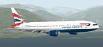
British Airways Boeing 777-200
(Category: FS2000 > Civil Jets)
0.17Mb (347 downloads)
FS2000
British Airways Boeing 777-200 (ProMaxLT) Features new lighting
textures including the engine nacelles and moving parts. Design
and paint by: Camil Valiquette. 179K
Posted Jun 23, 2008 14:37 by archive
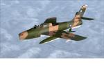
FSX F-84F Thunderstreak (corrected)
(Category: FSX > Military)
12.44Mb (346 downloads)
An updated version of Alphasim's F-84F Thunderstreak. Originally converted to FSX native by Y.T. and LLS. VC has new, improved texturing and gauge package for a more realistic look. I added some strobes and beacon lights to the exterior and new engine smoke effect. (I accidently uploaded my F-8 crusader folder instead of the F-84. . Sorry once again.)
-Bob
Posted Dec 28, 2025 23:09 by Bob Erwin
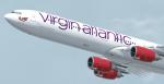

FSX/P3D Virgin Atlantic (G-VRED) Thomas Ruth A340-600 Textures
(Category: FSX > Civil Jets)
18.20Mb (346 downloads)
Virgin Atlantic (G-VRED) Texture for the Thomas Ruth A340-600 model. This texture is a part of my project to attempt to re-texture the Thomas Ruth A340s with 4096*4096 HD Textures. Special thanks to Oniel Black for helping with the slats textures. Feel free to join the JetRepaintsSG group on Facebook for more of my repaint works! Installation instructions have been included in the file. Made by Muhammad Akmal Farhan, Requires the full model to be installed.
Required files:
required file
Posted Jul 6, 2024 02:18 by Muhammad Akmal Farhan
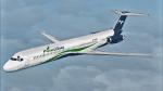
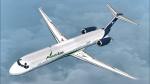
FSX/P3D SGA McDonnell-Douglas MD83 YV3499 Venezolana *TEXTURE*
(Category: FSX > Civil Jets)
10.10Mb (346 downloads)
FSX/P3D MD80 SGA Native, textures by Yober Arteaga @eltobo Prepared and Tested in P3D v5 by Yober Arteaga. Should work in FSX and earlier P3D versions.
Required files:
required file
Posted Mar 30, 2023 15:00 by Yober Arteaga -
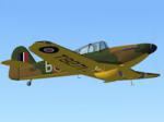
FS2004-Miles-M9A. Master-Mk. 1a.
(Category: FS2004 > Vintage)
3.42Mb (346 downloads)
FS2004 Miles M9A. Master Mk. 1a.
An advanced training aircraft for the RAF.
Aircraft of ATA Training Unit.
Based at White Waltham in 1942.
Ver.2, By Edward Cook [27/06/14]
Posted Sep 11, 2020 10:40 by Edward Cook
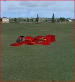
Old Sarum Mission
(Category: FSX > Missions)
0.65Mb (346 downloads)
Take off in an updated and unusual Edgley Optica from Old Sarum airport
and fly to Boscombe Down airport UK.
On the way, perform a low level pass over Middle Wallop Army airport
and a touch and go at Thruxton.
Posted Sep 1, 2020 13:08 by Don Olsson
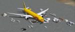
FS2004 DHL Boeing 787-9 Cargo
(Category: FS2004 > Civil Jets)
2.89Mb (346 downloads)
FS2004 DHL Boeing 787-9 Cargo AGS V6.1.
New Night lights reflection.
New Animated Ground Servicing.
New static displays.
New landing / taxi soft light beams.
New 2D panel.
Model design and paint by Camil Valiquette. ( CamSim )
Posted Jun 25, 2020 03:19 by Camil Valiquette
.jpg-thumb.jpg)
.jpg-thumb.jpg)
FSX/P3D Boeing 747-131 TWA 1976 Textures
(Category: FSX > Civil Jets)
11.99Mb (346 downloads)
This is a repaint of the 747-131 in TWA 'Star Stream' Double Globe colors. The FSX freeware 747-200 'Ready For Pushback' - RFP is needed for this repaint. This is a repaint of TWA 747-131, delivered to TWA on February 23 1970 and flew for the carrier until September 1997. The actual aircraft, as mentioned above, was a 747-100, as RFP only has the 200 model, I used that model for the repaint. Textures are 32bit DDS. This repaint was tested FSX-SE. It should work on FSX & P3D v1-3.
Required files:
required file
Posted Nov 26, 2019 22:35 by Ted Giana
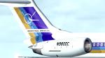
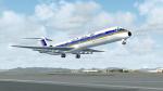
FSX McDonnell Douglas MD-81 House Colors (N908DC) Textures
(Category: FSX > Civil Jets)
10.72Mb (346 downloads)
The MD-80 has just turned 40 years old, and over the years, has served many airlines with pride, as it stands the test of time. Textures only for the Eagle Rotorcraft FSX-native version of Erick Cantu's MD-80.
Required files:
required file
Posted Oct 19, 2019 13:07 by fs10inator
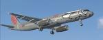
FSX default Airbus A321 'FlyNiki' Textures
(Category: FSX > Civil Jets)
1.21Mb (346 downloads)
FlyNiki textures for the default FSX Airbus A321. Niki was an Austrian airline founded by Formula 1 Racing driver Niki Lauda. In 2018, Niki was absorbed into Lauda, now part of Ryanair.
Posted Oct 16, 2019 02:24 by Marius Flieger