


All Time Popular > Page 4867


FSX/P3D/FS2004 Boeing 737-500 - Maleth-Aero Textures
(Category: FSX > Civil Jets)
2.56Mb (268 downloads)
FS9/FSX VistaLiners Boeing 737-500 in Maleth-Aero livery. Texture only for the freeware VistaLiners (VL) model. Repaint by Sergey Gleba aka serg09. Description and instruction in the archive. Link to my products on SimMarket: http://secure.simmarket.com/paintsim.mhtml
Posted Mar 21, 2019 11:48 by Sergey Gleba aka serg09

X-Plane 11.25+ Horten Ho IVa High Performance Glider
(Category: X Plane > Misc)
114.77Mb (268 downloads)
X-Plane 11.25+ Horten Ho IVa High Performance Glider 1.0 The Horten Ho IV was a high performance, all wing, competition glider designed to compete with the best gliders of its time. It featured a high aspect wing for optimum gliding performance and a prone pilot position, minimizing drag while providing a unique flight experience. 4 were built in the 1940s and one was used in competitions in the 1950s (taking prizes a number of times). This X-Plane model features: highly accurate model based on historical, research and restoration data, full flying wing aerodynamic model using original Horten airfoils, a bell-shaped lift distribution and custom fuselage airfoils to model the entire aircraft for a realistic flight experience, custom airfoils analysed with X-foil across the Reynolds number regimes of the aircraft, custom flight controls using X-Plane's override_control_surfaces feature to simulate the triple differential elevon and dual drag/dive brake control surfaces of the Ho IV design, plus many more additional features. Documentation included in the package. By Fred Highland.
Posted Feb 1, 2019 00:29 by xplover

Garry Smith Archive Files: TVA Merlin III
(Category: FS2004 > Props)
6.08Mb (268 downloads)
Garry Smith Archive Files: Fairchild SA-227AT Merlin3
Originally developed by Swearingen as a fast, twin turbo-prop executive transport, the Merlin was later acquired by Fairchild.
Self installing executable file. Developed by Mike Stone and painted by Garry Smith.
Posted Jul 31, 2018 22:40 by Ronald Falzon
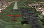
AFG Sud Caravelle se210-6 Textures
(Category: FS2004 > Civil Jets)
9.50Mb (268 downloads)
(Textures Only) AFG Sud Caravelle SE210-6 Vintage 1950's Jetliner, Re-Painted with Historic Jetliners Group Logo, sponsored by the HJG / Historic Jetliners Group - works in FSX should also work in 2004 by Jetranger
Pilots will need the Freeware Base pack from HJG.
Posted Feb 24, 2016 00:47 by Jetranger
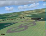
RAF Wendling, UK
(Category: FSX > Scenery)
0.19Mb (268 downloads)
RAF Wendling is a former Royal Air Force station located 4 miles (6.4 km) north west of East Dereham, Norfolk, England. Opened in 1942, it was used by both the Royal Air Force (RAF) and United States Army Air Forces (USAAF). During the war it was used primarily as a bomber airfield, being the home of the United States Army Air Forces Eighth Air Force 392nd Bombardment Group. After the war, it was used by the RAF as a standby airfield before being finally closed in 1961 and returned to agriculture. With the end of military control the airfield has become a turkey farm.
Posted Feb 16, 2016 05:02 by Terry Boissel
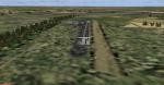
FS2004 Russia Samara region airports
(Category: FS2004 > Scenery)
19.49Mb (268 downloads)
FS2004 Scenery-Russia-Samara region
UWW1-Nizhnee Sancheleyevo, UWWE-Verkhneye Sancheleyevo, UWWI-Georgiyevka, UWWN-Lunachar, UWWQ-Samara (Krasnyy Yar), UWWR-Samara (Rozhdestveno GA), UWWT-Tol'yatti, XWWB-Bezenchuk, XWWD-Samara (Rozhdestveno MO), XWWZ-Chapayevsk (Zvezda), ZB0L-Voskresenka (Аeropark), ZCJ3-Tol'yatti (Podstepki), ZDK0-Isakly, ZED8-Sosnoviy Solonets, ZET1-Tol'yatti (Vasil'yevka), ZET3-Stariy Amanak, ZET6-Samara (Chayka)
Posted Jan 22, 2016 15:50 by Andrey Anta

AirbusX Extended A321 CFM Tarom Textures
(Category: FSX > Payware)
5.72Mb (268 downloads)
Tarom livery A321 CFM for the payware AEX A321.
Posted Jan 11, 2014 13:13 by Artur
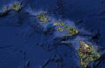
FSX Hawaii Airfield Locator Update1
(Category: FS Navigation > Flight Simulator Navigation)
1.14Mb (268 downloads)
Tested on Windows XP and Windows 7.
This download adds airfield markers and ICAO id's found in FSX, and overlays them on Google Earth.
This file is an update for Hawaii. USA. It places 'hi99' and 'hi32' in the correct locations. It adds a marker for 'phnl' water runway.
It replaces the original Hawaii airfield locator.
There is also a seperate file with a list of basic airfield location details.
i.e: EGBB Birmingham Airport. Birmingham. N52* 27.23' W1* 44.88' alt325.
Also the tidying "My places" in Google Earth, file.
Other locator files to follow.
by Carl Vokes
Posted Jun 3, 2013 14:02 by carl vokes
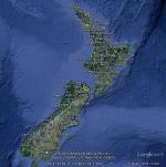
FSX New Zealand Airfield Locator
(Category: FS Navigation > Flight Simulator Navigation)
1.04Mb (268 downloads)
Tested on Windows XP and Windows 7.
This download adds airfield markers and ICAO id's found in FSX, and overlays them on Google Earth.
This file is for New Zealand.
There is also a seperate file with a list of basic airfield location details.
i.e: EGBB Birmingham Airport. Birmingham. N52* 27.23' W1* 44.88' alt325.
Also the tidying "My places" in Google Earth, file.
Other locator files to follow.
by Carl Vokes
Posted Apr 10, 2012 11:54 by carl vokes
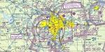
Real Charts VFR Sectionals: Chicago
(Category: FS Navigation > Flight Simulator Navigation)
27.52Mb (268 downloads)
Hi-def scans of real VFR aeronautical United States charts, as available for download from the FAA, reduced and formatted in pdf form by me for use with flight sims. Display them in a kneeboard utility,print them, whatever...I like to use fragments of them to make pdfs for different flights, but that is only one way.
If you want to "get real" about navigating in the sim the way it's done in real life, these charts are for you. But you might also just enjoy wandering around, comparing the chart to the world depicted in the sim. These charts will most likely be outdated by the time you use them, or your sim may even pre-date the charts, but they should work well enough.
A basic guide for interpreting them is included, as well as tips on how to measure and mark them. Each chart also includes a handy chart legend, a map showing what region it covers, and airspace and frequency information.
If you are unfamiliar with how to use them for navigation, be sure to check out my multi-part tutorial series "Compass, Clock, and Chart", available here at simviation.com.
Posted Apr 29, 2011 02:29 by Sean Morrissey