



All Time Popular > Page 4914


Nemeth MI-24 Air Force Russia RF-13010 Textures
(Category: FSX > Payware)
56.66Mb (264 downloads)
Nemeth Designs MI-24 (Hind) for in Air Force - Russia livery. Description and instruction in the archive. Repaint by Sergey Gleba aka serg09. Link to my products on SimMarket: http://secure.simmarket.com/paintsim.mhtml
Posted Jan 12, 2019 11:17 by Sergey Gleba | PaintSim


FSX/FS2004 Tupolev Tu-154B-2 Aeroflot Riga OJSC CCCP-85553 Textures
(Category: FSX > Civil Jets)
66.69Mb (264 downloads)
FSX Project Tupolev Tu-154B-2 in Aeroflot (Riga OJSC) livery. Texture only for freeware Project Tupolev model. Repaint by Sergey Gleba aka serg09.
Posted Dec 1, 2018 11:51 by Sergey Gleba aka serg09


P3D4 KPIT - Pittsburgh Pennsylvania Intl. Airport
(Category: Prepar3d > Scenery)
4.89Mb (264 downloads)
KPIT - Pittsburgh Pennsylvania Intl. Airport For P3Dv4.
This is a redesign of the default P3Dv4 airport. It has only been tested in P3Dv4. I can not guarantee that it will work in previous versions or FSX.
Since this scenery uses mostly default P3Dv4 buildings, the installation process is different from my previous airports. By Patrick Finch
Posted Aug 4, 2018 02:22 by uploader

Nephis-Red Bull Air Race Lausitz
(Category: FSX > Scenery)
0.58Mb (264 downloads)
SMOKE ON!
Fly the original track of the Red Bull Air Race in Lausitz (we recommend the use of Aeroworks ARX-5X).Original files by Thomas PIRIOU, FSX Update and airport by Georges TISSEYRE. Made in Nephis Airlines.
Posted Apr 7, 2017 16:22 by Guillaume


FSX/P3D Houston Executive Airport
(Category: Prepar3d > Scenery)
59.23Mb (264 downloads)
Prepar3d scenery for Houston Executive Airport in Brookshire, Texas. Includes photoreal terrain, AI traffic, and day and night effects. Also works in FSX.
Posted Jun 4, 2015 16:22 by James S. Shaddox

Iris C27J Spartan Polish Air Force texture
(Category: FSX > Payware)
1.46Mb (264 downloads)
C27J Spartan Polish Air Force texture by Voiteh
Posted May 15, 2014 13:23 by Voiteh

A2A Cessna 172 Calgary Flying Club Textures
(Category: FSX > Payware)
20.78Mb (264 downloads)
Calgary Flying Club C-GQCU textures for the payware FSX A2A Cessna.
Posted Apr 21, 2014 13:10 by Spencer Whitney

FSX Russia Airfield Locator
(Category: FS Navigation > Flight Simulator Navigation)
1.06Mb (264 downloads)
Tested on Windows XP and Windows 7.
This download adds airfield markers and ICAO id's found in FSX, and overlays them on Google Earth.
This file is for Russia.
There is also a seperate file with a list of basic airfield location details.
i.e: EGBB Birmingham Airport. Birmingham. N52* 27.23' W1* 44.88' alt325.
Also the tidying "My places" in Google Earth, file.
Other locator files to follow.
by Carl Vokes
Posted Apr 25, 2012 15:43 by carl vokes

FSX Golden Age Simulations WACO RNF Textures
(Category: FSX > Payware)
8.67Mb (264 downloads)
FSX Golden Age Simulations wing only textures 3 PACK for the payware WACO RNF. These textures replace the old ugly wing textures with these great new ones, enjoy!
Posted Sep 15, 2011 10:31 by Ken Pochinko
Real Charts VFR Sectionals: Las Vegas
(Category: FS Navigation > Flight Simulator Navigation)
24.55Mb (264 downloads)
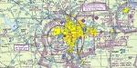
Hi-def scans of real VFR aeronautical United States charts, as available for download from the FAA, reduced and formatted in pdf form by me for use with flight sims. Display them in a kneeboard utility,print them, whatever...I like to use fragments of them to make pdfs for different flights, but that is only one way.
If you want to "get real" about navigating in the sim the way it's done in real life, these charts are for you. But you might also just enjoy wandering around, comparing the chart to the world depicted in the sim. These charts will most likely be outdated by the time you use them, or your sim may even pre-date the charts, but they should work well enough.
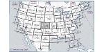
A basic guide for interpreting them is included, as well as tips on how to measure and mark them. Each chart also includes a handy chart legend, a map showing what region it covers, and airspace and frequency information.
If you are unfamiliar with how to use them for navigation, be sure to check out my multi-part tutorial series "Compass, Clock, and Chart", available here at simviation.com.
Posted May 1, 2011 11:50 by Sean Morrissey