



All Time Popular > Page 5073

Sibwings An-2 "Colt" RA-40384 Textures
(Category: FSX > Payware)
8.74Mb (224 downloads)
An-2 "Colt" RA-40384. Ufa - Pervushino (UWUO). Textures only for the payware Sibwings An-2.
Posted Apr 26, 2017 01:17 by Ivan750

Project Tupolev Tu-154B-2 - Tyumen Airlines Textures
(Category: FSX > Civil Jets)
27.37Mb (224 downloads)
Project Tupolev Tu-154B-2 in Tyumen Airlines livery. Textures is Full HD format. Repaint by Sergey Gleba.
Required files:
required file
Posted Mar 31, 2017 10:42 by Sergey Gleba aka serg09


FSX Super Lynx 300 Mk 64 helicopter Splashscreen
(Category: Videos/Splashscreens > Splashscreens)
2.46Mb (224 downloads)
Super Lynx 300 Mk 64 helicopters from AgustaWestland are to operate from the SA Navy's Meko A200SAN class frigattes. The helicopters will provide a surface search capability in the anti-surface warfare roles, search and rescue (SAR), maritime patrol and utility duties.
Posted Feb 26, 2016 00:15 by Mark Cranko


A319 TRransportes Aereos Guatemaltecos
(Category: FS2004 > Civil Jets)
7.33Mb (224 downloads)
A319 Transportes Aereos Guatemaltecos N27YV. Model by iFDG Airbus. Texture by Yankyvictor.
Posted Feb 8, 2015 23:07 by YANKYVICTOR

Morane Saulnier MS406 Finland
(Category: CFS1 > Aircraft)
0.24Mb (224 downloads)
French Fighter MS406 in Finland Textures
Posted Oct 15, 2013 10:33 by 64FULCRUMFREAK
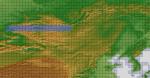
ASTER GDEMv2 30m mesh for Mongolia & surrounding areas Pt11.
(Category: FSX > Terrain Mesh)
226.58Mb (224 downloads)
There are Fourteen (14) parts of this mesh to download as separate files.
ASTER GDEM Version 2 is a 30 metre definition DEM, its better than the version 1 data that ERSDAC, of Japan and NASA originally released, but it does have its limitations.
GDEM has been obtained from a satellite that uses stereoscopic infrared scanning cameras, this brings with it problems in the resultant data.....where it sees the tops of trees, buildings etc, as the ground terrain.
If you look at the jpg image with the terrain type errors shown as a graph, you will see that the only 'safe' terrain to use this data with - in FSX - is scrubland, or desert terrain.
Its hopeless in defining the terrain in places like Europe - with all the artificial structures, (buildings) and different types of woodland, so any mesh I create from this data won't include areas like that....it will be more desert type terrain, and scrubland.
I won't be doing Greenland because something about the ice around Greenland, (or any other land mass with ice) it creates false data.
It does give enough fine data to reveal railway lines, and some roads though.
This mesh has been made for FSX only.
Grateful thanks to ERSDAC, and NASA for making this data freely available to the public.
ASTER GDEM
Copyright (c) 2009 - 2011 Earth Remote Sensing Data Analysis Center (ERSDAC) All rights reserved.
ASTER GDEM is a product of METI and NASA.
Posted Apr 4, 2012 04:08 by Wayne Evans
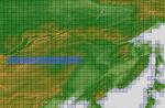
ASTER GDEMv2 30m mesh for Mongolia & surrounding areas Pt5.
(Category: FSX > Terrain Mesh)
184.21Mb (224 downloads)
There are Fourteen (14) parts of this mesh to download as separate files.
ASTER GDEM Version 2 is a 30 metre definition DEM, its better than the version 1 data that ERSDAC, of Japan and NASA originally released, but it does have its limitations.
GDEM has been obtained from a satellite that uses stereoscopic infrared scanning cameras, this brings with it problems in the resultant data.....where it sees the tops of trees, buildings etc, as the ground terrain.
If you look at the jpg image with the terrain type errors shown as a graph, you will see that the only 'safe' terrain to use this data with - in FSX - is scrubland, or desert terrain.
Its hopeless in defining the terrain in places like Europe - with all the artificial structures, (buildings) and different types of woodland, so any mesh I create from this data won't include areas like that....it will be more desert type terrain, and scrubland.
I won't be doing Greenland because something about the ice around Greenland, (or any other land mass with ice) it creates false data.
It does give enough fine data to reveal railway lines, and some roads though.
This mesh has been made for FSX only.
Grateful thanks to ERSDAC, and NASA for making this data freely available to the public.
ASTER GDEM
Copyright (c) 2009 - 2011 Earth Remote Sensing Data Analysis Center (ERSDAC) All rights reserved.
ASTER GDEM is a product of METI and NASA.
Posted Apr 3, 2012 08:23 by Wayne Evans

F4U
Wireframe Texture CFS2 Only
(Category: CFS2 > Aircraft)
0.08Mb (224 downloads)
F4U
Wireframe Texture CFS2 Only Just for fun I thought I would
create a wireframe texture for the Microsoft F4U1a Corsair Aircraft.
-imagine multiplaying games with this skin. Regards Garry J. Smith.
83K
Posted Jun 10, 2008 11:31 by archive

Supermarine
Seafire L III
(Category: CFS1 > Aircraft)
0.08Mb (224 downloads)
Supermarine
Seafire L III The last of the Seafires with Merlin engine.
The Seafire was adapted for the fleet roll do to lack of funds. It
started out as a plain Spitfire and move through many advances.This
one has folding wings, a visual hook, and a working hook.The air file
and DP file are stock Spitfire IX. By Ryan Hensley. 84K
Posted Jun 10, 2008 11:32 by archive
FS2000
Super Flight Planner Utility Database
(Category: FS2000 > Utilities)
0.40Mb (224 downloads)
FS2000
Super Flight Planner Utility Database. With this database
you can use your FS2000 areaman engine to find and read the
bgl files in FS2000 to load adventures into Super Flight Planner.
By Mike Hall. 414K
Posted Jun 23, 2008 14:34 by archive