



All Time Popular > Page 5345


BearStudios New MiG-15Bis Paintkit
(Category: Prepar3d > Payware)
47.65Mb (147 downloads)
This is Paintkit Png layered blank template for skin painters.
Bear Studios MiG-15Bis for P3D Aircraft Mod released on:
Just Flight
https://www.justflight.com/product/bear-studios-mig-15-p3d-fsx
Simmarket
https://secure.simmarket.com/bear-studios-mig-15bis-p3d4-5-fsx-fsxse.phtml
Posted Aug 18, 2022 02:33 by Bill Wolfgen

F6F-5_HELLCAT_VF-20
(Category: CFS2 > Aircraft)
11.54Mb (147 downloads)
Grumman F6F-5 Hellcat VF-20 Unit: VF-20 USS Enerprise (CV-6) Oct, 1944 Pilot: Anon The F6F-5 Hellcat was a further refinement of the successful F6F-3. It had a strengthened airframe, a closer cowl that eliminate the cheek bulges, added permanent rocket pylons under wings, a flat bullet proof front windscreen simplified the front canopy giving a better undistorted image through the gun sight especially at night, and the small rear windows were deleted with a rear view mirror installed as these windows added nothing to the rear view. (Some early dash 5 aircraft still had the rear windows before they were eliminated during production.) The camouflage for all of the F6F-5’s was changed to overall sea blue. It was built in the largest number of Hellcats, some 7,870 being produced. Simple, rugged, and deadly, yet easy to fly, the Hellcat was another product of the Grumman Iron Works. It was larger, heavier, faster, and more powerful than Grumman's F4F Wildcat, and the first American fighter to exceed the performance of the Mitsubishi Zero. Its immense 18-cylinder, 2,000 horsepower radial engine gave it the power to dictate the terms of engagement. Its speed, maneuverability, high-altitude capability, and typical Grumman toughness made it a winner against all comers. Credits Captain Kurt: Aircraft model, drop tank, bomb racks, VC, paint textures, panel, aircraft.cfg and .dp Shessi: Pilot figure Kelticheart: Prop blurred texture Microsoft: Gauges and .air file Bombs and rockets used are from Dbolt's db_us_wep_v2.0a package available at Sim-Outhouse.com http://www.sim-outhouse.com/sohforums/local_links.php?action=jump&catid=281&id=6270
Posted Jul 14, 2022 00:22 by Captain Kurt


FSX P3D Dino Cattaneo E-2D_4F_Flottille_Tiger Meet 2022 Textures
(Category: FSX > Payware)
22.36Mb (147 downloads)
Textures for FSX-P3D Dino Cattaneo E-2D. 4F Aeronavale, Base Aéronavale Lann Bihoué. Tiger Meet 2022
Posted Jul 11, 2022 00:56 by Antonio Diaz


P3D/FSX Feelthere Embraer ERJ-145 Loganair G-RJXH Textures
(Category: FSX > Payware)
29.12Mb (147 downloads)
Loganair Embraer ERJ145LR 4K HD textures for the payware ERJ v2 by Feelthere/Wilco. Textures only
Posted Dec 31, 2020 00:10 by Kelvin Keeble


FSX/P3D USAF Fairchild C-119F Thunderbirds Textures
(Category: FSX > Props)
5.69Mb (147 downloads)
This is a repaint of a Fairchild C-119F in USAF Thunderbirds colors. Ted Giana's C-119 package is needed for this repaint. Full credit to Daisuke Yamamoto for the model. .Textures are 32bit BMP. This repaint was tested on FSX-SE. It should also work on FSX, P3D v1-3. This C-119F was used by the USAF Thunderbirds as a support aircraft from 1954-1959. Textures are 32bit BMP. This repaint was tested on FSX-SE. It should also work on FSX, P3D v1-3.
Required files:
required file
Posted Oct 20, 2019 08:55 by Ted Giana
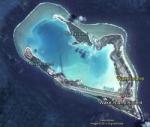
FSX Wake Island Airfield Locator
(Category: FS Navigation > Flight Simulator Navigation)
2.48Mb (147 downloads)
Tested on Windows XP and Windows 7.
This download adds airfield markers and ICAO id's found in FSX, and overlays them on Google Earth.
This file is for Wake Island.
There is also a seperate file with a list of basic airfield location details.
i.e: EGBB Birmingham Airport. Birmingham. N52* 27.23' W1* 44.88' alt325.
Also the tidying "My places" in Google Earth, file.
Other locator files to follow.
by Carl Vokes
Posted Aug 3, 2013 12:12 by carl vokes
Overland SMS A330 and A340 Gauge Fix
(Category: FSX > Payware)
0.01Mb (147 downloads)
Fix for the Overland SMS A330 and A340 Gauges upgrade.
Posted Apr 19, 2012 15:58 by Dimitrios Moschos

FSX Alberta Airfield Locator
(Category: FS Navigation > Flight Simulator Navigation)
1.09Mb (147 downloads)
Tested on Windows XP and Windows 7.
This download adds airfield markers and ICAO id's found in FSX, and overlays them on Google Earth.
This file is for Alberta. Canada
There is also a seperate file with a list of basic airfield location details.
i.e: EGBB Birmingham Airport. Birmingham. N52* 27.23' W1* 44.88' alt325.
Also the tidying "My places" in Google Earth, file.
Other locator files to follow
by Carl Vokes
Posted Mar 23, 2012 18:56 by carl vokes
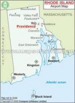
FSX Rhode Island Airfield Locator
(Category: FS Navigation > Flight Simulator Navigation)
1.67Mb (147 downloads)
Tested on Windows XP and Windows 7.
This download adds airfield markers and ICAO id's found in FSX, and overlays them on Google Earth.
This file is for Rhode Island, USA.
There is also a separate file with a list of basic airfield location details.
i.e: EGBB Birmingham Airport. Birmingham. N52* 27.23' W1* 44.88' alt325
Other locator files to follow
by Carl Vokes
Posted Feb 9, 2012 12:28 by carl vokes
Real Charts VFR Sectionals: Omaha
(Category: FS Navigation > Flight Simulator Navigation)
25.96Mb (147 downloads)
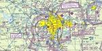
Hi-def scans of real VFR aeronautical United States charts, as available for download from the FAA, reduced
and formatted in pdf form by me for use with flight sims. Display them in a kneeboard utility,print them,
whatever...I like to use fragments of them to make pdfs for different flights, but that is only one way.
If you want to "get real" about navigating in the sim the way it's done in real life, these charts are for
you. But you might also just enjoy wandering around, comparing the chart to the world depicted in the sim.
These charts will most likely be outdated by the time you use them, or your sim may even pre-date the charts,
but they should work well enough.
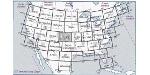
A basic guide for interpreting them is included, as well as tips on how to measure and mark them. Each chart
also includes a handy chart legend, a map showing what region it covers, and airspace and frequency
information.
If you are unfamiliar with how to use them for navigation, be sure to check out my multi-part tutorial
series "Compass, Clock, and Chart", available here at simviation.com.
Posted May 2, 2011 17:10 by Sean Morrissey