


All Files > Page 3766
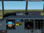
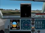
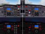
FS2002 simple c-130j "glass "fun" panel"
(Category: FS2002 > Panels)
2.66Mb (363 downloads)
FS2002
simple c-130j "glass "fun" panel"
(fictional) use standard and some custom gauges (requires
FS2000 concorde gauge available here)
By Eric Hellemann. 2.7MB
Required files:
required file
Posted Jun 23, 2008 14:32 by archive
Wingview
package (fs200x standard/PRO)
(Category: FS2002 > Panels)
2.52Mb (659 downloads)
Wingview
package (fs200x standard/PRO) This is my second version
of my Wingview package. This version includes 4 new wingviews!
These wingviews are compatible with FS2000 and FS2002. This
wingviews can be used for every aircraft. The 4 wingviews are
designed for the: Boeing 737, 767, BAE 146, and for the Airbus
A330/340. There is also one winampskin included for the users
of winamp. By Frank Elfert. 2.6MB
Posted Jun 23, 2008 14:32 by archive
MD
90 panel (FS98 and fs2000/fs2002 standard/PRO)
(Category: FS2002 > Panels)
0.78Mb (512 downloads)
MD
90 panel (FS98 and fs2000/fs2002 standard/PRO) This MD 90
panel is designed for FS98 (this panel was a request from Johan
Bakker). But this panel is also tested in FS2000 and FS2002
without any problems. This panel is designed for use in 800x640
or higher! By Frank Elfert. 802K
Posted Jun 23, 2008 14:32 by archive
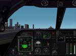
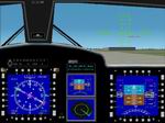
FS
2002 Panel B-1b
(Category: FS2002 > Panels)
1.24Mb (1415 downloads)
FS
2002 Panel B-1b -based on a picture of the real B1 B Panel
-includes the buttons for the GPS,ATC,HSI,PFD -internal views
will be for arround Juli -recomended resolution is: 1024-768*32
by Johan Peeters. 1.2MB
Posted Jun 23, 2008 14:32 by archive
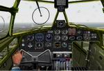
FS2002
Pro RAF BRISTOL BLENHEIM Mk IV.
(Category: FS2002 > Panels)
0.83Mb (836 downloads)
FS2002
Pro RAF BRISTOL BLENHEIM Mk IV. This is a highly detailed
repaint by John Rushby-Smith of D.Kahlstom's FS2000 Blenheim
IV model, which is a long-nose version, with moving parts, of
Hervé Devred's original Blenheim Mk 1. The package includes
a realistic panel, plus supplementary gauges, which include
a version of Chuck Dome's moving yoke and a moving throttle
hand. For ease of flying the panel is equipped with an autopilot
and GPS. 850 Kb John Rushby-Smith. 849K
Posted Jun 23, 2008 14:32 by archive
Fs
2002 panel A-380 panel
(Category: FS2002 > Panels)
(1608 downloads)
Fs
2002 panel A-380 panel for the Airbus 380 realistic panel
generally based on panel bmp from the download a-380 added
changes so it maches more to the real thing By Johan Peeters.
477K
Update:
Fs
2002 panel A-380 fix this file fixes the problems with
the gauges and adds the missing gauge file for use with: 380pnljp.zip
Posted Jun 23, 2008 14:32 by archive
Fs
2002 panel Airwolf A panel
(Category: FS2002 > Panels)
0.45Mb (1111 downloads)
Fs
2002 panel Airwolf A panel for the airwolf helicopter. Includes
GPS,Radios.HUD,radar,AP. By Johan Peeters. 459K
Posted Jun 23, 2008 14:32 by archive
FS2002
Panel fictional panel
(Category: FS2002 > Panels)
0.60Mb (202 downloads)
FS2002
Panel fictional panel for one engined plane gauges are included
and the xml gauges of the default B744 and a HUD(3D only) and
sorry for the fighter panel(my mistake) By Peeters Johan. 610K
Posted Jun 23, 2008 14:32 by archive
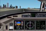
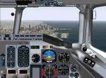
FS2002
Pro Saab 2000 Panel
(Category: FS2002 > Panels)
7.83Mb (686 downloads)
FS2002
Pro Saab 2000 Panel Version 0.91. Includes Interior wiews
and customized flight model used by aircraft. Nighlighted and
real owerhead panel. Few bugfix, and missed gauges. Not requied
my Saab2k02.zip By Tamas Biro. 8MB
Posted Jun 23, 2008 14:32 by archive
FS2002/FS2000
EMBRAER EMB-120 Panel
(Category: FS2002 > Panels)
0.73Mb (952 downloads)
FS2002/FS2000
EMBRAER EMB-120 Panel The EMB 120 is a 30-seat, pressurized
twin-turboprop featuring high cruise speed and low operating
costs. The cockpit features Electronic Flight instruments. Its
roomy cabin can seat up to 30 passengers. By Daniel da Silva.
748K
Posted Jun 23, 2008 14:32 by archive