


All Files > Page 1608
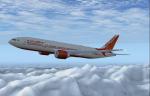
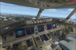
Boeing 777-200 Air India NC Package
(Category: FSX > Civil Jets)
26.48Mb (5386 downloads)
The new Air India Boeing 777-200ER GE, textures dds HD with new lights. Can carry 395 passengers in 2 class with a range of 7,725 nmi(14,310 km) at 43,100 ft (13,140 m) in Mach 0.86.
Model by SMS and texture by ricardo_tv.
Posted Oct 6, 2012 18:13 by ricardo_tv
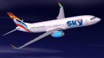
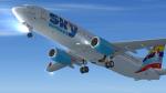
German Sky Airlines Boeing 737-800 Textures
(Category: FSX > Civil Jets)
16.00Mb (1939 downloads)
Textures for the default FSX B737-800. German Sky Airlines GmbH commenced business as a travel agency in 2004.
In 2010, after the purchase of a couple of 737-800’s, it became based at Dusseldorf International, mainly servicing holiday flights to destinations in Turkey.
The company is owned by the Kayi Group, a Turkish tourism organisation.
This repaint is based on D-AGSA and is texture only
Posted Oct 6, 2012 06:49 by Paul Davies
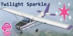
Cessna C-172SP Twilight Sparkle Textures
(Category: FSX > Props)
3.48Mb (798 downloads)
This is a Twilight Sparkle texture pack for the default FSX Cessna C-172SP. Textures include new decals and a custom "Twilighlicious" interior.
Based off of Hasbro's My Little Pony Friendship is Magic series.
Textures By: Fay "Twitchy" Cheung
Posted Oct 6, 2012 05:36 by DanielA.B.
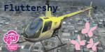

Robinson R22 Fluttershy Textures
(Category: FSX > Helicopters)
0.99Mb (585 downloads)
Fluttershy textures for the default FSX Robinson R22. Textures based off of Hasbro's My Little Pony Friendship is magic series.
Repaint Textures By:Fay "Twitchy" Cheung
Posted Oct 6, 2012 05:09 by Daniel A.B.
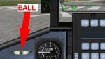
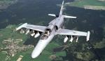
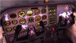
Aero Vodochody L159A Widescreen 2D panel: patch
(Category: FSX > Panels)
0.01Mb (388 downloads)
Ball gauge missing in the first upload. Sorry about that. Here it is.
Required files:
required file
Posted Oct 6, 2012 03:35 by Jean-Luc Peters
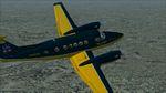
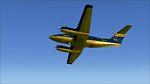
FS2004/FSX Super King Air 300 TRB Aviation Textures
(Category: FS2004 > Props)
10.94Mb (368 downloads)
This is a fictional repaint of the Super King Air 300 Base Package for FS2004/FSX in the fictional TRB Aviation colors. You need the base AFG B300 for FS9, then the upgrade for FSX.
Required files:
required file
Posted Oct 5, 2012 22:27 by Harry Gage
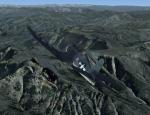
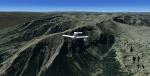
Yellowstone National Park Photoscenery Part 5 of 5
(Category: FSX > Scenery)
655.33Mb (2261 downloads)
This is Photoreal scenery for Yellowstone National Park in the United States. The package is 3 Gb compressed due to the high detail and area coverage. It covers 4340 square miles or 11240.5 square kilometers. Zip preview for more screenshots.
Posted Oct 5, 2012 21:57 by scenery dude
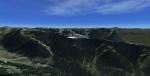
Yellowstone National Park Photoscenery Part 4 of 5
(Category: FSX > Scenery)
645.85Mb (5814 downloads)
This is Photoreal scenery for Yellowstone National Park in the United States. The package is 3 Gb compressed due to the high detail and area coverage. It covers 4340 square miles or 11240.5 square kilometers. Zip preview for more screenshots.
Posted Oct 5, 2012 21:20 by scenery dude
Yellowstone National Park Photoscenery Part 3 of 5
(Category: FSX > Scenery)
676.24Mb (2358 downloads)
This is Photoreal scenery for Yellowstone National Park in the United States. The package is 3 Gb compressed due to the high detail and area coverage. It covers 4340 square miles or 11240.5 square kilometers. Zip preview for more screenshots.
Posted Oct 5, 2012 20:57 by scenery dude

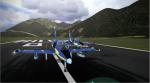
Lotus Sim L-39C Albatros MLP-Wonderbolts Textures
(Category: FSX > Payware)
32.69Mb (655 downloads)
This pack includes 5 Wonderbolt Textures for Lotus Simulations Aero Vodochody L-39C Albatros. Based off of Hasbro's My Little Pony Friendship is Magic series.
Textures By:Fay "Twitchy" Cheung
Posted Oct 5, 2012 20:28 by DanielA.B.