


All Files > Page 1707
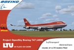
LTU Fleet - Boeing 747-200
(Category: FSX > Civil Jets)
19.12Mb (3413 downloads)
LTU, now operating as Air Berlin, was a popular German budget airline, and flew many type of aircraft including McDonnell, Boeing, Airbus.
This
Boeing B747-200 (converted of a 400f) by Project Opensky.
Added default FSX VC. Textures by ricardo_tv
Have fun
Posted May 10, 2012 13:41 by ricardo_tv
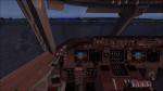
LTU Fleet - Boeing 767-300
(Category: FSX > Civil Jets)
28.27Mb (4798 downloads)
LTU, now operating as Air Berlin, was a popular German budget airline, and flew many type of aircraft including McDonnell, Boeing, Airbus.
This
Boeing B767-300 model by Project Opensky V5.
VC by Alrot Alejandro and textures by ricardo_tv
Posted May 10, 2012 13:33 by ricardo_tv
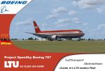
LTU Fleet - Boeing 757-200
(Category: FSX > Civil Jets)
23.08Mb (2988 downloads)
LTU, now operating as Air Berlin, was a popular German budget airline, and flew many type of aircraft including McDonnell, Boeing, Airbus.
This
Boeing B757-200 by Project Opensky.
VC edits and textures by ricardo_tv
Have fun
Posted May 10, 2012 13:03 by ricardo_tv
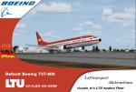
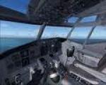
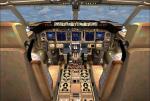
LTU Fleet - Boeing 737-400
(Category: FSX > Civil Jets)
17.46Mb (3927 downloads)
LTU, now operating as Air Berlin, was a popular German budget airline, and flew many type of aircraft including McDonnell, Boeing, Airbus.
This
Boeing B737-400 (&VC) by from FS2004.
Textures by ricardo_tv
Have fun
Posted May 10, 2012 12:45 by ricardo_tv
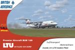
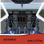
LTU Fleet - BAE-146
(Category: FSX > Civil Jets)
6.22Mb (3143 downloads)
LTU Germany and was a popular Airline, and flew many type of aircraft including McDonnell, Boeing, Airbus.
This
BAE-146 by Premier Aircraft.
Includes VC. Textures by ricardo_tv
Have fun
Posted May 10, 2012 12:34 by ricardo_tv
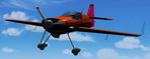
FS2004 Akrotech Giles 202 OTR750
(Category: FS2004 > Props)
0.52Mb (824 downloads)
FS2004 Akrotech Giles 202 OTR750
This is a light weight, tandem, aerobatic aircraft. Designed by Don Halcom.
Wayne Handley's Oracle Turbo Raven
based on this plane.
Added G750 FD, reduced repaint
by George Csillag.
Posted May 10, 2012 12:29 by George Csillag

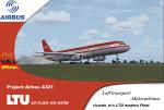
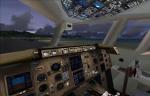
LTU Fleet - Airbus A321
(Category: FSX > Civil Jets)
24.76Mb (1756 downloads)
LTU Germany and was a popular Airline, and flew many type of aircraft including McDonnell, Boeing, Airbus.
This Airbus A321 model by Project Airbus.
Added default A321VC. Textures by ricardo_tv
Have fun
Posted May 10, 2012 11:38 by ricardo_tv

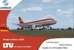
LTU Fleet - Airbus A320
(Category: FSX > Civil Jets)
18.97Mb (1681 downloads)
LTU (renamed Air Berlin) was a German budget airline and was a popular Airline, and flew many type of aircraft including McDonnell, Boeing, Airbus.
This
Airbus A320 by Project Airbus.
Includes default FSX A321 VC. Textures by ricardo_tv
Have fun
Posted May 10, 2012 11:20 by ricardo_tv
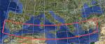
CGIAR-CSI v4.1 90 metre SRTM mesh for Southern Europe-2
(Category: FSX > Terrain Mesh)
113.48Mb (1625 downloads)
This version of the NASA SRTM DEM data, processed by the people at CGIAR-CSI, Kings College, London - is a considerable improvement on previous versions.
It is considered to be the highest quality SRTM 90m dataset available.
So I thought it would be a good idea to process it, so you FSX users out there could use it.
Citation:
Thanks to NASA, and CGIAR-CSI Kings College, London, UK.
Void-filled seamless SRTM data V1 (Now v4.1), 2004, International Centre for Tropical Agriculture (CIAT), available from the CGIAR-CSI SRTM 90m Database: http://srtm.csi.cgiar.org and http://www.ambiotek.com/topoview
Posted May 10, 2012 06:51 by Wayne Evans
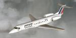
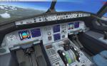
Embraer ERJ 135 Air France Regional
(Category: FSX > Civil Jets)
5.85Mb (5367 downloads)
The Embraer ERJ 135 is the shortest version of the ERJ 145 and has a capacity of 38 passengers. More than 870 aircrafts have been produced (135 + 140 +145) and a lot of companies are using it. Credits: Carl Selin for the original model. Textures, adaptation and panel (no VC) by Philippe Wallaert. See instructions concerning installations and use of the autopilot in the readme.txt file. Nice flights!
Posted May 10, 2012 06:22 by Philippe Wallaert