All Files > Page 1696
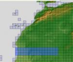
ASTER GDEMv2 30m mesh North Africa Pt17 incl Mauritania, Mali.
(Category: FSX > Terrain Mesh)
202.74Mb (387 downloads)
There are Eighteen (18) parts of this mesh to download as separate files.
ASTER GDEM Version 2 is a 30 metre definition DEM, its better than the version 1 data that ERSDAC, of Japan and NASA originally released, but it does have its limitations.
GDEM has been obtained from a satellite that uses stereoscopic infrared scanning cameras, this brings with it problems in the resultant data.....where it sees the tops of trees, buildings etc, as the ground terrain.
If you look at the jpg image with the terrain type errors shown as a graph, you will see that the only 'safe' terrain to use this data with - in FSX - is scrubland, or desert terrain.
Its hopeless in defining the terrain in places like Europe - with all the artificial structures, (buildings) and different types of woodland, so any mesh I create from this data won't include areas like that....it will be more desert type terrain, and scrubland.
I won't be doing Greenland because something about the ice around Greenland, (or any other land mass with ice) it creates false data.
It does give enough fine data to reveal railway lines, and some roads though.
This mesh has been made for FSX only.
Grateful thanks to ERSDAC, and NASA for making this data freely available to the public.
ASTER GDEM
Copyright (c) 2009 - 2011 Earth Remote Sensing Data Analysis Center (ERSDAC) All rights reserved.
ASTER GDEM is a product of METI and NASA.
Posted Apr 22, 2012 05:11 by Wayne Evans
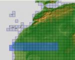
ASTER GDEMv2 30m mesh North Africa Pt16 incl W. Sahara, Mauritania, Mali.
(Category: FSX > Terrain Mesh)
221.35Mb (352 downloads)
There are Eighteen (18) parts of this mesh to download as separate files.
ASTER GDEM Version 2 is a 30 metre definition DEM, its better than the version 1 data that ERSDAC, of Japan and NASA originally released, but it does have its limitations.
GDEM has been obtained from a satellite that uses stereoscopic infrared scanning cameras, this brings with it problems in the resultant data.....where it sees the tops of trees, buildings etc, as the ground terrain.
If you look at the jpg image with the terrain type errors shown as a graph, you will see that the only 'safe' terrain to use this data with - in FSX - is scrubland, or desert terrain.
Its hopeless in defining the terrain in places like Europe - with all the artificial structures, (buildings) and different types of woodland, so any mesh I create from this data won't include areas like that....it will be more desert type terrain, and scrubland.
I won't be doing Greenland because something about the ice around Greenland, (or any other land mass with ice) it creates false data.
It does give enough fine data to reveal railway lines, and some roads though.
This mesh has been made for FSX only.
Grateful thanks to ERSDAC, and NASA for making this data freely available to the public.
ASTER GDEM
Copyright (c) 2009 - 2011 Earth Remote Sensing Data Analysis Center (ERSDAC) All rights reserved.
ASTER GDEM is a product of METI and NASA.
Posted Apr 22, 2012 04:15 by Wayne Evans

ASTER GDEMv2 30m mesh North Africa Pt15 incl W. Sahara, Mauritania, Mali, Algeria.
(Category: FSX > Terrain Mesh)
208.97Mb (463 downloads)
There are Eighteen (18) parts of this mesh to download as separate files.
ASTER GDEM Version 2 is a 30 metre definition DEM, its better than the version 1 data that ERSDAC, of Japan and NASA originally released, but it does have its limitations.
GDEM has been obtained from a satellite that uses stereoscopic infrared scanning cameras, this brings with it problems in the resultant data.....where it sees the tops of trees, buildings etc, as the ground terrain.
If you look at the jpg image with the terrain type errors shown as a graph, you will see that the only 'safe' terrain to use this data with - in FSX - is scrubland, or desert terrain.
Its hopeless in defining the terrain in places like Europe - with all the artificial structures, (buildings) and different types of woodland, so any mesh I create from this data won't include areas like that....it will be more desert type terrain, and scrubland.
I won't be doing Greenland because something about the ice around Greenland, (or any other land mass with ice) it creates false data.
It does give enough fine data to reveal railway lines, and some roads though.
This mesh has been made for FSX only.
Grateful thanks to ERSDAC, and NASA for making this data freely available to the public.
ASTER GDEM
Copyright (c) 2009 - 2011 Earth Remote Sensing Data Analysis Center (ERSDAC) All rights reserved.
ASTER GDEM is a product of METI and NASA.
Posted Apr 22, 2012 03:36 by Wayne Evans
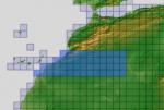
ASTER GDEMv2 30m mesh North Africa Pt14 incl Morocco, Algeria, W. Sahara, Mauritania.
(Category: FSX > Terrain Mesh)
209.04Mb (589 downloads)
There are Eighteen (18) parts of this mesh to download as separate files.
ASTER GDEM Version 2 is a 30 metre definition DEM, its better than the version 1 data that ERSDAC, of Japan and NASA originally released, but it does have its limitations.
GDEM has been obtained from a satellite that uses stereoscopic infrared scanning cameras, this brings with it problems in the resultant data.....where it sees the tops of trees, buildings etc, as the ground terrain.
If you look at the jpg image with the terrain type errors shown as a graph, you will see that the only 'safe' terrain to use this data with - in FSX - is scrubland, or desert terrain.
Its hopeless in defining the terrain in places like Europe - with all the artificial structures, (buildings) and different types of woodland, so any mesh I create from this data won't include areas like that....it will be more desert type terrain, and scrubland.
I won't be doing Greenland because something about the ice around Greenland, (or any other land mass with ice) it creates false data.
It does give enough fine data to reveal railway lines, and some roads though.
This mesh has been made for FSX only.
Grateful thanks to ERSDAC, and NASA for making this data freely available to the public.
ASTER GDEM
Copyright (c) 2009 - 2011 Earth Remote Sensing Data Analysis Center (ERSDAC) All rights reserved.
ASTER GDEM is a product of METI and NASA.
Posted Apr 22, 2012 02:53 by Wayne Evans
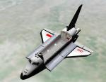
Soviet Space Shuttle Buran V4.8 Release 3
(Category: Space Orbiter > Orbiter Addons)
3.65Mb (6433 downloads)
Soviet Space Shuttle Buran, Version V4.8.1 on January 16, 2012.
This model utilizes meshes and textures recently updated by Don Gallagher ("Donamy"). This version is essentially a
Shuttle Fleet V4.8 vehicle, modified in several places.
This package uses a Multistage2 (included along with BrianJ's updated stage.dll) Energia launch vehicle. Because of
the changes to the fleet vehicle, this model required its own version of the GPCMFD ("BGPCMFD.dll, included) and the
payload bay lights ("BPBLights.dll", also included).
The included scenarios have two scenarios that utilize the latest New Mir release:
Three runway bases are included, Baikonur, Khorol in the far East (a contingency abort landing site) and Simferopol
(the western contingency abort landing site). The BGPCMFD uses a separate landing site table file which has these
three landing sites as the first three landing site choices.
To use these bases, a model of the Buran Analogue which had its own jet engines is also included in order to
practice approach and landing.
The majority of features and key controls are identical to the Shuttle Fleet V4.8 and the manual for the add-on
should be referenced. The one major key difference is using "CTRL+J" which will extend / retract the docking system
tunnel. The tunnel should be extended prior to docking (the docking port is offset accordingly as is the docking
port view).
The latest versions of RPOP and Universal Pointing MFDs are included in case you install this package and do not
have Shuttle Fleet V4.8 already installed.
Please test this package on a "clean" installation with only Orbitersound, UMMU 2.0, the latest Mir package and
Shuttle Fleet V4.8 only.
Posted Apr 21, 2012 22:20 by David413

Embraer 312 Tucano 2D wide-screen panel.
(Category: FSX > Panels)
4.50Mb (959 downloads)
A 2D wide-screen panel for J.E. Narcizo's beautiful Embraer 312 Tucano T-27, based on the Simshed Shorts Tucano panel and gauges, and including an adapted minipanel. No VC.
Most probably FS2004 compatible. Will fit to any other EMB Tucano (e.g. J.R. Lucariny's Tucano).
Posted Apr 21, 2012 16:29 by Jean-Luc Peters
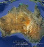
FSX Australia Airfield Locator
(Category: FS Navigation > Flight Simulator Navigation)
1.08Mb (402 downloads)
Tested on Windows XP and Windows 7.
This download adds airfield markers and ICAO id's found in FSX, and overlays them on Google Earth.
This file is for Australia.
There is also a seperate file with a list of basic airfield location details.
i.e: EGBB Birmingham Airport. Birmingham. N52* 27.23' W1* 44.88' alt325.
Also the tidying "My places" in Google Earth, file.
Other locator files to follow.
by Carl Vokes
Posted Apr 21, 2012 14:37 by carl vokes
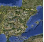
FSX Spain Airfield Locator Update 1
(Category: FS Navigation > Flight Simulator Navigation)
1.06Mb (504 downloads)
Tested on Windows XP and Windows 7.
This download adds airfield markers and ICAO id's found in FSX, and overlays them on Google Earth.
This file is for Spain. This update adds the missing LEAL airfield.
This replaces the original FSX Spain airfield locator.
There is also a seperate file with a list of basic airfield location details.
i.e: EGBB Birmingham Airport. Birmingham. N52* 27.23' W1* 44.88' alt325
Also the tidying "My places" in Google Earth file
Other locator files to follow
by Carl Vokes
Posted Apr 21, 2012 14:35 by carl vokes

Dave Hanvey Bf109H V2
(Category: CFS2 > Aircraft)
4.38Mb (754 downloads)
I'm revising my old planes. I learn a lot in all these years and the tools enhanced. in this package, I'm including the Bf109H-0.
Posted Apr 21, 2012 13:39 by Pepe Rezende
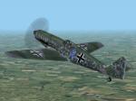
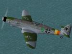
Dave Hanvey Me209s V2
(Category: CFS2 > Aircraft)
11.60Mb (672 downloads)
I'm revising my old planes. I learn a lot in all these years and the tools enhanced. in this package, I'm including the Me209-II serie with the Me209A and the Me209H.
Posted Apr 21, 2012 13:26 by Pepe Rezende


