


All Files > Page 1916
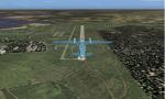
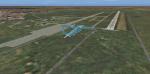
Ukraine Scenery Package Part 5
(Category: FS2004 > Scenery)
18.85Mb (1315 downloads)
Ukraine the Nikolaev, Odessa and Kherson area
UKBP-Primorskoe, UKOA-Askaniya-Nova, UKOB-Blagoyevo, UKOC-Kherson Chernobayevka, UKOD-Ochakov, UKOE-Artsiz, UKOG-Genichesk, UKOH-Kherson, UKOI-Izmail, UKOJ-Kiliya, UKOK-Kakhovka, UKOL-Odessa Liman, UKOM-Limanske, UKOP-Raukhovka, UKOQ-Belhorod-Dnistrovskyy, UKOS-Skadovsk, UKOT-Odessa Dalnik, UKOU-Bolgrad Zhovtnevoe, UKOW-Voznesensk, UKOY-Chaplynka, UKOZ-Suvorovo
Posted Aug 12, 2011 13:12 by Andrey anta
Ukraine Scenery Package Part 4
(Category: FS2004 > Scenery)
16.64Mb (791 downloads)
Ukraine Kharkiv, Poltava, Sumy
UKHA-Akhtyrka, UKHB-Bliznyuki, UKHC-Chervonoye Pustogorod, UKHD-Kharkiv Sokolnyky North, UKHE-Kharkiv Lyubotin, UKHG-Kremenchug, UKHI-Izyum, UKHJ-Poltava, UKHK-Kremenchug Kakhnovka, UKHL-Lokhvitsya, UKHM-Velikaya Krucha, UKHN-Lebedin, UKHP-Poltava Suprunovka, UKHR-Kochubeyevka Artemivka, UKHT-Mirgorod, UKHU-Kupyansk Uzlovoy, UKHX-Khorol
Posted Aug 12, 2011 13:07 by Andrey anta
Ukraine Scenery Package Part 2
(Category: FS2004 > Scenery)
16.88Mb (708 downloads)
Ukraine Donetsk, Luhansk area
UKCB-Bilenke, UKCD-Dmitrievka, UKCK-Kramatorsk, UKCM-Mariupol, UKCO-Mospyne, UKCP-Petrovskoye, UKCQ-Olhinka, UKCS-Sieverodonetsk, UKCT-Starobelsk, UKCV-Valeryanivka, UKCW-Luhansk, UKCY-Yenakiyeve
Posted Aug 12, 2011 12:56 by Andrey anta
Ukraine Scenery Package Part 1
(Category: FS2004 > Scenery)
18.00Mb (838 downloads)
Ukraine Kiev, Kirovohrad, Zhytomyr area
UKBC-Kiev Belaya Tserkov, UKBK-Kamyanka, UKBM-Mala Vyska, UKBO-Popelnya, UKKB-Kiev Borodyanka, UKKC-Chоrnobil Pripyat Heliport, UKKD-Drabiv, UKKE-Cherkassy, UKKF-Kiev Hydropark, UKKH-Kiev Uzyn Chepelevka, UKKI-Ivangorod, UKKN-Kiev Mariinsky park helipad, UKKO-Ozernoe, UKKP-Palmira, UKKQ-Kirovograd Kanatovo, UKKR-Matusiv Rotmistrovka, UKKU-Uman, UKKV-Zhitomir, UKKW-Kiev Vasylkiv, UKKY-Aleksandriya North, UKKZ-Ovruch, XKKY-Aleksandriya
Posted Aug 12, 2011 12:46 by Andrey anta
Ukraine Scenery Package Krym
(Category: FS2004 > Scenery)
15.64Mb (694 downloads)
Ukraine Krym
UKFA-Kacha Air Base, UKFH-Krasnoperekopsk, UKFI-Saki Air Base, UKFJ-Armyansk Chernyi Chaban, UKFL-Veseloe Karankut Air Base, UKFN-Sevastopol Kruglaya Bukhta Heliport, UKFQ-Gora Klementyeva Airfield, UKFS-Sovyetskiy Air Base, UKFT-Kirovskoe Air Base, UKFU-Sevastopol Yuzhniy Airfield, UKFV-Abay-Kuchuk, UKFX-Chkalovskiy, UKFY-Djankoy, UKFZ-Sevastopol Yukharina Balka, XKFB-Bagerovo Air Base, XKFC-Chornomorske, XKFD-Donuzlav Myrne, XKFF-Foros Helipad, XKFN-Sevastopol Naval Institute Helipad, XKFP-Prymorskyy, XKFR-Respect Hall Helipad, XKFY-Yalta Heliport
Posted Aug 12, 2011 12:31 by Andrey anta
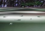
Animal World Scenery - Europe Animal and Bird Life
(Category: FS2004 > Scenery)
28.76Mb (2466 downloads)
Animal World Scenery - Europe Animal and bird life. Contains 680 animals, reptiles, birds and mammals from the continent and coastlines of Europe. For use in scenery FS2004 (may work in other's but not tested). Of the many thousand gmax-things I have made through years the global animal scenery is one of my dearest. This library contains more than 3000 BGL-files. It puts singles or groups of animals into your Flight Simulator 2004 as static scenery. Marine animals and terrestrial animals. Mammals, reptiles and birds - more than a hundred species. By land by water and by air in places where they occur in reality world.
Posted Aug 12, 2011 07:07 by Ivar Danielsen
Animal World Scenery - South America Animal, Reptile and Bird Life
(Category: FS2004 > Scenery)
14.03Mb (1335 downloads)
Animal World Scenery - South America Animal, reptile and bird life. Contains 318 animals, reptiles, birds and mammals from the continent, Rain Forests and coastlines of South America. For use in scenery FS2004 (may work in other's but not tested). Of the many thousand gmax-things I have made through years the global animal scenery is one of my dearest. This library contains more than 3000 BGL-files. It puts singles or groups of animals into your Flight Simulator 2004 as static scenery. Marine animals and terrestrial animals. Mammals, reptiles and birds - more than a hundred species. By land by water and by air in places where they occur in reality world.
Posted Aug 12, 2011 07:06 by Ivar Danielsen
FS2002 Patch For the Talulqan Terrain (OATQ), Afghanistan
(Category: FS2002 > Scenery)
0.19Mb (215 downloads)
FS2002 Patch For the Talulqan Terrain (OATQ), Afghanistan
This is a patch to the FS2002 error which places the Talulqan terrain (OATQ), Afghanistan, at a towering altitude of 8,500 ft. We brought that back to the surrounding terrain, or about 3000 ft. We also corrected that in the airports list of data, with the altitude now 3,009ft
Posted Aug 11, 2011 17:54 by G. Guichard
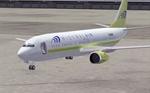
Boeing 737-400 Mistral Air Textures
(Category: FS2002 > Civil Jets)
0.38Mb (1047 downloads)
FS2002 Default Boeing 737-400 Replacement Textures in The Colors of Mistral Air, an Italian Charter airline.
Posted Aug 11, 2011 17:52 by G. Guichard
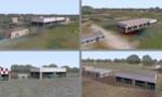
Dijon, Burgundy, France Area Upgrade
(Category: FS2002 > Scenery)
0.89Mb (271 downloads)
FS2002 Additional Small Terrains and Sceneries Around
These .bgl files for use with FS2002 will add some more details in the area of Dijon, Burgundy, France and useful for GA flights. Two additonal small terrains are to be found, Pouilly-Maconges (LFXI), West of Dijon and Nuits-St Georges-La Berchère (LFHU), South of that city which due to their rough surface or exiguity will be suited to soft-field or short-field pproach and landing training. Some additional scenery is available too to Darois (LFGI), home to the 'Aéro-Club de la Côte d'Or' and Tilchâtel (LFET), a smaller flying-club North of Dijon. The Nuits-St Georges antenna further, accurate ATC frequencies for LFXI and LFHU, or lake Kir, such sceneries will allow to improve the realism of any flight around Dijon. You will note that we did not figure taxiways in Darois as we estimate that the scenery aldready animate there. A treat consists, for Darois, to alternate files representing, for the summer period, a sailplane in the area where that activity occurs
Posted Aug 11, 2011 17:50 by G. Guichard