All Files > Page 4385

FS2004
CBLA, Alaska, Scenery
(Category: FS2004 > Scenery)
0.10Mb (1095 downloads)
FS2004
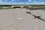
CBLA, Alaska, Scenery.
The airport is fictional but it is at my favorite lake in FS2004.
The runway is 700ft long and is made of gravel.To use the scenery
you must have RWY 12 textures installed. I have included two
bonus items also. there labeled AKK oil rig fix which adds the
Mobil 1 Oil rig at NDB, ABC South of Kodiak Island, Alaska.
TFFJ bird adds a tropical bird standing at the airport. 106K
Posted Jun 23, 2008 14:24 by archive
FS2004
LFBH La Rochelle International Airport , France 2007 Scenery.
(Category: FS2004 > Scenery)
2.52Mb (1592 downloads)
FS2004
LFBH La Rochelle International Airport , France 2007 Scenery.
Randolph Chevallier. 2.6MB
Posted Jun 23, 2008 14:24 by archive
FS2004
Gambo Sky Dive Centre (GSDC)
(Category: FS2004 > Scenery)
0.08Mb (379 downloads)
FS2004
Gambo Sky Dive Centre (GSDC).
For those who like to have some action in your FS, this file
will give you a little fun with the right aircraft. I recommend
the Deer Valley Douglas Twin Otter. Rob Brentnall. 81K
Posted Jun 23, 2008 14:24 by archive

FS2004
Alitak Outpost, south of Kodiak Island, Alaska
(Category: FS2004 > Scenery)
0.03Mb (519 downloads)
FS2004
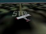
Alitak Outpost, south of Kodiak Island, Alaska.
STOL. The runway length is 350ft of dirt perfect for Piper Supercubs,
etc. . File created by Drew Blankenship. 33K
Posted Jun 23, 2008 14:24 by archive

FS2004
RAF Coningsby, UK
(Category: FS2004 > Scenery)
9.56Mb (3212 downloads)
FS2004
RAF Coningsby, UK.
A detailed representation of the home of the Eurofighter Typhoon
in operational service in the UK. Gmax scenery with photo-tiles.
Features aircraft shelters with animated doors, flight line
equipment and personnel and options to maintain frame rate for
users with lower end PCs. A comprehensive AI package is available
at UKMIL. By John Young, UKMIL. 9.8MB
Posted Jun 23, 2008 14:24 by archive

FS2004
RAF Fairford, UK, Scenery.
(Category: FS2004 > Scenery)
6.05Mb (2599 downloads)
FS2004
RAF Fairford, UK, Scenery.
With FS9's default Fairford AFCAD simply being a piece of tarmac
which was hardly realistic. Hours of pouring over scale charts,
maps and photos saw the AFCAD completed with as much accuracy
as was possible so it seemed natural to try to add a few buildings.
Therefore what we have here is a representation of the layout
of RAF Fairford with a few hard sought extra added bits for
reality! Stephen Legg & Keith Steadman. 6.2MB
Posted Jun 23, 2008 14:24 by archive

FS2004
UKMIL AI TLP Kinloss 2008 Military Aircraft Scenery Package.
(Category: FS2004 > Scenery)
8.34Mb (2425 downloads)
FS2004
UKMIL AI TLP Kinloss 2008 Military Aircraft Scenery Package.
AI
TLP Kinloss, Scotland, 2008/1; this is based on a real TLP that
happened. All the serials I have painted on the aircraft are
the ones used here. Some required AI aircraft included. UKMil.
8.5MB
Posted Jun 23, 2008 14:24 by archive

FS2004
Hogwarts School of Witchcraft and Wizardry Scenery Package.
(Category: FS2004 > Scenery)
13.36Mb (1120 downloads)
FS2004
Hogwarts School of Witchcraft and Wizardry Scenery Package.
located near Inverness Scotland United Kingdom. Take off From
Inverness Airport and fly West accross the river Ness near Lock
Ness. Contenue to fly West until you see the dark forest. After
you clear the dark forest you fly over Hogwarts and Hogsmeade.
This is a fantasy flight Hogwarts is the fictional School that
Harry Potter attended for seven years. Includes Airbus A333
repainted in "Hogwarts Express" livery. A tribute
for Harry Potter fans Original aircraft belong to POSKY (Project
Original Open Sky), repainted by Rio Gunawan. Design by Gary
L Varnam. 13.7MB
Posted Jun 23, 2008 14:24 by archive

FS2004
DDH16 Landable Carrier
(Category: FS2004 > Scenery)
0.72Mb (4305 downloads)
FS2004
DDH16 Landable Carrier.
Static &AI Model included. Mitsuya Hamaguchi. 733k
Posted Jun 23, 2008 14:24 by archive

FS2004
Island Of Crete, Greece, Scenery Package
(Category: FS2004 > Scenery)
27.35Mb (3876 downloads)
FS2004
Island Of Crete, Greece, Scenery Package.
Crete is the biggest island of the Greek archipelago and is
the south rampart of the Aegean sea. In this scenario the following
airports are represented: LGIR, LGSA, LGOB, LGTL, LGST and LGKK.
By Toni Agramont. 28MB
Posted Jun 23, 2008 14:24 by archive


