0.30Mb (971 downloads)
Track Red Bull Air Race 2010
Posted Mar 13, 2010 08:08 by Sy Dsg Siscot Yves


16.23Mb (1856 downloads)
Featuring custom GMAX models, landclass changes, satelite imagery, and AFCAD airport update, Hobart International Airport (YMHB), Tasmania, is the result of several years development. The model itself has been designed with first hand knowledge and is highly accurate to the real airport. The textures of the airport are also based on real-life photographs. This download includes the nearby Mt. Wellington observatory and signal tower. It is recommended to be flown with FTX landclass installed. A free no restrictions demo of Tasmanian landclass is available from FTX at www.fullterrain.com/freeware.html. Authors: Sean and Matthew Devenish.
Posted Mar 11, 2010 19:10 by Matthew Devenish

92.41Mb (2170 downloads)
FS2004/FSX Page (KPGA), Lake Powell West, Utah/Arizona (UT AZ)
photo-scenery. This scenery covers the western part of Lake Powell, the city of
Page (KPGA), the Vermillion Cliffs, Glenn Canyon just south of Glenn Canyon Dam,
the northern part of Marble Canyon, Paria Canyon, Cockscomb, etc. By Gottfried
Razek.
Posted Mar 10, 2010 05:51 by Gottfried Razek

96.35Mb (3243 downloads)
FS2004/FSX Bryce Canyon National Park (KBCE), Utah (UT) photo-scenery. Despite its name, Bryce Canyon is not actually a canyon that was formed by a river, but rather a giant natural cliff shaped thru erosion by wind, water, and ice. Bryce is distinctive due to its geological formations, delicate and colorful pinnacles called hoodoos that are up to 200 feet high. The bizzarre forms and red, orange and white colors of the rocks provide spectacular views. Unfortunately the hoodoos are too small for the elevation mesh in flight simulator. But you can enjoy the colors and shape of the cliffs. The cliffs in main region of the park, just south of the airport are partly covered by snow. But on the southern and western part of the plateau you can enjoy them free of snow. Bryce Canyon is named after the Mormon pioneer Ebenezer Bryce who settled in this area in the 1850s. It was designated as a national park in 1928. Bryce Canyon Airport (KBCE) just handles small aircraft on a daily basis. By Gottfried Razek.
Posted Mar 10, 2010 05:07 by Gottfried Razek

96.20Mb (1741 downloads)
FS2004/FSX Grand Staircase Escalante National Monument/East, Escalante
(1L7), Utah (UT) photo-scenery. This scenery contains the eastern part of the
Grand Staircase Escalante National Monument. It extends from the town of
Escalante down south where it connects with the Page/Lake Powell scenery.
Contains the upper part of wonderful Escalante Canyon. By Gottfried Razek.
Posted Mar 10, 2010 05:06 by Gottfried Razek
![Flake Island NAS [Fictional] Scenery](https://static.simviation.com/Flake.jpg-thumb.jpg)
0.12Mb (739 downloads)
This Scenery is made by 'Freedom Simulations' and is used by the GPEO. GPEO is a Virtual Military Faction of the FSX VR-World.
Posted Mar 8, 2010 06:50 by Dragnoxz

27.58Mb (4012 downloads)
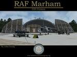
FSX scenery of RAF Marham in the UK.
A very detailed, but frame-rate efficient
scenery of this busy Tornado GR4 airfield.
Designed for use with the FSX-converted
MAIW GR4 AI package. Includes photo
ground tiles with kind permission of Just Flight.
By John Young, with contributions from friends,
at the Airfield Design Group.
Posted Mar 8, 2010 06:21 by Uploader

0.12Mb (717 downloads)
Scar Creak is (In the FSX Virtual World) a USEA (Universal Space Exploration Administration) Lead base Defended by the GPEO (Global Pioneers Elite Organization). It has a long history in the VR-World and is a fun place to fly in and out of. ICAO is "CBA7". You can read more about this Facility at (http://topsecretgpeo.webs.com/mission.htm)
Posted Mar 8, 2010 06:16 by Dragnoxz

10.53Mb (3378 downloads)
Updated & fixed. A remake of the wonderfull FS-2004 scenery from Simon H. (Austrian Design Group). Best used with FSX Austria Professional X from Aerosoft but can be used in default. It includes extra Buildings, Objects, Static Planes and Hangars. Credits to Guy Diotte for the EF200 & F-5E Model. Credits to Jim Dhaenens for the excellent RADAR Object. And many thanks to Simon for the pretty buildings he has done! A few objects are still substituted (the Graz Banner for example) but will be fixed in the next version I hope! You should have Austria X if you want a good Surface Texture for the surrounding grass!
Posted Mar 5, 2010 14:28 by Karl Meindl

0.98Mb (5109 downloads)
Washington's Dulles International Airport - KIAD v3. 1. Reworked the RNAV(RNP) transition at Tring to 19L and 19C using CR and CF legs;
2. Updated the taxiway network including taxiway signs and holds at 1C-19C per the Runway 1C-19C Rehabilitation Package dated April 2009 - taxiways W2, W3, W4, S, E1, E2, E3 and EE are now operational;
3. Updated SID/STAR terminal waypoints and navaids per January 2010 charts;
4. Gates B14-B32 have been renamed to A14-A32 per new specs;
5. SID/STAR waypoints/Navaids updated per January 2010 charts;
6. Updated cargo facilities; and
*7. Updated Terminals B and C airline assignments per the latest specifications including the addition of Air India (AIC) and OpenSkies (BOS), which are due to begin service in the spring of 2010. By Kambiz Agazi
Posted Mar 4, 2010 13:52 by Uploader


