



All Time Popular > Page 3770

FS2004/FS2002
Piaggio-Douglas PD-808, Aeronautica Militare Italiana (Italian
Air Force), Electronic Warfare Version (Early). Textures
(Category: FS2004 > Civil Jets)
0.96Mb (625 downloads)
FS2004/FS2002
Piaggio-Douglas PD-808, Aeronautica Militare Italiana (Italian
Air Force), Electronic Warfare Version (Early). Textures
Only for an aircraft of the 71st Gruppo (Electronic Warfare)
of 14th Stormo (Pratica di Mare, Roma, Italy 1982). Weathered
Dark Green / Dark Grey (N.A.T.O.) livery. These textures require
the original aircraft by Mario Noriega (here)
. Installation instructions are included. Repaint by Manuele
Villa. 988K
Posted Jun 23, 2008 14:30 by archive

Baltimore Clipper
(Category: CFS2 > Misc)
0.41Mb (625 downloads)
These small (90-120 feet) fast and maneuverable topsail schooners were developed as packets and fishing ships in the Chesapeake before the Revolution. During the that war and the next several they served as the vessel of choice for Privateers, carrying only 4-12 guns.
Posted Jun 16, 2009 02:02 by Tom Sanford


FSX Airbus A350-900 GUGFLUG
(Category: FSX > Civil Jets)
69.38Mb (624 downloads)
Hey! I'm Goog, and I'm pleased to announce the virtual launch of my airline, GUGFLUG! We plan to operate a fleet of 5 Airbus A321neos, 1 A320neo, and 10 A350-900s, with our base being in Dortmund, Germany. Our business plan involves operating flights around the world, with our long-range, environmentally friendly aircraft, with a casual vibe and interior, with seats made of recycled plastic. Model by FSPXAI. Updated VC by Speedbird77. RR sounds included. Made for Microsoft Flight Simulator X by Goog. The model fix is already installed.
Posted May 6, 2024 19:05 by Goog


FSX/P3D Airbus A319-100 BeOnd
(Category: FSX > Civil Jets)
83.16Mb (624 downloads)
Project Airbus A319-100 BeOnd for P3D and FSX.
Model by Project Airbus.
Textures by Peter M.
Panel by Microsoft/Speedbird77.
Install : Place the folder Airbus A319-100 Beond into the /Simobjects/Airplanes folder in P3D or FSX.
Posted Feb 25, 2024 15:15 by uploader


FSX/P3D Boeing 737-800 Boeing 737-800 Japan Transoceanair Jinbei (Whale Shark) package
(Category: FSX > Civil Jets)
63.58Mb (624 downloads)
FSX/P3D Boeing 737-800 Boeing 737-800 Japan Transoceanair Jinbei (Whale Shark) package. Japan Transoceanair is mostly owned by Japan Airlines and is based at Naha International Airport, Okinawa. This aircraft is one of 2 painted in the Whale Shark livery Jinbei Jet. Credit to Kat
Ansell for the whale shark artwork.
TDS high spec. native FSX Boeing 738-800 model and quality paint kit. The VC is the FSND modified version of the Microsoft Boeing 738 VC to include various upgrades. Thank you to Alrot fot this. I retextured the VC to make it more resemble the darker grey of today's 737's.
Textured, packaged and prepared for FSX & P3D up to v5.3 by Chris Evans.
Posted Apr 6, 2022 11:57 by chris evans

FSX/P3D/FS2004 ATR 42-500 Easyfly Colombia textures
(Category: FSX > Props)
1.75Mb (624 downloads)
ATR 42-500 Easyfly Colombia textures. This aircraft, registered HK-5071, is currently flying for Easyfly covering mostly smaller cities in the central and northern regions of Colombia. High definition textures only for the freeware VirtualCol ATR-42-500 model. By Rodolfo Estrella C.
Posted Apr 9, 2019 03:38 by uploader

FSX/P3D AlphaJet FSX native non pod model
(Category: FSX > Military)
1.85Mb (624 downloads)
This is a additionel basic model without visible smokesystem pod for the FSX native AlphaBleuCiel Dassault / Dornier Alphajet-E package .
September 2018
Bluebear
Required files:
required file
Posted Sep 8, 2018 16:30 by Bluebear


Update for F-102 by Kazunori Ito
(Category: FSX > Military)
2.85Mb (624 downloads)
This is an update for FSX acceleration of the
F-102 Delta Dagger by Kazunori Ito. I have
updated the flight dynamics and changed the
panel background so it is more user friendly.
I have changed some gauges, added some
gauges, and reduced the centre post so you
can see out the front better. I have changed
the touchdown, burner and flame effects and
updated the flight dynamics. This is the
whole aircraft. No virtual cockpit.
Posted May 22, 2017 09:20 by Bob Chicilo

Manitowoc County Airport, Wisconsin
(Category: FSX > Scenery)
7.39Mb (624 downloads)
KMTW Manitowoc County Airport, Manitowoc, Wisconsin, US
Manitowoc Airport is a county owned, public
use airport located two miles northwest of
the downtown Manitowoc, a city in Manitowoc
County, Wisconsin, United States. It is
categorized it as a general aviation
facility. By Tony Vienonen.
Posted Oct 2, 2013 07:32 by uploader
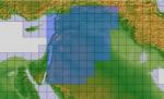
ASTER GDEMv2 30m mesh for Jordan & Syria Pt 2/4
(Category: FSX > Terrain Mesh)
89.05Mb (624 downloads)
There are four parts of this mesh to download as separate files.
ASTER GDEM Version 2 is a 30 metre definition DEM, its better than the version 1 data that ERSDAC, of Japan and NASA originally released, but it does have its limitations.
GDEM has been obtained from a satellite that uses stereoscopic infrared scanning cameras, this brings with it problems in the resultant data.....where it sees the tops of trees, buildings etc, as the ground terrain.
If you look at the jpg image with the terrain type errors shown as a graph, you will see that the only 'safe' terrain to use this data with - in FSX - is scrubland, or desert terrain.
Its hopeless in defining the terrain in places like Europe - with all the artificial structures, (buildings) and different types of woodland, so any mesh I create from this data won't include areas like that....it will be more desert type terrain, and scrubland.
I won't be doing Greenland because something about the ice around Greenland, (or any other land mass with ice) it creates false data.
It does give enough fine data to reveal railway lines, and some roads though.
This mesh has been made for FSX only.
Grateful thanks to ERSDAC, and NASA for making this data freely available to the public.
ASTER GDEM
Copyright (c) 2009 - 2011 Earth Remote Sensing Data Analysis Center (ERSDAC) All rights reserved.
Posted Feb 16, 2012 15:34 by Wayne Evans