



All Time Popular > Page 4422
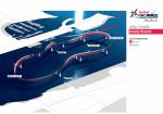
Nephis-Red Bull Abu Dhabi 2015
(Category: FSX > Scenery)
0.53Mb (402 downloads)
Fly the iconic Red Bull Air Race in Abu Dhabi, as it was designed in 2015. The scenery includes a nearby fictious airflield.
SMOKE ON!
Posted Mar 17, 2017 17:22 by Guillaume
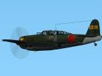
D4Y3 Suisei 601-35 Textures
(Category: CFS2 > Aircraft)
2.18Mb (402 downloads)
Repaint for the superb Thicko's Yokosuka D4Y3 Suisei for CFS2. I used a texture by Morton as a base for this repaint of a "Judy" from 601 Kokutai - Tail number #35.
Required files:
required file
Posted Nov 4, 2016 23:58 by Enrique Godoy
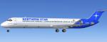
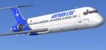
FSX McDonnell Douglas DC-9-50 Northern Star Airlines N698KH Textures
(Category: FSX > Civil Jets)
3.63Mb (402 downloads)
FSX Northern Star Airlines McDonnell Douglas DC-9-50, registration N698KH.
Textures for the Historic Jetliners Group (HJG) DC-9-50 base pack
(JT8D-17 v1.13). Also includes FSX engine smoke [SMOKESYSTEM]
coordinates for your 'aircraft.cfg' file if you wish.
Repaint by Tom Tiedman.
Posted May 9, 2014 20:57 by Tom Tiedman
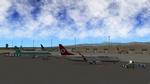
X-Plane 10 Agadir Morocco (GMAD)
(Category: X Plane > Scenery)
0.26Mb (402 downloads)
X-Plane 10 Scenery--Agadir Morocco (GMAD), v1.0. This is another 'plausible' airport for XP-10 using 'lego-brick' style. This is really for a longer flight for those using Canary Island airports. This is if you want to do a longer flight then island hopping. It is approximately a 250 nm flight from Fuerteventura to Agadir. Requires Openscenery 2.0 to work. By Rene Bruun (Renair).
Posted Sep 15, 2013 05:01 by uploader
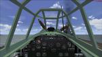
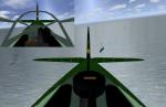
FSX VC-upgrade For Mitsubishi Tenzan
(Category: FSX > Panels)
0.54Mb (402 downloads)
FSX/FS2004 VC-Panel upgrade for Erik Hertzbergers Mitsubishi B6N2 Tenzan (MitsubishiB6N2.zip). This upgrade will improve the VC so it looks identical to the 2D-panel. Additional there are added views and weapon effect configurations. VC-Configuration by Michael Pook, cameras with reargunner view and effect configuration by Erwin Welker
Required files:
required file
Posted Oct 14, 2013 05:38 by Erwin Welker
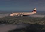
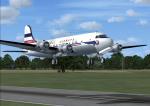
General Airways DC-4 Textures
(Category: FSX > Props)
3.36Mb (402 downloads)
FS9/FSX General Airways DC-4 textures.
Requires DC4_V30-1.zip for FS9 or DC4_V30x.zip for FSX.
DC-4/C-54 aircraft by Jens Kristensen.
Textures by Gary Harper
Required files:
required file
Posted Feb 15, 2013 22:24 by Gary Harper
FSX Australia Airfield Locator
(Category: FS Navigation > Flight Simulator Navigation)
1.08Mb (402 downloads)
Tested on Windows XP and Windows 7.
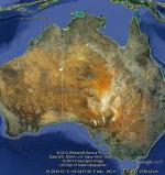
This download adds airfield markers and ICAO id's found in FSX, and overlays them on Google Earth.
This file is for Australia.
There is also a seperate file with a list of basic airfield location details.
i.e: EGBB Birmingham Airport. Birmingham. N52* 27.23' W1* 44.88' alt325.
Also the tidying "My places" in Google Earth, file.
Other locator files to follow.
by Carl Vokes
Posted Apr 21, 2012 14:37 by carl vokes
ASTER GDEMv2 30m mesh for Iran & West Caspian Sea states Pt2a
(Category: FSX > Terrain Mesh)
89.50Mb (402 downloads)
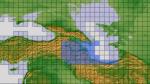
There are Fourteen (14) parts of this mesh to download as separate files.
ASTER GDEM Version 2 is a 30 metre definition DEM, its better than the version 1 data that ERSDAC, of Japan and NASA originally released, but it does have its limitations.
GDEM has been obtained from a satellite that uses stereoscopic infrared scanning cameras, this brings with it problems in the resultant data.....where it sees the tops of trees, buildings etc, as the ground terrain.
If you look at the jpg image with the terrain type errors shown as a graph, you will see that the only 'safe' terrain to use this data with - in FSX - is scrubland, or desert terrain.
Its hopeless in defining the terrain in places like Europe - with all the artificial structures, (buildings) and different types of woodland, so any mesh I create from this data won't include areas like that....it will be more desert type terrain, and scrubland.
I won't be doing Greenland because something about the ice around Greenland, (or any other land mass with ice) it creates false data.
It does give enough fine data to reveal railway lines, and some roads though.
This mesh has been made for FSX only.
Grateful thanks to ERSDAC, and NASA for making this data freely available to the public.
ASTER GDEM
Copyright (c) 2009 - 2011 Earth Remote Sensing Data Analysis Center (ERSDAC) All rights reserved.
ASTER GDEM is a product of METI and NASA.
Posted Mar 10, 2012 04:49 by Wayne Evans
CFS2
ATTACK ON CALAIS
(Category: CFS2 > Missions & Campaigns)
0.05Mb (402 downloads)
CFS2
ATTACK ON CALAIS File
By: KG76_CO_Wespe1 (Jamie Walls) This is a "Might Have Happened".
It is quite possible for the RAF to sneak in a carrier and attack
German planes on the ground. This mission needs specific add-on planes.
Greg Law's He177a5, Blond_Knights Bf110c Zorsterer, William Tell's
Bf109e "#CCCC66 Nose", and C. Muir's Beaufighter TFX. Scenery Needed
is the GZR_Calais Base. I took care of the rest. RAF Bomber Command
has sent B-24's to bomb Calais. You are bieng sent in to assess damage
and add to it as needed. Knock out the He177a5 Griffons and Bf110c's
on the ground But look out for patroling Me109's! The flak at Calais
is horrendous and very realistic. I used actual German flak guns for
this mission, as well as some Japanese AA. Comments and suggestions
are welcome. Jamie Walls. 5K
Posted Jun 10, 2008 11:31 by archive
GZR_Montichiari-Ghedi
Italy By Richard Charlebois AKA:- "GZR_Frenchy/Frenchy 335th".
(Category: CFS2 > Scenery)
2.07Mb (402 downloads)
GZR_Montichiari-Ghedi
Italy By Richard Charlebois AKA:- "GZR_Frenchy/Frenchy 335th".
GZR_ Montichiari-Ghedi Italy is the fourth in a series of CFS2
sceneries depicting the Italian airfields used during the war. These
two bases are located in Northern Italy at the base of the Alps.
They have been modeled together because they were linked to each
other by a very long taxiway. This taxiway was used to switch aircraft
from one field to the other. The fog and weather was to dictate
which was operational, if not both. Night lit runways placed in
exact location to the original. Also, "Triple Entry" in free flight
is installed allowing a choice of starting from the runway of either
aerodrome or the ramp near the hanger and a night lit refueling
area. A vertical moving searchlight will assist you in the dead
of night whilst returning home.
Posted Jun 10, 2008 11:30 by archive