



All Time Popular > Page 4495

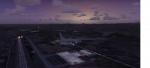
Limnos Ifestos Airport LGLM
(Category: FSX > Scenery)
507.76Mb (379 downloads)
LEMNOS Historical Review
Lemnos (or Limnos) is a Greek island, since ancient times, with a pure Greek population.
Due to the old volcanic activity, it was considered as the island of Hephaestus, the god of Fire. According to mythology, Zeus in a dispute with Hera threw his son Hephaestus from Olympus to the land of Lemnos. Hephaestus set up his workshop there and taught the art of metallurgy to the inhabitants of the island.
The lglm Limnos airport scenery was made over a period of 5 years and includes multiple moving parts, such as AI vehicles, moving people, night effects, air and sea traffic. Google earth was widely used for the 3D representation and the depiction of reality contains many fantastic additions to the airport and the surrounding area. An atmospheric scenery was created to provide a realistic flying experience in FSX.
You can also find a video of scenery capabilities in youtube:
https://youtu.be/y8q0dL5wb3Q
Posted Mar 16, 2023 03:18 by Vangelis Vasilias
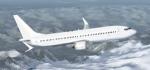
TDS Boeing 737 Max 8 V3 Public Paintkit
(Category: FS Design > Aircraft Paintkits)
7.16Mb (379 downloads)
Public paintkit for the TDS Boeing 737 Max 8 V3
Posted Feb 1, 2021 00:35 by uploader
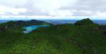
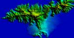
American Samoa Islands 10m Mesh v2.0 for FSX/P3D
(Category: FSX > Terrain Mesh)
0.68Mb (379 downloads)
This freeware addon upgrades the default terrain mesh of the American Samoa Islands to a stunning 10 meters in resolution. All Mesh has been derived from 1/3 arc-second USGS elevation data. Compatible with FSX, P3Dv2, P3Dv3, P3Dv4, & P3Dv5. Scenery created by Chris Britton (Rotornut44) of Emerald Scenery Design.
Posted Nov 8, 2020 16:11 by Emerald Scenery Design
.jpg-thumb.jpg)
.jpg-thumb.jpg)
FSX/Accel/P3dV3 Pilotable Kriegsmarine Light Cruisers
(Category: FSX > Misc)
31.71Mb (379 downloads)
FSX/Accel Pilotable Kriegsmarine Light Cruisers Koenigsberg and Nuernberg. Koenigsberg, first vessel of the K-class, went in service 1929, was involved in the Spanish Civil War and served most time as trainings vessel. It was sunk by british Blackburn Skuas in 1940 at Bergen/Norway. Nuernberg was a modernized vessel (with 3three instead of two props) of the quite similar but improved Leipzig-class, went in service 1935. Active also in the Spanish Civil War, against Poland and in Norway. She survided the Great War and became the russian Admiral Makarov. Both vessels had a length of about 180 m, reached a speed of 32 knots and was armed with three 15 cm triple turrets and different light guns. Twenty five FSX-cameras let you explore the old warships. Ai-vessels converted from Sketchup to native FSX by Klaus Novak. Koenigsberg repaint in camo, configurations and files for pilotable vessel by Erwin Welker
Posted Mar 1, 2020 03:00 by Erwin Welker
Cerasim USCG All Yellow Textures
(Category: FSX > Payware)
11.06Mb (379 downloads)
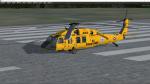
These textures depict helo 6003 from Elizabeth City. The Jayhawk helicopter, the first specially painted aircraft delivered by the Coast Guard to an operational unit in 2016, arrived from Coast Guard Aviation Logistics Center in Elizabeth City, North Carolina, and was to be operated for the next 4 years. This Jayhawk helicopter is painted yellow to represent the chrome yellow paint scheme that Coast Guard and Navy helicopters used in the late 1940s and early 1950s. Examples include the Sikorsky HO3S-1G used from 1946 to 1955 and the Sikorsky HO4S used from 1951 to 1966. This repaint is for the payware Cera Sim UH-60L Blackhawk.
Posted Jan 8, 2020 17:23 by Jason Anderson

FSX Prime Air Boeing 787-9 Cargo
(Category: FSX > Civil Jets)
10.20Mb (379 downloads)
FSX Prime Air Boeing 787-9 Cargo AGS V6.
New Night lights reflection.
New Animated Ground Servicing.
New static displays.
New landing / taxi soft light beams.
New 2D panel. (No VC).
Model design and paint by Camil Valiquette. ( CamSim )
Posted Oct 31, 2019 02:18 by Camil Valiquette
P3D Weather Theme Pack
(Category: Prepar3d > Misc)
1.35Mb (379 downloads)
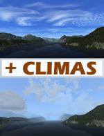
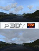
New "+Climas" weather theme pack for P3D. New pack with 4 weather themes. (tested on prepar3d v4).
Install
1) open the folder themes.
2) copy all files to folder. C:\Program Files\Lockheed Martin\Prepar3D v4\Weather\themes .
Posted Jan 14, 2019 00:06 by juan30005
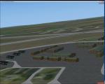
RAF Air Force Base, Bottesford, UK
(Category: FSX > Scenery)
1.59Mb (379 downloads)
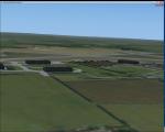
Royal Air Force Station Bottesford or more simply RAF Bottesford is a former Royal Air Force station located on the Leicestershire-Lincolnshire county border, 6.8 miles (10.9 km) north west of Grantham, Lincolnshire and 7.6 miles (12.2 km) south of Newark-on-Trent, Nottinghamshire and about 107 miles (172 km) north-northwest of London, England.
Opened in 1942, it was used by both the Royal Air Force (RAF) and United States Army Air Forces (USAAF). During the war it was used primarily as a troop carrier airfield for paratroopers and as a bomber airfield before closing in 1948.
Today the remains of the airfield are located on private property with the technical site being used as an industrial estate.
Posted Dec 4, 2015 04:33 by Terry Boissel
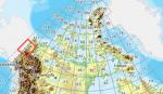
FSX Canadian CDED mesh above 60 degrees Lat 19 metre resolution Pt45, block 116.
(Category: FSX > Terrain Mesh)
152.31Mb (379 downloads)
As Raimondo Taburet hasn't processed the CDED files above 60 degrees latitude for Canada, well here are the ones I have processed.
There isn't any data available from geobase in some of the blocks above 60 degrees latitude, these are blocks: 15, 17, 18, 28, 108, 109, 118, 119.
See jpg for coverage.
Thanks go to Geobase (Copyright) Canada for the availability & public use of this data.
Posted May 20, 2012 03:43 by Wayne Evans
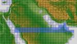
ASTER GDEMv2 30m mesh for Arabian Peninsula Pt3a
(Category: FSX > Terrain Mesh)
58.55Mb (379 downloads)
There are Twenty parts of this mesh to download as separate files.
ASTER GDEM Version 2 is a 30 metre definition DEM, its better than the version 1 data that ERSDAC, of Japan and NASA originally released, but it does have its limitations.
GDEM has been obtained from a satellite that uses stereoscopic infrared scanning cameras, this brings with it problems in the resultant data.....where it sees the tops of trees, buildings etc, as the ground terrain.
If you look at the jpg image with the terrain type errors shown as a graph, you will see that the only 'safe' terrain to use this data with - in FSX - is scrubland, or desert terrain.
Its hopeless in defining the terrain in places like Europe - with all the artificial structures, (buildings) and different types of woodland, so any mesh I create from this data won't include areas like that....it will be more desert type terrain, and scrubland.
I won't be doing Greenland because something about the ice around Greenland, (or any other land mass with ice) it creates false data.
It does give enough fine data to reveal railway lines, and some roads though.
This mesh has been made for FSX only.
Grateful thanks to ERSDAC, and NASA for making this data freely available to the public.
ASTER GDEM
Copyright (c) 2009 - 2011 Earth Remote Sensing Data Analysis Center (ERSDAC) All rights reserved.
ASTER GDEM is a product of METI and NASA.
Posted Mar 7, 2012 11:50 by Wayne Evans