All Time Popular > Page 4598


Russis Kemerovo Region
(Category: FS2004 > Scenery)
13.27Mb (334 downloads)
FS2004 Scenery Russia-Kemerovo region
UNWI-Tashtagol, XNET-Tanay, XNKM-Kemerovo (Severniy), ZB2W-Mikhailovka, ZBH8-Leninsk-Kuznetsky, ZC7U-Muryuk (Novaya Pokrovka), ZCT5-Kemerovo (Borovoy), ZD0U-Mezhdurechensk, ZDR2-Novokuznetsk (Sosnovka), ZE0M-Saltymakovo, ZE0N-Kiya-Shaltyr, ZE0P-Tsentralnyy, ZE0Q-Chumaiy, ZE0V-Yaya, ZE0W-Izhmorskiy, ZE0X-Ulanovka, ZE12-Tuyla, ZE13-Taezhno-Alexandrovka, ZE14-Verkhnyaya Chebula, ZE15-Mariinsk, ZE18-Tundinka, ZE1B-Tyazhinskiy, ZE1R-Novokuznetsk (Abagur-Lesnoi)
Posted Nov 12, 2014 09:38 by Andrey Anta

ASTER GDEMv2 30m mesh for Arabian Peninsula Pt5a
(Category: FSX > Terrain Mesh)
83.55Mb (334 downloads)
There are Twenty parts of this mesh to download as separate files.
ASTER GDEM Version 2 is a 30 metre definition DEM, its better than the version 1 data that ERSDAC, of Japan and NASA originally released, but it does have its limitations.
GDEM has been obtained from a satellite that uses stereoscopic infrared scanning cameras, this brings with it problems in the resultant data.....where it sees the tops of trees, buildings etc, as the ground terrain.
If you look at the jpg image with the terrain type errors shown as a graph, you will see that the only 'safe' terrain to use this data with - in FSX - is scrubland, or desert terrain.
Its hopeless in defining the terrain in places like Europe - with all the artificial structures, (buildings) and different types of woodland, so any mesh I create from this data won't include areas like that....it will be more desert type terrain, and scrubland.
I won't be doing Greenland because something about the ice around Greenland, (or any other land mass with ice) it creates false data.
It does give enough fine data to reveal railway lines, and some roads though.
This mesh has been made for FSX only.
Grateful thanks to ERSDAC, and NASA for making this data freely available to the public.
ASTER GDEM
Copyright (c) 2009 - 2011 Earth Remote Sensing Data Analysis Center (ERSDAC) All rights reserved.
ASTER GDEM is a product of METI and NASA.
Posted Mar 8, 2012 04:20 by Wayne Evans

FSX Ngoma Airstrip, Kafue National Park, Zambia
(Category: FSX > Scenery)
1.40Mb (334 downloads)
Ngoma airstrip, Kafue National Park, Zambia.An improvement over the Default FSX Version.
Posted Jan 5, 2012 11:23 by Bashir Ismail


FS2004 Island Hopper Airways textures for Volpar Amphibian
(Category: FS2004 > Props)
0.62Mb (334 downloads)
Based in the Bahamas, Island Hopper makes cargo and passenger flights between the various islands and Jamaica using an assortment of aircraft including this one. Textures for use with the Volpar Amphib by Brian Gladden (Vol_am.zip) Repaint by Don Brynelsen using Brian's paintkit.
Required files:
required file
Posted Nov 9, 2011 14:25 by Don Brynelsen


Real Charts VFR Sectionals: Kansas City
(Category: FS Navigation > Flight Simulator Navigation)
25.39Mb (334 downloads)
Hi-def scans of real VFR aeronautical United States charts, as available for download from the FAA, reduced and formatted in pdf form by me for use with flight sims. Display them in a kneeboard utility,print them, whatever...I like to use fragments of them to make pdfs for different flights, but that is only one way.
If you want to "get real" about navigating in the sim the way it's done in real life, these charts are for you. But you might also just enjoy wandering around, comparing the chart to the world depicted in the sim. These charts will most likely be outdated by the time you use them, or your sim may even pre-date the charts, but they should work well enough.
A basic guide for interpreting them is included, as well as tips on how to measure and mark them. Each chart also includes a handy chart legend, a map showing what region it covers, and airspace and frequency information.
If you are unfamiliar with how to use them for navigation, be sure to check out my multi-part tutorial series "Compass, Clock, and Chart", available here at simviation.com.
Posted May 6, 2011 16:08 by Sean Morrissey
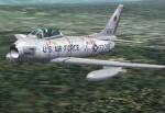

TR_F-86H 1st TFS, 413th TFW, 1957 Textures
(Category: CFS2 > Post WW2 Aircraft)
0.66Mb (334 downloads)
This is an original set of textures by Bub, AKA Bob McGee, representing an aircraft of the 1st TFS, 413th TFW, 1957.
Required files:
required file
Posted Jan 26, 2011 15:08 by Tom Sanford, Tango_Romeo
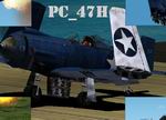
CFS2,
PC_47H (FICTIONAL AIRCRAFT)
(Category: CFS2 > Aircraft)
3.23Mb (334 downloads)
CFS2,
PC_47H (FICTIONAL AIRCRAFT)
Has full animation for CFS2.Also has folding wings, a true tailhook,
damage profiles, and CFS2 style breaking parts with damage textures
(get behind a flight of Bettys and check it out).Uses CFS2 gauges.
Models and original textures copyright(c)2003 by Ronnie Lee Pendergraft.
3.3MB
Posted Jun 10, 2008 11:31 by archive
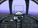
CFS
Panel for the P-80c Shooting Star
(Category: CFS1 > Panels)
0.63Mb (334 downloads)
CFS
Panel for the P-80c Shooting Star Includes pop-up HUD Radar Homing
Device & GPS; Chuck Dome Compass, Ammo Counter & Digital Fuel Meter;
Jerry Beckwith Panel & Crisp-O-Vision concept by Mike Eustace. 645K
Posted Jun 10, 2008 11:32 by archive
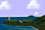
FS98
- CFS1 FARPOINT CFS (Coffee Fly-in Station)
(Category: CFS1 > Scenery)
0.14Mb (334 downloads)
FS98
- CFS1 FARPOINT CFS (Coffee Fly-in Station) Farpoint is a
small look out station in the Caribbean that was built on top of Juancho
Yrausquin. Its primary function is to re-fuel small aircraft in the
area and to serve as a CPVA embassy in the Caribbean. This is only
sample scenery for Coffee Party VA nonmembers. Created with Airport
v2.10 for FS98. By Colonel Pops . 141K
Posted Jun 10, 2008 11:32 by archive
CFS
Scenery - Gravesend Satellite Airfield
(Category: CFS1 > Scenery)
0.00Mb (334 downloads)
CFS
Scenery - Gravesend Satellite Airfield Example scenery for
Combat Flight Simulator created with Airport 2.10 and CFSApi11 Macros.
Wartime Temporary Grass Airfield incorporating a Radar Station covering
the Thames Estuary. BGL size 13k - no extra files or Libraries needed.
By Martin Wright. 3k
Posted Jun 10, 2008 11:32 by archive


