



All Time Popular > Page 4613


DJC A319 and A320 Latam Brasil Textures for AI
(Category: FSX > Civil Jets)
1.56Mb (344 downloads)
This Package is from Latam, DJC AI Aircraft for Traffic with the A319 PT-TMO, PR-MBF and PR-MYI Aircraft from Latam Brasil with the new paint. Works on FS2004 and FSX (Tested on FSX only)
Posted Nov 27, 2020 12:22 by Rafael Matias
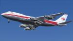
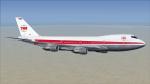
FSX/P3D CLS Boeing 747-131 TWA 1979 Textures
(Category: FSX > Payware)
34.92Mb (344 downloads)
This is a repaint of the 747-131 in TWA 'Star Stream' Double Globe colors. The payware 747-200 HD by Commercial Level Simulations- CLS is needed for this repaint. TWA operated 37 various types of 747s; 100s, 200s, and SPs. This repaint is of a 747-131 which was purchased new from Boeing in April 1970 and stayed with the carrier till 2000, which was one year before the takeover of the airline by American Airlines. Textures are 32bit DDS HD. This repaint was tested FSX-SE. It should work on FSX & P3D v1-3.
Posted Nov 26, 2019 22:37 by Ted Giana
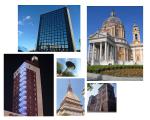
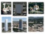
Raccolta Palazzi Torino, Italy
(Category: Prepar3d > Scenery)
3.17Mb (344 downloads)
This file integrates the visual traffic of Edoardo Agnelli LIMA airport of Torino Aeritalia.
Posted May 9, 2018 12:10 by Senior Commander

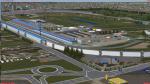
Indy 4 FSX Official Pace Care
(Category: FSX > Misc)
15.72Mb (344 downloads)
Derived from opensource, and provided here as freeware, the Indy 4 FSX Corvette Pace car is specifically built to meet the needs for Indy 4 FSX's official pace car with a top speed in simulation of 165 MPH.
Posted Dec 23, 2016 06:51 by Orion K. Daley

Cessna 172SP (N5399K) Textures
(Category: FSX > Props)
1.89Mb (344 downloads)
Textures for the default FSX Cessna 172. This texture works on both FSX and FSX SE.
Posted May 3, 2015 17:02 by Maksym Designs
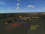
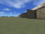
Air Station Poznan Lawica in the interwar years
(Category: FSX > Scenery)
16.05Mb (344 downloads)
Air Station Poznan-Lawica is one of the oldest airports in Poland. Built in 1913 was one of the most important Polish airports in the interwar years.
By Rob Kowalski.
Posted Oct 28, 2014 06:47 by Rob Kowalski
FStarToFS2K V1.1.3
(Category: FSX > Utilities)
4.95Mb (344 downloads)
FStarToFS2K provides the possibility to convert Jeppesen FliteStar/FliteMap(R) 8.x/9.x Version Flight Plans to Microsoft Flight Simulator(R) 2000/2002/2004/FSX or Lockheed Martin Prepar3D(R) Flight Plans, thereafter called MS FS or LM P3D Flight plans. Meanwhile Flight plans for Ted Wright's NAV3.x, Alessandro Antonini's Super Flight Planner, Radar Contact, SquawkBox and Alain Captain's ACS-GPS can be produced as well.
It provides an intuitive interface and an extensive help system. See Readme.txt for Changes!
Posted Jun 28, 2014 02:14 by Conrad F. Staeheli

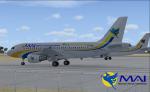
FSX Myanmar Airways Int'l SEA Games CS Textures
(Category: FSX > Civil Jets)
4.38Mb (344 downloads)
When 27th Southeast Asian Games is around the corner,MAI and its domestic wing,Air KBZ,start to adopt a giant-yellow "Official Main Sponsor" tagline on some of their aircraft.
Being the main supporter for the Games and the flag carrier of the host nation,MAI gets one of its A320s,XY-AGO,and an A319,XY-AGR,in this special scheme to mark the another prestigious milestone in the country's history.
It will be the third time that Myanmar will host the Games after 44 years.
Thus,it is an opportunity,not to be missed,to witness the movements of the special scheme on flag carrier's metal and see it soaring boastfully high above the skies.
Thought my airport also deserved this moment too and hence led me into the creation of the repaint.
Required files:
required file
Posted Nov 10, 2013 03:35 by Phyo Pyae Sone
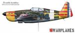
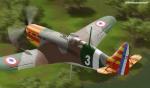
Morane Saulnier 406
(Category: CFS1 > Aircraft)
0.23Mb (344 downloads)
This is Morane Saulnier French fighter for CFS1
Posted Oct 11, 2013 16:46 by 64FULCRUMFREAK
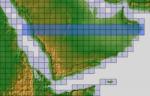
ASTER GDEMv2 30m mesh for Arabian Peninsula Pt4b
(Category: FSX > Terrain Mesh)
49.90Mb (344 downloads)
There are Twenty parts of this mesh to download as separate files.
ASTER GDEM Version 2 is a 30 metre definition DEM, its better than the version 1 data that ERSDAC, of Japan and NASA originally released, but it does have its limitations.
GDEM has been obtained from a satellite that uses stereoscopic infrared scanning cameras, this brings with it problems in the resultant data.....where it sees the tops of trees, buildings etc, as the ground terrain.
If you look at the jpg image with the terrain type errors shown as a graph, you will see that the only 'safe' terrain to use this data with - in FSX - is scrubland, or desert terrain.
Its hopeless in defining the terrain in places like Europe - with all the artificial structures, (buildings) and different types of woodland, so any mesh I create from this data won't include areas like that....it will be more desert type terrain, and scrubland.
I won't be doing Greenland because something about the ice around Greenland, (or any other land mass with ice) it creates false data.
It does give enough fine data to reveal railway lines, and some roads though.
This mesh has been made for FSX only.
Grateful thanks to ERSDAC, and NASA for making this data freely available to the public.
ASTER GDEM
Copyright (c) 2009 - 2011 Earth Remote Sensing Data Analysis Center (ERSDAC) All rights reserved.
ASTER GDEM is a product of METI and NASA.
Posted Mar 7, 2012 12:36 by Wayne Evans