



All Time Popular > Page 4625

10m Finland mesh V
(Category: FSX > Terrain Mesh)
232.83Mb (342 downloads)
G'day Cobbers,
This mesh was produced with 10m dem data and is the eleventh of thirteen files that covers all of Finland.
Thanks and enjoy
drunk
Posted Nov 2, 2014 01:24 by Brett Sintropolis

Boeing 737-400 Oops Air Textures
(Category: FS2004 > Civil Jets)
3.45Mb (342 downloads)
FS2004/FSX Boeing 737-400 Oops Air textures for the default FS2004 B737-400. Counter strike player will get this .. Anyway, Oopsair is a fictional, funny livery found crashed in de_survivor map from famous FPS game Counter Strike. By Ahmad Sallehuddin.
Posted Dec 12, 2012 22:16 by Ahmad Sallehuddin
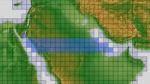
ASTER GDEMv2 30m mesh for Arabian Peninsula Pt2a
(Category: FSX > Terrain Mesh)
69.26Mb (342 downloads)
There are Twenty parts of this mesh to download as separate files.
ASTER GDEM Version 2 is a 30 metre definition DEM, its better than the version 1 data that ERSDAC, of Japan and NASA originally released, but it does have its limitations.
GDEM has been obtained from a satellite that uses stereoscopic infrared scanning cameras, this brings with it problems in the resultant data.....where it sees the tops of trees, buildings etc, as the ground terrain.
If you look at the jpg image with the terrain type errors shown as a graph, you will see that the only 'safe' terrain to use this data with - in FSX - is scrubland, or desert terrain.
Its hopeless in defining the terrain in places like Europe - with all the artificial structures, (buildings) and different types of woodland, so any mesh I create from this data won't include areas like that....it will be more desert type terrain, and scrubland.
I won't be doing Greenland because something about the ice around Greenland, (or any other land mass with ice) it creates false data.
It does give enough fine data to reveal railway lines, and some roads though.
This mesh has been made for FSX only.
Grateful thanks to ERSDAC, and NASA for making this data freely available to the public.
ASTER GDEM
Copyright (c) 2009 - 2011 Earth Remote Sensing Data Analysis Center (ERSDAC) All rights reserved.
ASTER GDEM is a product of METI and NASA.
Posted Mar 7, 2012 11:10 by Wayne Evans

Fspassenger mod for the Bac 1-11
(Category: FSX > Payware)
0.06Mb (342 downloads)
DM BAC 1-11 payload file for the payware FSpassenger gizmo. You need to copy\paste in FSX\FSpassenger\payload and you're done.
Required files:
required file
Posted Jan 15, 2012 06:48 by ricardo_tv
Real Charts VFR Sectionals: Kansas City
(Category: FS Navigation > Flight Simulator Navigation)
25.39Mb (342 downloads)
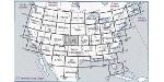
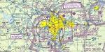
Hi-def scans of real VFR aeronautical United States charts, as available for download from the FAA, reduced and formatted in pdf form by me for use with flight sims. Display them in a kneeboard utility,print them, whatever...I like to use fragments of them to make pdfs for different flights, but that is only one way.
If you want to "get real" about navigating in the sim the way it's done in real life, these charts are for you. But you might also just enjoy wandering around, comparing the chart to the world depicted in the sim. These charts will most likely be outdated by the time you use them, or your sim may even pre-date the charts, but they should work well enough.
A basic guide for interpreting them is included, as well as tips on how to measure and mark them. Each chart also includes a handy chart legend, a map showing what region it covers, and airspace and frequency information.
If you are unfamiliar with how to use them for navigation, be sure to check out my multi-part tutorial series "Compass, Clock, and Chart", available here at simviation.com.
Posted May 6, 2011 16:08 by Sean Morrissey

FS2002/2004 Cessna 208 Textures (Rosewood Lodge)
(Category: FS2004 > Props)
1.22Mb (342 downloads)
Repaint textures for the default Caravan Amphibian in the colors of a sportsman's lodge in Maine. Repaint by Don Brynelsen
Posted Sep 13, 2010 13:27 by Don Brynelsen

CFS2
Far Eastern Nav Panel
(Category: CFS2 > Panels)
0.49Mb (342 downloads)
CFS2
Far Eastern Nav Panel was
created with an Auto Pilot, Refuel Dump gauge, Military Chronometer
Clock, and four GPS gauges. Three of the GPS gauges I used to program
all of Steve Mclelland's Pacific Far East scenery base coordinates
into them. The fourth GPS is the old CFS2 euro GPS. 504K
Posted Jun 10, 2008 11:30 by archive
ITALY
MAP
(Category: CFS1 > Scenery)
0.58Mb (342 downloads)
ITALY
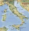
MAP FOR COMBAT FLIGHT SIMULATOR I Version2 08-01-02 by Edmundo
Abad, Agosto 2002 Santiago- Chile This is a Version 2 of Italy Map
for CFS1, with NDB frequencies in MHz near the airfield or beacon
icons. The chart lists available radio beacons (NDB) for CFS1 Scenery
For All Of Italy, v1.5. 595K
Posted Sep 19, 2007 08:52 by archive

FS98/CFS
Blue Angels TA-4J Skyhawk
(Category: CFS1 > Modern Aircraft)
0.20Mb (342 downloads)
FS98/CFS
Blue Angels TA-4J Skyhawk Blue Angels #7 registration 154049.
The TA-4J Skyhawk was used by the "Blues" from 1974 to 1986. Great
for carrier ops. Original by Deane Baunton. Textures, flight dinamic,
moving parts by Lewis Magruder. 203K
Posted Jun 10, 2008 11:32 by archive

FS2004
ZX Spectrum Splashscreen.
(Category: Videos/Splashscreens > Splashscreens)
0.00Mb (342 downloads)
FS2004
ZX Spectrum Splashscreen.
A fun splash screen for all those who remember the ZX Spectrum
Flight Simulator. 5K
Posted Jun 23, 2008 14:14 by archive