



All Time Popular > Page 4628
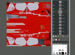
RWD-13/13S paintkits
(Category: FSX > Vintage)
373.54Mb (340 downloads)
Paintkits for RWD-13/13S in .psd by Rob Kowalski from FlyFreeStudio.
Posted Mar 24, 2015 06:35 by Rob Kowalski

10m Finland mesh N
(Category: FSX > Terrain Mesh)
404.09Mb (340 downloads)
G'day Cobbers,
This mesh was produced with 10m dem data and is the third of thirteen files that covers all of Finland.
Thanks and enjoy
Posted Oct 31, 2014 17:10 by Brett Simtropolis
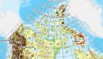
FSX Canadian CDED mesh above 60 degrees Lat 19 metre resolution Pt3, block 26.
(Category: FSX > Terrain Mesh)
214.03Mb (340 downloads)
As Raimondo Taburet hasn't processed the CDED files above 60 degrees latitude for Canada, well here are the ones I have processed.
There isn't any data available from geobase in some of the blocks above 60 degrees latitude, these are blocks: 15, 17, 18, 28, 108, 109, 118, 119.
See jpg for coverage.
Thanks go to Geobase (Copyright) Canada for the availability & public use of this data.
Posted May 16, 2012 08:04 by Wayne Evans
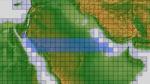
ASTER GDEMv2 30m mesh for Arabian Peninsula Pt2a
(Category: FSX > Terrain Mesh)
69.26Mb (340 downloads)
There are Twenty parts of this mesh to download as separate files.
ASTER GDEM Version 2 is a 30 metre definition DEM, its better than the version 1 data that ERSDAC, of Japan and NASA originally released, but it does have its limitations.
GDEM has been obtained from a satellite that uses stereoscopic infrared scanning cameras, this brings with it problems in the resultant data.....where it sees the tops of trees, buildings etc, as the ground terrain.
If you look at the jpg image with the terrain type errors shown as a graph, you will see that the only 'safe' terrain to use this data with - in FSX - is scrubland, or desert terrain.
Its hopeless in defining the terrain in places like Europe - with all the artificial structures, (buildings) and different types of woodland, so any mesh I create from this data won't include areas like that....it will be more desert type terrain, and scrubland.
I won't be doing Greenland because something about the ice around Greenland, (or any other land mass with ice) it creates false data.
It does give enough fine data to reveal railway lines, and some roads though.
This mesh has been made for FSX only.
Grateful thanks to ERSDAC, and NASA for making this data freely available to the public.
ASTER GDEM
Copyright (c) 2009 - 2011 Earth Remote Sensing Data Analysis Center (ERSDAC) All rights reserved.
ASTER GDEM is a product of METI and NASA.
Posted Mar 7, 2012 11:10 by Wayne Evans
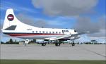
PBA Martin 404 Textures
(Category: FS2004 > Vintage)
1.64Mb (340 downloads)
FS9/FSX Provincetown-Boston Airlines textures only for Dee Waldron's Martin 404.
PBA textures by Gary Harper.
Required files:
required file
Posted May 20, 2011 22:48 by Gary Harper

VRS SuperBug F/A 18E VFA-83 Rampagers CAG Textures
(Category: FSX > Payware)
6.30Mb (340 downloads)
VFA-83 Rampagers CAG Textures for the payware VRS SuperBug
just unzip and use ACM to install
Enjoy
Posted Oct 26, 2010 01:04 by Zebulun"Zebie"Wright
CFS
Scenery - Gravesend Satellite Airfield
(Category: CFS1 > Scenery)
0.00Mb (340 downloads)
CFS
Scenery - Gravesend Satellite Airfield Example scenery for
Combat Flight Simulator created with Airport 2.10 and CFSApi11 Macros.
Wartime Temporary Grass Airfield incorporating a Radar Station covering
the Thames Estuary. BGL size 13k - no extra files or Libraries needed.
By Martin Wright. 3k
Posted Jun 10, 2008 11:32 by archive
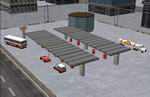
FS2000 - SHELL GAS STATION API MACRO
(Category: FS Design > Scenery Design Objects)
0.38Mb (340 downloads)
FS2000
- SHELL GAS STATION API MACRO You can use this macro
in your own scenery adding cars, buses, fuel trucks, fspeople,
etc. For FS2000. By Pablo Garzón Gavilanes. 390K
Posted Jun 23, 2008 14:18 by archive
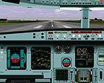
FS2K
A-330 BETA VERSION
(Category: FS2000 > Panels)
(340 downloads)
FS2K
A-330 BETA VERSION
- posted with the kind permission of designer Roy Chaffin. This
panel has little documentation & is still in the development
stage - however it should be useable. File size 2834734
Posted Jun 23, 2008 14:36 by archive
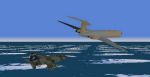
RAF
Refuelling VC-10 K 3 (for FS98)
(Category: FS98 > Scenery)
0.03Mb (340 downloads)
RAF
Refuelling VC-10 K 3 (for FS98)
You are presented with Dynamic Scenery depicting a choice of
mid - air refuelling tankers, depending upon your heading, over
the North Sea off the East coast of Great Britain in an area
used by RAF and other NATO aircraft, at 20000 feet, 250 airspeed,
and headings of 65 and 244 degrees. Each A/C follows a straight
vector for 35-40 Nm, then commits a 90degree turn to starboard
for approx 10 Nm before disappearing and then restarting the
cycle. You have approx. 9 minutes on the long leg. There is
another tanker about 4 1/2 minutes apart. Garvin (Barney) Barnicoat.
31K
Posted Jun 23, 2008 14:20 by archive