All Files > Page 4378

FS2004/02
WLP HQ. Fictious simple Bush Camp Scenery
(Category: FS2004 > Scenery)
3.37Mb (381 downloads)
FS2004/02
WLP HQ. Fictious simple Bush Camp Scenery
with runway in Northern Tanzania just west of famous Lake Natron.
Based on Chance's newest interactive flightsim adventure, this
camp is the head quarter of the story's hero Max Stein's wildlife
project. Made with Airport for Windows V 3.0, by J.T. Chance.
3.4 MB
Posted Jun 23, 2008 14:24 by archive
FS2004
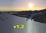
NY Lakes, Rivers & Coastlines v1.2.
(Category: FS2004 > Scenery)
3.54Mb (2036 downloads)
FS2004
NY Lakes, Rivers & Coastlines v1.2.
This scenery significantly enhances the lakes, rivers, & coastlines
of New York State (USA- excluding Long Island). Many lakes have
been added, esp. in the Adirondack Mt. area, all lake locations
& sizes have been fixed, "MS-fictional" lakes have been removed,
and shoreline detail resolution is increased. v1.2 adds more
lakes, rivers, & corrects some issues. See Readme. By Peter
Ricciardiello. 3.6MB
Posted Jun 23, 2008 14:24 by archive

FS2004
Grano Airport of Oro, Maracaibo Ziruma, Venezuela
(Category: FS2004 > Scenery)
2.50Mb (777 downloads)
FS2004
Grano Airport of Oro, Maracaibo Ziruma, Venezuela.
2.5MB
Posted Jun 23, 2008 14:24 by archive
FS2004
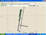
Updated AFCAD Files for YSHT,YMAV,YPID,YBLA.
(Category: FS2004 > Scenery)
0.04Mb (389 downloads)
FS2004
Updated AFCAD Files for YSHT,YMAV,YPID,YBLA.
These files are to update the airports listed above in Victoria,
Australia. I have fixed the default afcad files with more accurate
and realistic ones using the Australian ERSA and by visualy
flying over them in real life by Jake Saw (AFCAD available here
if required). 46K
Posted Jun 23, 2008 14:24 by archive

FS2004
Continental Airlines TrafficPack Version 2
(Category: FS2004 > Scenery)
6.60Mb (3640 downloads)
FS2004
Continental Airlines TrafficPack Version 2.
This is Continental Airlines AI traffic for FS 2004. Might work
on FS2002. Flight plans are NOT the original of Continental
Airlines. Package includes Boeing 727-200, 737-300, 737-200,
757-300, 757-200, and the DC-9-30 for AI so they are very framerate
friendly. 7.1MB
Posted Jun 23, 2008 14:24 by archive

FS2004
Tieton Flying Club - 4S6 in Rimrock, Washington
(Category: FS2004 > Scenery)
4.74Mb (422 downloads)
FS2004
Tieton Flying Club - 4S6 in Rimrock, Washington.
The default 4S6 airport enhanced using the RWY12 program. This
airport is now the "home base" of the Tieton Flying Club. You
can visit them at www.tietonflyingclub.bravehost.com. RWY12
program is NOT required for this scenery - all required files
are included in this package. Unzip to a temporary folder (using
folder option) and follow the simple installation instructions.
Tested in FS2004 only. Compiled by David "Opa" Marshall. 4.8MB
Posted Jun 23, 2008 14:24 by archive

FS2004,
Texture fix for Nadi, Fiji and Guam
(Category: FS2004 > Scenery)
0.40Mb (1264 downloads)
FS2004,
Texture fix for Nadi, Fiji and Guam This
fix should correct the missing asphalt textures which some are
encountering with my Nadi, Fiji, and Guam scenery. Both Sceneries
above . It seems that one of the asphalt textures changed names
when it was compiled into the scenery which causes it not to
show on some peoples computers. I have only heard of this problem
from one person who had both my Guam and Nadi sceneries installed,
so I thought it was an isolated case. When I heard of the same
problem from a different person with my latest Mexico scenery
I investigated further, and finally isolated the problem. This
fix should take care of it, and is only recommended for those
having this particular problem. Otherwise you can leave your
scenery as is .By: Bill Melichar. 409K
Posted Jun 23, 2008 14:24 by archive
FS2004
Guam International Airport, Won Pat, PGUM
(Category: FS2004 > Scenery)
7.03Mb (3761 downloads)
FS2004
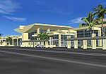
Guam International Airport, Won Pat, PGUM.
Thia scenery represents the architecturally beautiful Guam International
airport located in the Pacific Islands near the Phillippines.
It has been completely redone for FS2004, and now represents
the airport much closer due to some new photos. It is a fairly
large airport, and an important stop over point for many trans
Pacific flights. The scenery contains the main terminal, commuter
terminal, cargo area, general aircraft area, hangar area, airport
business center, and a residential area overlooking the resort
city of Agana. It also features all new tropical trees, and
new jetways which conform to the type of aircraft. By: Bill
Melichar. 7.2MB
Posted Jun 23, 2008 14:24 by archive

FS2004,
Nadi International Airport, Fiji Islands (NFFN)
(Category: FS2004 > Scenery)
5.64Mb (2488 downloads)
FS2004,
Nadi International Airport, Fiji Islands (NFFN)
This scenery completely remakes the airport in a more accurate
and complete style than the FS2002 version. It now more accurately
depicts the entire airport, and corrects the sloppy taxiways
in FS9. Night ramp lighting, along with several hangar areas
are now included. This airport, along with Honolulu and the
Phillippines is one of the larger mid Pacific hubs. It is
also a favorite holiday spot for New Zealand, and Australia,
and is the gateway to the Fiji Islands. Air Pacific also makes
it's home here. By: Bill Melichar. 5.8MB
Posted Jun 23, 2008 14:24 by archive
FS2004
Adelaide International Airport, South Australia
(Category: FS2004 > Scenery)
4.24Mb (2283 downloads)
FS2004
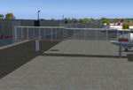
Adelaide International Airport, South Australia Adelaide
is currently receiving a new integrated domestic and international
terminal. This file will depict this new terminal in four stages.
Prior to 2004 it won't exist, then two stages of construction
in 2004, 2005 then fully functional after 2005. Features 'active
trees' that appear to sway in the breeze, an active docking
system and the new glass sided gates can be controlled via com
1. Requires Nova and Nova Gold Textures. By Chris Hutchings
4.3MB
Posted Jun 23, 2008 14:24 by archive


