All Files > Page 4380

FS2004
Mineta San Jose International Airport (KSJC), California (CA)
(Category: FS2004 > Scenery)
5.87Mb (1917 downloads)
FS2004
Mineta San Jose International Airport (KSJC), California (CA).
Includes accurately modeled terminals, hangars, jet blast shields
and even downtown San Jose with the HP Pavilion arena. Also
includes general aviation ramp, street traffic and other goodies
scattered around. By Jaxan Prier and Jose Gutierrez (Mach-1
Scenery Design Group). 6MB
Posted Jun 23, 2008 14:24 by archive

FS2004
Ants Scenery Bundle'o'fun
(Category: FS2004 > Scenery)
0.15Mb (2195 downloads)
FS2004
Ants Scenery Bundle'o'fun.
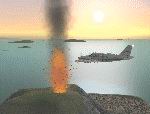
Here's a bit of fun. This bundle of files uses default scenery
and effects to add a few volcanoes, icebergs, aurora, blimps,
fireworks, waterfalls, deicing FX, a forest fire and the mysterious
2nd aircraft carrier. Includes flights to see them as well.
Readme file is in the AntsDocs folder. By Anthony Lynch. 156K
Posted Jun 23, 2008 14:24 by archive

FS2004 Galicia class (Galicia and Castilla ships)
(Category: FS2004 > Scenery)
1.40Mb (1480 downloads)
FS2004 Galicia class (Galicia and Castilla ships)
Posted Jun 23, 2008 14:24 by archive
FS
2004 ILS Airport Updates:
(Category: FS2004 > Scenery)
0.00Mb (1005 downloads)
FS
2004 ILS Airport Updates:
United Kingdom: Sandown, Isle Of Wight (EGHN) runway 5 - Freq.110.300
- ILS ID: SAND - Heading: 050 Portugal: Faro,Algarve (LPFR)
runway 10 - Freq. 110.350 - ILS ID: IFRO - Heading - 106 runway
28 - Freq. 110.300 - ILS ID: IFO - Heading - 286 Madeira,Madeira:
(LPMA) runway 23 - Freq. 111.150 - ILS ID: IMAD - Heading -
234. 3K
Posted Jun 23, 2008 14:24 by archive

FS2004
KNJM Swansboro, NC, Scenery Update
(Category: FS2004 > Scenery)
0.12Mb (420 downloads)
FS2004
KNJM Swansboro, NC, Scenery Update.
Contains Edited files for Bogue MCAS, in Swansboro N.C. Includes
stock airport equipment. 122K
Posted Jun 23, 2008 14:24 by archive

FS2004 KMBS Saginaw, MI Airport and AFCAD
(Category: FS2004 > Scenery)
1.57Mb (471 downloads)
FS2004
KMBS Saginaw, MI Airport and AFCAD Updated.
There was an extra file that placed a second unfinished terminal,
and it screwed up the night textures, so heres the one without
the file, or if you already have it delete "deleting old
buildings.bgl". This is as accurate as I can get it, I
haven’t actually been to MBS in several years, so if you
see something wrong or out of place, feel free to e-mail me
so I can correct the problem. I used Google earth to figure
out where everything should go. The AFCAD is edited for two
northwest gates (4 and 6) and one United gate (2). If this is
wrong, please let me know. Runway 12 libraries are needed. Building
and AFCAD by Devon Johnson. Runway 12 libraries are needed (here).
Building and AFCAD by Devon Johnson. 1.6MB
Required files:
required file
Posted Jun 23, 2008 14:24 by archive

FS2004
Gambo Fictional Airport, Newfoundland, Canada.
(Category: FS2004 > Scenery)
0.17Mb (379 downloads)
FS2004
Gambo Fictional Airport, Newfoundland, Canada.
Joey Smallwood was the first Premier of the Province and the
last Father of Confederation for Canada. I built the airport
and the dock in Freshwater Bay. You can fly, drive, or boat
from this airport! I hope you enjoy it. Thanks to EZ Landclass,
Russ Dirks, RWY12, and AFCAD2.21. 176K
Posted Jun 23, 2008 14:24 by archive
FS2004
Frontier Airlines AI Traffic
(Category: FS2004 > Scenery)
1.45Mb (1338 downloads)
FS2004
Frontier Airlines AI Traffic.
Adds Frontier AI traffic to FS2004. Models : EVAI A320-200 Repaint
: Jasper van Zuuk Flightplans : Jeffery Andrews. 1.5MB
Posted Jun 23, 2008 14:24 by archive

Fs2004
Lawrence, Kansas Airport
(Category: FS2004 > Scenery)
0.53Mb (203 downloads)
Fs2004
Lawrence, Kansas Airport
This is the Rock Springs-Sweetwater County Airport. The model
is built with SceneGenX,Abacus FSDS2,JASC Paintshop, Rwy12 and
AFCAD. The model has full AFD and AI support. I included the
rwy12 ramp lights in case you don't have them. 546K
Posted Jun 23, 2008 14:24 by archive

FS2004
Task Force Falkland Islands Carrier Scenery
(Category: FS2004 > Scenery)
3.29Mb (2204 downloads)
FS2004
Task Force Falkland Islands Carrier Scenery.
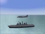
This is a modification of Simon Swallows 'Portsmouth Highrise'
scenery. The carrier and frigate from the above scenery have
been moved from portsmoth harbour and positioned to the east
of Stanley Airport in the Falklands. The Task Force Consists
of:1 Carrier - HMS Ark Royal (Not Historically accurate because
it was HMS Invincible used during the Falklands War of 1982
but it is the exact same class of carrier) 4 Frigates - All
have landable flight decks. Author: Thomas Pitts Original Author:
Simon Swallow. 3.4MB
Posted Jun 23, 2008 14:24 by archive


