



All Time Popular > Page 3645


FSX Saab JAS 39 Gripen Splashscreen
(Category: Videos/Splashscreens > Splashscreens)
2.84Mb (675 downloads)
The Saab JAS 39 Gripen is a light single-engine multirole fighter aircraft manufactured by the Swedish aerospace company Saab. It was designed to replace the Saab 35 Draken and 37 Viggen in the Swedish Air Force.
Posted Feb 25, 2016 23:48 by Mark Cranko

"TomProps" FSX Propeller Texture 10-packs v1.4 White Tips
(Category: FSX > Props)
0.34Mb (675 downloads)
By request, "TomProps" FSX varying transparency propeller texture 10-packs v1.4. These are freeware FSX prop textures that work in FS2004 as well. In both Bitmap format and DDS format, so you can use whichever format you prefer. This version contains, by request, 10 identical white-tipped propeller textures, each one varying in transparency, with #1 being the most transparent and #10 being the least transparent. This version is a stand-alone, with no previous installation of my version 1.0 required. I place no restrictions on these prop textures... anybody may use them for any reason they please.
Posted Oct 19, 2015 23:32 by Tom Tiedman


Sutton Bank Airfield, UK, v2
(Category: FSX > Scenery)
6.72Mb (675 downloads)
Alf's_UK_airfields Sutton Bank version 2. Home of Yorkshire Gliding Club and originally issued in my Volume 11. Main change, generic hangars replaced by custom built ones.
Posted Feb 21, 2015 08:55 by Alf Denham


SMS A320 IAE Aegean Visit Greece
(Category: FSX > Payware)
6.50Mb (675 downloads)
Overland SMS Aegean Airbus A320 IEA model, with Visit Greece logo.
Posted Oct 28, 2014 14:14 by Dimitrios Moschos

FSX Indonesia Airfield Locator
(Category: FS Navigation > Flight Simulator Navigation)
2.56Mb (675 downloads)
Tested on Windows XP and Windows 7.
This download adds airfield markers and ICAO id's found in FSX, and overlays them on Google Earth.
This file is for Indonesia .
There is also a seperate file with a list of basic airfield location details.
i.e: EGBB Birmingham Airport. Birmingham. N52* 27.23' W1* 44.88' alt325.
Also the tidying "My places" in Google Earth, file.
Other locator files to follow.
by Carl Vokes
Posted Aug 18, 2013 08:27 by carl vokes

Gerald's Park TRPG, Caribbean
(Category: FS2004 > Scenery)
2.42Mb (675 downloads)
"Gerald's Park (TRPG)".Scenery of the new Airport of Montserrat Island,locate no far from Antigua and Guadeloupe islands in the Carribeans.
Posted Dec 9, 2012 21:48 by Delblond Christian


C.R.D.A. Cant Z1014 & Z512
(Category: FS2004 > Vintage)
13.44Mb (675 downloads)
FS2004-C.R.D.A.Cant Z1014 Bomber & Z512 Float Plane
Two models,the second derived from the first,
both entered in the Long Range Bombers project
of the Regia Aeronautica; Z1014 first flight on
July 19th, 1940,only 20 were built. None of them
entered in service because Piaggio P108 was
preferred. Z512 never flew for the first time
and remained as project. Model, texture, vc-
cockpit F.Giuli. Panel by alphasim. Gauges by
other authors
Posted Jun 21, 2012 12:05 by FRANCESCO GIULI

Airbus A310-304/ET White Airways Textures
(Category: FSX > Civil Jets)
3.77Mb (675 downloads)
White Airways High-Definition textures only for the incredible Thomas Ruth Airbus A310-300 model. White Airways is an airline operating leisure charter flights out of Lisbon Portela Airport. This repaint reflects the same livery i uploaded some time ago, but this time it sports HD graphics - Read inside for details. Airbus A310-304/ET WHT.
Required files:
required file
Posted Mar 3, 2012 16:11 by Nuno Miguel Pinto
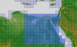
ASTER GDEMv2 30m mesh for Egypt pt5/6
(Category: FSX > Terrain Mesh)
97.89Mb (675 downloads)
There are six parts of this mesh to download as separate files.
ASTER GDEM Version 2 is a 30 metre definition DEM, its better than the version 1 data that ERSDAC, of Japan and NASA originally released, but it does have its limitations.
GDEM has been obtained from a satellite that uses stereoscopic infrared scanning cameras, this brings with it problems in the resultant data.....where it sees the tops of trees, buildings etc, as the ground terrain.
If you look at the jpg image with the terrain type errors shown as a graph, you will see that the only 'safe' terrain to use this data with - in FSX - is scrubland, or desert terrain.
Its hopeless in defining the terrain in places like Europe - with all the artificial structures, (buildings) and different types of woodland, so any mesh I create from this data won't include areas like that....it will be more desert type terrain, and scrubland.
I won't be doing Greenland because something about the ice around Greenland, (or any other land mass with ice) it creates false data.
It does give enough fine data to reveal railway lines, and some roads though.
This mesh has been made for FSX only.
Grateful thanks to ERSDAC, and NASA for making this data freely available to the public.
ASTER GDEM
Copyright (c) 2009 - 2011 Earth Remote Sensing Data Analysis Center (ERSDAC) All rights reserved.
Posted Feb 15, 2012 11:16 by Wayne Evans

Update --- Find Dr.Laura Fokkler
(Category: FSX > Missions)
1.25Mb (675 downloads)
These are the missing Flight files in "Your Flight ..todarien.zip..If you don't wish to download these, Just start the Flight at the waterfront in Panama City and follow the Pilot's Map in the Read Me document.
Posted Sep 23, 2010 09:17 by Gera Godoy Canova