


All Time Popular > Page 4137
FS2002
KLM summer 2002 flight plans,
(Category: FS2002 > Utilities)
0.05Mb (491 downloads)
FS2002
KLM summer 2002 flight plans, which are only for use
in Flight Simulator 2002 – the KLM flight plans are available
for download now. This is the first in a long stream of the
real world flight plans that happen in the world around us that
happen every day. Once the traffic has been downloaded, a html
file guides the user telling him/her how to install the plans.
Word from The AITG says that a big UK airline will be released
soon, along with a small no frills airline. The times in the
KLM plans have been taken from the real world schedule, and
converted by Peter De Bock.
Posted Jun 23, 2008 14:31 by archive
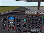
FS2000
Boeing 707 panel
(Category: FS2000 > Panels)
(491 downloads)
FS2000
Boeing 707 panel. This panel includes: Radiostuck, throttle
controles, compass, GPS and this panel has also a pushback and
special engine/anti ice window (SHIFT + 4 and SHIFT + 5 for
the engine/anti ice window). Configured by : Frank Elfert. 1.7MB
Posted Jun 23, 2008 14:35 by archive
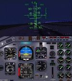
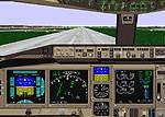
B737-IFR
panel v2 for FS2000 Pro only
(Category: FS2000 > Panels)
1.71Mb (491 downloads)
B737-IFR
panel v2 for FS2000 Pro only. This panel is exclusively
designed for IFR flight all intruments are efficient for this
kind of flights so no external view ! Have a good IFR flight.This
panel was designed for IFR training it's a full screen panel
with HUD external view when passing DH or MDA.This is my first
IFR panel And I will design the same on for Twin-prop aircraft.
Include BSATC-GPS-GPWS By Yann KOUN. 1.7MB
Posted Jun 23, 2008 14:35 by archive
FS98
Rome Fiumicino
(Category: FS98 > Scenery)
0.11Mb (491 downloads)
FS98
Rome Fiumicino. File size 113245. Eugenio
Napoles
Static
aircraft for this airport. File size 56713. Johan
Dees
Posted Jun 23, 2008 14:20 by archive
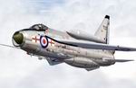
FS2004/2002 EE Lightning F.3 XP737 226 OCU (1970's) Textures only.
(Category: FS2004 > Military)
0.95Mb (491 downloads)
FS2004/2002
EE Lightning F.3 XP737 226 OCU (1970's) Textures only. The
Lightning was the mainstay of the UK's Air Defence Role throughout
the 1960's & 70's. This is a repaint of the Lightning By Kazunori
Ito (Required here)
Repaint by Ben Hartmann of UKMIL. 997K
Required files:
required file
Posted Jun 23, 2008 14:27 by archive
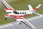
FS2000
Pro Beechcraft Duke.
(Category: FS2000 > Props)
0.91Mb (491 downloads)
FS2000
Pro Beechcraft Duke. (not transparent wondows) This is the
Beechcraft Duke B-60 painted in White with Red trim also aluminum
wings and underbelly. FSDS aircraft with full moving parts.
Includes a night-lit panel for twin turbocharged aircraft. Check
out Chuck Dome's great Panel for this Aircraft. All flight surfaces
are moveable, retractable landing gear. Requires Pro Edition.
Aircraft and Panel By Chuck Dome. Public domain. Repaint by
Bob Bongiovanni. 929K
Posted Aug 24, 2009 06:46 by archive
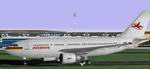
FS98/2000
INTERFLUG A310-300
(Category: FS98 > Civil Jets)
0.18Mb (491 downloads)
FS98/2000
INTERFLUG A310-300 DDR-ABA. Original model and textures:
Hans Peter "Hansi" Schwarz and Jens Dohrn Repaint in Interflug
colors by Federico Permutti. 188K
Posted Jun 23, 2008 14:22 by archive
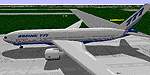
FS98
Boeing 777
(Category: FS98 > Civil Jets)
2.86Mb (491 downloads)
FS98
Boeing 777.
The 1st 777 finished in Boeing colors. Full pack incl panel
& sound. File size 2996791.
Posted Jun 23, 2008 14:22 by archive
FS2000
Iberia A-300-600R V2 PW Airbus A300-600R
(Category: FS2000 > Civil Jets)
0.48Mb (491 downloads)
FS2000
Iberia A-300-600R V2 PW Airbus A300-600R PW engine Version.
full moving parts, rotation Engine fan and turbin fan, increase
cockpit moving parts. now available night and cockpit textures
, include FS2000 default panel. Aircraft and texture Designer
: Jaefree Lin TW. Repaint Iberia colours by: Alfonso Bello.
492K
Posted Jun 23, 2008 14:37 by archive
FS2000
Airbus A320 TACA (v1.0)
(Category: FS2000 > Civil Jets)
0.40Mb (491 downloads)
FS2000
Airbus A320 TACA (v1.0) An Airbus A320 in the livery of
TACA Registration N457TA.Model features complete moving parts
(flaps,slats, spoilers, steerable nose wheel, etc). Transparent
cockpit with pilot figures. Included custom panel. Designed
using AD2000. By Mike Stone. Repainted by Jean-Jacques Parel.
422K
Posted Jun 23, 2008 14:36 by archive