


All Time Popular > Page 5462
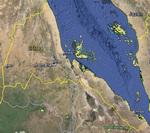
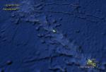
FSX Eritrea Airfield Locator
(Category: FS Navigation > Flight Simulator Navigation)
2.48Mb (63 downloads)
Tested on Windows XP and Windows 7.
This download adds airfield markers and ICAO id's found in FSX, and overlays them on Google Earth.
This file is for Eritrea.
There is also a seperate file with a list of basic airfield location details.
i.e: EGBB Birmingham Airport. Birmingham. N52* 27.23' W1* 44.88' alt325.
Also the tidying "My places" in Google Earth, file.
Other locator files to follow.
by Carl Vokes
Posted Sep 3, 2013 12:23 by carl vokes
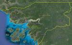
FSX Guinea-Bissau Airfield Locator
(Category: FS Navigation > Flight Simulator Navigation)
2.48Mb (63 downloads)
Tested on Windows XP and Windows 7.
This download adds airfield markers and ICAO id's found in FSX, and overlays them on Google Earth.
This file is for Guinea-Bissau .
There is also a seperate file with a list of basic airfield location details.
i.e: EGBB Birmingham Airport. Birmingham. N52* 27.23' W1* 44.88' alt325.
Also the tidying "My places" in Google Earth, file.
Other locator files to follow.
by Carl Vokes
Posted Aug 18, 2013 08:23 by carl vokes
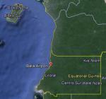
FSX Equatorial Guinea Airfield Locator
(Category: FS Navigation > Flight Simulator Navigation)
2.69Mb (63 downloads)
Tested on Windows XP and Windows 7.
This download adds airfield markers and ICAO id's found in FSX, and overlays them on Google Earth.
This file is for Equatorial Guinea.
There is also a seperate file with a list of basic airfield location details.
i.e: EGBB Birmingham Airport. Birmingham. N52* 27.23' W1* 44.88' alt325.
Also the tidying "My places" in Google Earth, file.
Other locator files to follow.
by Carl Vokes
Posted Aug 14, 2013 14:03 by carl vokes
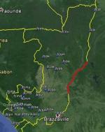
FSX Congo Airfield Locator
(Category: FS Navigation > Flight Simulator Navigation)
2.42Mb (63 downloads)
Tested on Windows XP and Windows 7.
This download adds airfield markers and ICAO id's found in FSX, and overlays them on Google Earth.
This file is for Congo.
There is also a seperate file with a list of basic airfield location details.
i.e: EGBB Birmingham Airport. Birmingham. N52* 27.23' W1* 44.88' alt325.
Also the tidying "My places" in Google Earth, file.
Other locator files to follow.
by Carl Vokes
Posted Aug 14, 2013 14:00 by carl vokes
FSX Kiribati Airfield Locator
(Category: FS Navigation > Flight Simulator Navigation)
2.44Mb (63 downloads)
Tested on Windows XP and Windows 7.
This download adds airfield markers and ICAO id's found in FSX, and overlays them on Google Earth.
This file is for Kiribati.
There is also a seperate file with a list of basic airfield location details.
i.e: EGBB Birmingham Airport. Birmingham. N52* 27.23' W1* 44.88' alt325.
Also the tidying "My places" in Google Earth, file.
Other locator files to follow.
by Carl Vokes
Posted May 26, 2013 12:07 by carl vokes
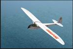
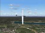
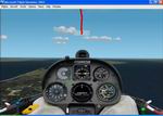
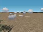
FS2004 Slingsby T-21 Hooters Textures only.
(Category: FS2004 > Gliders and Ultralites)
1.63Mb (63 downloads)
FS2004
Slingsby T-21 Hooters Textures only. This
is a fictional repaint of the Slingsby T-21-b (TX-1 Sedbergh)
Glider, Original Model by Rick Piper (required here),
Saverio Maurri. Repaint by Sean Doran. 1.7MB
Posted Jun 23, 2008 14:18 by archive
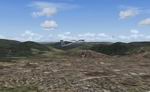
FS2004 Montana V1.0, USA Soaring Scenery
(Category: FS2004 > Gliders and Ultralites)
0.44Mb (63 downloads)
FS2004
Montana V1.0, USA Soaring Scenery This
file adds some thermals to default Microsoft Scenery to part
of Montana Region,USA Design:Francisco Vargas. 447K
Posted Jun 23, 2008 14:18 by archive
FS2002/2004 Queensland Coast,Australia Soaring Scenery
(Category: FS2004 > Gliders and Ultralites)
0.09Mb (63 downloads)
FS2002/2004
Queensland Coast,Australia Soaring Scenery These files
adds some thermals to default Microsoft whole,Queensland Region,Australia
Airport Scenery ,.over below airports: 1.Maroochydore City
- Maroochydore-Sunshine Coast Airp.(ICAO - YBMC); 2.Gympie
City - Gympir Airp.(ICAO - YGYW); 3.Maryborough City - Maryborough
Airp.(ICAO - YMYB); 4.Bundaberg City - Bundaberg Airp.(ICAO
- YBUD); 5.Monto City - Monto Airp.(ICAO - YMTO); 6.Thangool
City - Thangool Airp.(ICAO - YTNG); 7.Gladstone City - Gladstone
Airp.(ICAO - YGLA); 8.Rockhampton City - Rockhampton Airp(ICAO
- YBRK); 9.Williamson City - Williamson Airp.(ICAO - YWIS)
10.Mackay City - Mackay Airp(ICAO - YBMK); 11.Moranbah City
- Moranbah Airp(ICAO - YMRB); 12.Proserpine City - Whitsunday
Coasy Airp(ICAO - YBPN); 13.Bowen City - Bowen Airp(ICAO -
YBRK); 14.Ayr City - Ayr Airp.(ICAO - YAYR); 15.Ingham City
- Ingham Airp.(ICAO - YIGM); 16.Lavarack City - Lavarack Airp.(ICAO
- YLVK); 17.Innisfal City - Innisfal Airp.(ICAO - YIFL); 18.Mareeba
City - Mareeba Airp.(ICAO - YMBA); 19.Cooktown City - Cooktown
Airp.(ICAO - YCKN); 20.Chillagoe City - Chillagoe Airp.(ICAO
- YCGO); 21.Intermediate Point 1: Coordinates S 16* 9.93'
- E 144* 40.41" Elevation 1638.3 ft; 22.Intermediate Point
2: Coordinates S 14* 57.12' - E 144* 13.90" Elevation 67.0
ft; 23.Intermediate Point 3: Coordinates S 14* 41.19' - E
143* 34.90" Elevation 60.0 ft; 24.Coen City - Coeb Airp.(ICAO
- YCOE); 25.Lockhart River City - Lockhart River Airp.(ICAO
- YLHR); 26.Weipa City - Weipa Airp.(ICAO - YBWP); 27.Bamata
City - Inginoo Airp.(ICAO - YBAM); By Francisco Vargas. 93K
Posted Jun 23, 2008 14:18 by archive
FS2002/FS2004 Scenery--Ionia and Traveler City, Michigan (MI) thermal field
(Category: FS2004 > Gliders and Ultralites)
0.05Mb (63 downloads)
FS2002/FS2004
Scenery--Ionia and Traveler City, Michigan (MI) thermal field.
By Francisco Vargas. 55K
Posted Jun 23, 2008 14:18 by archive
FS2002 Nevada gliding scenery package
(Category: FS2002 > Gliders and Ultralites)
2.04Mb (63 downloads)
FS2002
Nevada gliding scenery package by
Fred Platt This pack includes:- Nevada soaring scenery, .DAT
file for the Cambridge instruments (instruments done by Max
Roodvelt, not provided in this package)The scenery covers
the whole of Nevada and a comparitively small area of California.
2MB
Posted Jun 23, 2008 14:18 by archive